Country:
Region:
City:
Latitude and Longitude:
Time Zone:
Postal Code:
IP information under different IP Channel
ip-api
Country
Region
City
ASN
Time Zone
ISP
Blacklist
Proxy
Latitude
Longitude
Postal
Route
Luminati
Country
Region
w
City
falun
ASN
Time Zone
Europe/Stockholm
ISP
Yelles AB
Latitude
Longitude
Postal
IPinfo
Country
Region
City
ASN
Time Zone
ISP
Blacklist
Proxy
Latitude
Longitude
Postal
Route
db-ip
Country
Region
City
ASN
Time Zone
ISP
Blacklist
Proxy
Latitude
Longitude
Postal
Route
ipdata
Country
Region
City
ASN
Time Zone
ISP
Blacklist
Proxy
Latitude
Longitude
Postal
Route
Popular places and events near this IP address

Falun Municipality
Municipality in Dalarna County, Sweden
Distance: Approx. 480 meters
Latitude and longitude: 60.6,15.63333333
Falun Municipality (Falu kommun) is a municipality in Dalarna County in central Sweden. Its seat is located in the city of Falun. Falun is the second biggest city and provincial capital of Dalarna County.

Falun
Place in Dalarna, Sweden
Distance: Approx. 335 meters
Latitude and longitude: 60.60722222,15.63111111
Falun (Swedish pronunciation: [ˈfɑ̂ːlɵn]) is a city and the seat of Falun Municipality in Dalarna County, Sweden, with 37,291 inhabitants in 2010. It is also the capital of Dalarna County. Falun forms, together with Borlänge, a metropolitan area with just over 100,000 inhabitants.

Dalarna Regiment
Swediah Army regiment
Distance: Approx. 1056 meters
Latitude and longitude: 60.60583333,15.65166667
The Dalarna Regiment (Swedish: Dalregementet), designation I 13, is a Swedish Army infantry unit that traced its origins back to the 16th century. The regiment's soldiers were originally recruited from the province of Dalarna, where it was later garrisoned. The unit was disbanded as a result of the disarmament policies set forward in the Defence Act of 2000.

Dalarna University College
Public university in Falun and Borlänge, Dalarna County, Sweden
Distance: Approx. 1560 meters
Latitude and longitude: 60.6138,15.6536
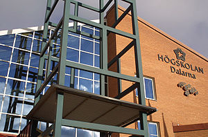
Dalarna University (Swedish: Högskolan Dalarna) is a public university (högskola) located in Falun and Borlänge, in Dalarna County, Sweden. Dalarna University is one of Sweden’s more recent institutions of higher education, established in 1977. It is situated in Dalarna, 200 kilometres north-west of the capital Stockholm.
Hosjö, Falun
Distance: Approx. 6465 meters
Latitude and longitude: 60.59166667,15.74805556
Hosjö (Swedish pronunciation: [ˈhǔːɧœ]) is a suburb and parish in Falun, Sweden. Hosjö forms the most eastern part of the city and consists mostly of houses, with some apartments. In Hosjö, there is a grocery store, news agency, school, preschools, petrol station, pizzeria, some sporting facilities and industries (2005).

Hosjö Church
Distance: Approx. 7134 meters
Latitude and longitude: 60.5922,15.7608
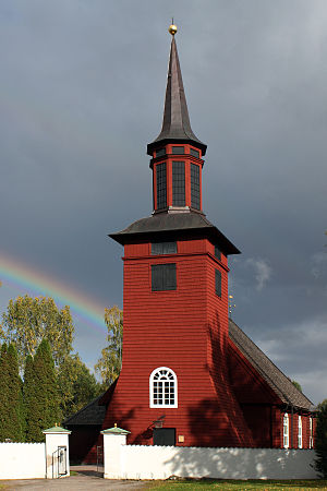
Hosjö Church (Swedish: Hosjö kyrka) is a congregational church for the Hosjö Congregation, in Falun, Sweden.

Lugnet, Falun
Sport complex located in Falun, Sweden
Distance: Approx. 2316 meters
Latitude and longitude: 60.62083333,15.65833333
Lugnet is a large sport complex located in Falun, Sweden. 58 of the Swedish Sports Confederation's 67 special sports can be practiced there. There are six full sized indoor pitches in the area where everything from dance to association football can be played or performed.

Falun Mine
UNESCO World Heritage Site in Dalarna County, Sweden
Distance: Approx. 1266 meters
Latitude and longitude: 60.59888889,15.61222222
Falun Mine (Swedish: Falu Gruva) was a mine in Falun, Sweden, that operated for a millennium from the 10th century to 1992. It produced as much as two-thirds of Europe's copper needs and helped fund many of Sweden's wars in the 17th century. Technological developments at the mine had a profound influence on mining globally for two centuries.

Varpan
Lake in Sweden
Distance: Approx. 5390 meters
Latitude and longitude: 60.65,15.6
Varpan is a lake just north of Falun in central Sweden; its surface is approximately 115 metres (377 ft) above sea level. Varpan features a 8.5 miles (13.7 km) bicycle trail loop which is open year-round.
Falu River
River in Sweden
Distance: Approx. 1425 meters
Latitude and longitude: 60.61527778,15.61916667
Falu River (Swedish: Faluån) is a river in Sweden. It runs from lake Varpan to lake Runn and passes through the town of Falun.
Lugnet Hills
Distance: Approx. 2586 meters
Latitude and longitude: 60.6211,15.6653
Lugnet HS134 is a large ski jumping hill located in Falun, Sweden. It has a hill size of HS134, a construction point of K-120. The hill has artificial lighting and bleachers for 15,000 viewers.

Kristine Church, Falun
Distance: Approx. 398 meters
Latitude and longitude: 60.6078,15.6311
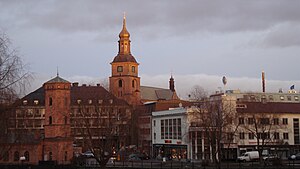
Kristine Church is the parish church of Falu Kristine in the Diocese of Västerås of the Church of Sweden in Falun.
Weather in this IP's area
light rain
4 Celsius
3 Celsius
3 Celsius
5 Celsius
1013 hPa
70 %
1013 hPa
1000 hPa
10000 meters
1.79 m/s
3.13 m/s
255 degree
100 %
07:57:23
15:26:44


