Country:
 Sweden
Region:
City:
Latitude and Longitude:
Time Zone:
Postal Code:
IP information under different IP Channel
ip-api
Country
Region
City
ASN
Time Zone
ISP
Blacklist
Proxy
Latitude
Longitude
Postal
Route
IPinfo
Country
Region
City
ASN
Time Zone
ISP
Blacklist
Proxy
Latitude
Longitude
Postal
Route
MaxMind
Country
Region
City
ASN
Time Zone
ISP
Blacklist
Proxy
Latitude
Longitude
Postal
Route
Luminati
Country
SEASN
Time Zone
Europe/Stockholm
ISP
GlobalConnect AB
Latitude
Longitude
Postal
db-ip
Country
Region
City
ASN
Time Zone
ISP
Blacklist
Proxy
Latitude
Longitude
Postal
Route
ipdata
Country
Region
City
ASN
Time Zone
ISP
Blacklist
Proxy
Latitude
Longitude
Postal
Route
Popular places and events near this IP address
Mark Municipality
Municipality in Västra Götaland County, Sweden
Distance: Approx. 1241 meters
Latitude and longitude: 57.51666667,12.68333333
Mark Municipality (Marks kommun) is a municipality in Västra Götaland County in southwest Sweden. The municipal seat is located in the center of Kinna town. The municipality was created through the Municipal Reform Act of 1971 by the amalgamation of eight smaller municipal entities.
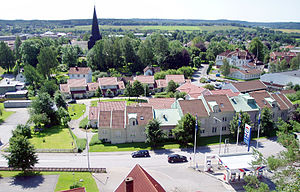
Kinna
Place in Västergötland, Sweden
Distance: Approx. 1241 meters
Latitude and longitude: 57.51666667,12.68333333
Kinna is a locality and the seat of Mark Municipality, Västra Götaland County, Sweden. It had 14,776 inhabitants in 2010. Kinna is located 30 kilometres (19 miles) south of Borås and 60 kilometres (37 miles) south east of Gothenburg.
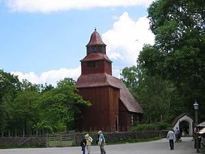
Seglora
Distance: Approx. 8775 meters
Latitude and longitude: 57.58333333,12.73333333
Seglora (Swedish pronunciation: [ˈsêːˌɡluːra]) is the most rural part of the Borås Municipality. It is bordering to Mark Municipality and Bollebygd Municipality in western Sweden. Seglora as a locality is not very well known in Sweden, but most Swedes know of the Seglora Church that can be found at Skansen.
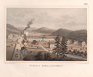
Rydal, Sweden
Place in Västergötland, Sweden
Distance: Approx. 4801 meters
Latitude and longitude: 57.55,12.68333333
Rydal (Swedish pronunciation: [rʏˈdɑːl]) is a locality situated in Mark Municipality, Västra Götaland County, Sweden. It had 402 inhabitants in 2010.
Berghem, Sweden
Place in Västergötland, Sweden
Distance: Approx. 8049 meters
Latitude and longitude: 57.46666667,12.58333333
Berghem is a locality situated in Mark Municipality, Västra Götaland County, Sweden. It had 360 inhabitants in 2010.
Fritsla
Place in Västergötland, Sweden
Distance: Approx. 7122 meters
Latitude and longitude: 57.55,12.78333333
Fritsla is a locality situated in Mark Municipality, Västra Götaland County, Sweden. It had 2,293 inhabitants in 2010.
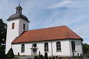
Örby, Kinna
Distance: Approx. 2463 meters
Latitude and longitude: 57.4852,12.6927
Örby is a part of the town Kinna in Mark Municipality, Västra Götaland County, Sweden. The area has about 2,000 inhabitants and was formerly a locality of its own, but has grown together with Kinna. Örby is the home of sports club IFK Örby.
Skene, Sweden
Place in Västergötland, Sweden
Distance: Approx. 3689 meters
Latitude and longitude: 57.49,12.642
Skene (Swedish pronunciation: [ˈɧɛ̌ːnɛ]) is the second largest town in Mark Municipality, Västra Götaland County, Sweden. The area has about 5,800 inhabitants and was formerly a locality of its own, but has grown together with Kinna.
Weather in this IP's area
overcast clouds
12 Celsius
11 Celsius
11 Celsius
13 Celsius
1017 hPa
85 %
1017 hPa
1009 hPa
10000 meters
2.36 m/s
7.6 m/s
159 degree
100 %
07:50:19
17:57:59