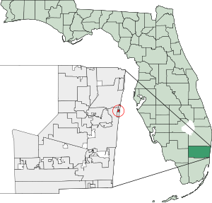
Country:
 USA
USARegion:
City:
Latitude and Longitude:
Time Zone:
Postal Code:
IP information under different IP Channel
ip-api
Country
Region
City
ASN
Time Zone
ISP
Blacklist
Proxy
Latitude
Longitude
Postal
Route
IPinfo
Country
Region
City
ASN
Time Zone
ISP
Blacklist
Proxy
Latitude
Longitude
Postal
Route
MaxMind
Country
Region
City
ASN
Time Zone
ISP
Blacklist
Proxy
Latitude
Longitude
Postal
Route
Luminati
Country
USASN
Time Zone
America/Chicago
ISP
CL-1379-14537
Latitude
Longitude
Postal
db-ip
Country
Region
City
ASN
Time Zone
ISP
Blacklist
Proxy
Latitude
Longitude
Postal
Route
ipdata
Country
Region
City
ASN
Time Zone
ISP
Blacklist
Proxy
Latitude
Longitude
Postal
Route
Popular places and events near this IP address
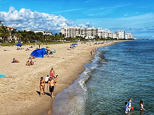
Lauderdale-by-the-Sea, Florida
Town in Florida, United States
Distance: Approx. 981 meters
Latitude and longitude: 26.18944444,-80.09777778
Lauderdale-by-the-Sea is a town in Broward County, Florida, United States, situated 33 miles north of Miami. The town is part of the South Florida metropolitan area. As of the 2020 census, the population was 6,198.
Sea Ranch Lakes, Florida
Village in Florida
Distance: Approx. 380 meters
Latitude and longitude: 26.20083333,-80.09694444
Sea Ranch Lakes is a village in Broward County, Florida, United States. The village is part of the Miami metropolitan area of South Florida. It is located on North Ocean Drive (Highway A1A) and is surrounded by Lauderdale-by-the-Sea.
Terra Mar, Florida
Neighborhood in Broward, Florida, United States
Distance: Approx. 1626 meters
Latitude and longitude: 26.2125,-80.09555556
Terra Mar was a census-designated place (CDP) in Broward County, Florida, United States. The population was 2,631 at the 2000 census. Most of the neighborhood belongs to Lauderdale-by-the-Sea, Florida with a small portion belonging to Pompano Beach, Florida.

Knox Theological Seminary
Evangelical theological seminary
Distance: Approx. 1850 meters
Latitude and longitude: 26.19555556,-80.11333333
Knox Theological Seminary is an independent, reformed evangelical seminary in Fort Lauderdale, Florida, US, founded in 1989 by D. James Kennedy. The school provides ministry training as a fully online seminary.
SS Copenhagen (1898)
Steamship wreck near Lauderdale-by-the-Sea, Florida
Distance: Approx. 1303 meters
Latitude and longitude: 26.20555556,-80.08512778
SS Copenhagen is a shipwreck off the town of Lauderdale-by-the-Sea, Florida, United States. She was a cargo steamship, built in England in 1898. She was wrecked on a reef south of Hillsboro Inlet in 1900.
Westminster Academy (Florida)
Private school in Fort Lauderdale, Florida, United States
Distance: Approx. 1781 meters
Latitude and longitude: 26.1973056,-80.112822
Westminster Academy is a private Christian school in Fort Lauderdale, Florida, serving students in grades PK2 through 12. It is an educational ministry of the Coral Ridge Presbyterian Church and is related denominationally to the Presbyterian Church in America. The main campus is located at 5601 North Federal Highway in Fort Lauderdale, with a "west campus" Athletic Complex located at 3701 NW 44th Street in Lauderdale Lakes.

Cardinal Gibbons High School (Fort Lauderdale, Florida)
Private secondary school in Fort Lauderdale, Florida, United States
Distance: Approx. 1917 meters
Latitude and longitude: 26.18527778,-80.10805556
Cardinal Gibbons High School, commonly known as Gibbons, is a private, Roman Catholic college-preparatory school in Fort Lauderdale, Florida. CGHS was established in 1961 and was named after James Gibbons, the second Cardinal in the United States. CGHS is sponsored by the Roman Catholic Archdiocese of Miami.
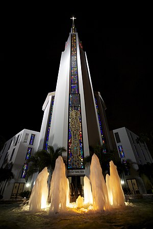
Coral Ridge Presbyterian Church
Church in Florida, U.S.
Distance: Approx. 1801 meters
Latitude and longitude: 26.19588889,-80.11288889
Coral Ridge Presbyterian Church is a Christian megachurch within the Presbyterian Church in America located in Fort Lauderdale, Florida. It was founded in 1960 by D. James Kennedy (1930–2007), who served as the church's senior pastor until shortly before his death. The present church building, which seats 2,300 persons, was dedicated on February 3, 1974, by evangelist Billy Graham.
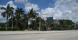
Mai-Kai Restaurant
United States historic place
Distance: Approx. 3761 meters
Latitude and longitude: 26.17246,-80.119775
The Mai-Kai is a Polynesian-themed restaurant and tiki bar in Oakland Park, Florida. It opened to the public on December 28, 1956, and is one of the few "Grand Polynesian Palaces of Tiki" still in operation today. In 2015 it was named the "best tiki bar in the world" by Critiki, an organization of fans of Polynesian pop culture.
Holy Cross Hospital (Fort Lauderdale)
Hospital in Florida, United States
Distance: Approx. 2779 meters
Latitude and longitude: 26.18694444,-80.12
Holy Cross Health fka Holy Cross Hospital is located in Fort Lauderdale, Florida. The hospital is a non-profit, 557-bed Catholic hospital which operates in the spirit of the Sisters of Mercy. It is a member of Trinity Health.
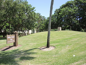
Pompano Beach Mound
Historic Florida Tequesta burial mound
Distance: Approx. 2657 meters
Latitude and longitude: 26.22166667,-80.0925
The Pompano Beach Mound, located at Indian Mound Park in Pompano Beach, Florida, in Broward County, is a 100-foot (30 m) wide, 7-foot (2.1 m) tall oval Tequesta burial mound. It was listed on the National Register of Historic Places on April 17, 2014.

USCGC Hollyhock (WAGL-220)
Hollyhock-class tender of the United States Coast Guard
Distance: Approx. 3696 meters
Latitude and longitude: 26.218783,-80.066233
USCGC Hollyhock (WAGL-220) was the lead ship of the Hollyhock-class buoy tender built in 1937 and operated by the United States Coast Guard. The ship was named after an annual, biennial, or perennial plant usually taking an erect, unbranched form.
Weather in this IP's area
broken clouds
27 Celsius
32 Celsius
26 Celsius
29 Celsius
1011 hPa
91 %
1011 hPa
1011 hPa
10000 meters
4.01 m/s
4.63 m/s
135 degree
53 %
07:03:35
19:32:33