Country:
Region:
City:
Latitude and Longitude:
Time Zone:
Postal Code:
IP information under different IP Channel
ip-api
Country
Region
City
ASN
Time Zone
ISP
Blacklist
Proxy
Latitude
Longitude
Postal
Route
Luminati
Country
Region
sc
City
chester
ASN
Time Zone
America/New_York
ISP
TRUVISTA
Latitude
Longitude
Postal
IPinfo
Country
Region
City
ASN
Time Zone
ISP
Blacklist
Proxy
Latitude
Longitude
Postal
Route
db-ip
Country
Region
City
ASN
Time Zone
ISP
Blacklist
Proxy
Latitude
Longitude
Postal
Route
ipdata
Country
Region
City
ASN
Time Zone
ISP
Blacklist
Proxy
Latitude
Longitude
Postal
Route
Popular places and events near this IP address

Camden, South Carolina
City in South Carolina, United States
Distance: Approx. 1861 meters
Latitude and longitude: 34.25916667,-80.60916667
Camden is the largest city and county seat of Kershaw County, South Carolina. The population was 7,764 in the 2020 census, and the 2022 population estimate is 8,213. It is part of the Columbia, South Carolina, Metropolitan Statistical Area.

Battle of Hobkirk's Hill
Battle of the American Revolutionary War
Distance: Approx. 1683 meters
Latitude and longitude: 34.27444444,-80.60722222
The Battle of Hobkirk's Hill (sometimes referred to as the Second Battle of Camden) was a battle of the American Revolutionary War fought on April 25, 1781, near Camden, South Carolina. A small American force under Nathanael Greene occupying Hobkirk's Hill, north of Camden, was attacked by British troops led by Francis Rawdon. After a fierce clash, Greene retreated, leaving Rawdon's smaller force in possession of the hill.

Camden station (South Carolina)
Amtrak station in Camden, South Carolina, United States
Distance: Approx. 3753 meters
Latitude and longitude: 34.248,-80.625
Camden station, also known as the Seaboard Air Line Railroad Depot, is a train station in Camden, South Carolina. It serves Amtrak, the national passenger rail service. The station was built by the Seaboard Air Line Railroad in 1937.
Camden Military Academy
School in Camden, South Carolina, United States
Distance: Approx. 2939 meters
Latitude and longitude: 34.27888889,-80.56277778
Camden Military Academy (CMA) is a private, all-male, military boarding school located in Camden, South Carolina, United States. The State of South Carolina has recognized the institution as the official state military academy of South Carolina. Camden Military Academy accepts male students in grades 7 through 12, also offering a post-graduate year.
Camden High School (Camden, South Carolina)
Public school in Camden, South Carolina, United States
Distance: Approx. 3685 meters
Latitude and longitude: 34.24083333,-80.61583333
Camden High School is located in Camden, South Carolina, and is one of three high schools in the Kershaw County School District. It is the second largest high school. The school has approximately 980 students.

Bethesda Presbyterian Church (Camden, South Carolina)
Historic church in South Carolina, United States
Distance: Approx. 2661 meters
Latitude and longitude: 34.24611111,-80.60535556
Bethesda Presbyterian Church is a historic church at 502 DeKalb Street in Camden, South Carolina. A National Historic Landmark, the main church building was built in 1822 and is one of few surviving churches designed by 19th-century American architect Robert Mills.

Historic Camden Revolutionary War Site
National Historic Site of the United States
Distance: Approx. 3849 meters
Latitude and longitude: 34.23388889,-80.60333333
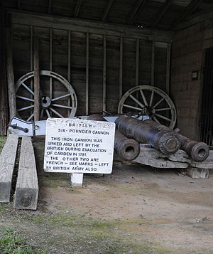
Historic Camden Revolutionary War Site is a national historic district and open-air museum located in Camden, Kershaw County, South Carolina, United States. Roughly 40 minutes away from Columbia, the state capitol, it is one of the state's largest tourist attractions. The 107-acre site is also known as Historic Camden Revolutionary War Restoration, and as the British Revolutionary War Fortifications.
Boylan-Haven-Mather Academy
Private, boarding school
Distance: Approx. 3082 meters
Latitude and longitude: 34.2461678,-80.6133641
Boylan-Haven-Mather Academy, more familiarly known as “Mather Academy,” was a private African American boarding school in Camden, South Carolina. Its name reflects four schools founded and merged in South Carolina, Georgia and Florida by the Women's Home Missionary Society of the Methodist Episcopal Church to educate former slaves and their descendants. Boylan-Haven-Mather Academy closed in 1983.

Cool Springs (Camden, South Carolina)
Historic house in South Carolina, United States
Distance: Approx. 3426 meters
Latitude and longitude: 34.29361111,-80.61
Cool Springs is a historic home located near Camden, Kershaw County, South Carolina. It was built about 1832, and is a two-story Greek Revival style house on a raised brick basement. The original house was remodeled in the 1850s.

City of Camden Historic District
Historic district in South Carolina, United States
Distance: Approx. 1934 meters
Latitude and longitude: 34.25444444,-80.60583333
City of Camden Historic District is a national historic district located at Camden, Kershaw County, South Carolina. The district encompasses 48 contributing buildings, 8 contributing sites, 2 contributing structures, and 3 contributing objects in Camden. The district is mostly residential but also include public buildings, a church, and a cemetery.

Kendall Mill Historic District
Historic district in South Carolina, United States
Distance: Approx. 872 meters
Latitude and longitude: 34.25916667,-80.59111111
Kendall Mill Historic District is a historic mill complex, mill village, and national historic district located at Camden, Kershaw County, South Carolina. The district encompasses 119 contributing buildings, 1 contributing sites, and 1 contributing structure in Camden. The district is centered on the Wateree Plant and associated structures that date from 1899 to 1923.
East Camden, South Carolina
Census-designated place in South Carolina, United States
Distance: Approx. 2220 meters
Latitude and longitude: 34.26833333,-80.56722222
East Camden is an unincorporated area and census-designated place (CDP) in Kershaw County, South Carolina, United States. It was first listed as a CDP prior to the 2020 census with a population of 3,215. East Camden is in south-central Kershaw County, bordered to the southwest and south by the city of Camden, the county seat.
Weather in this IP's area
light intensity drizzle
12 Celsius
12 Celsius
11 Celsius
13 Celsius
1014 hPa
98 %
1014 hPa
1006 hPa
4828 meters
100 %
06:55:02
17:18:57