192.158.190.134 - IP Lookup: Free IP Address Lookup, Postal Code Lookup, IP Location Lookup, IP ASN, Public IP
Country:
Region:
City:
Location:
Time Zone:
Postal Code:
ISP:
ASN:
language:
User-Agent:
Proxy IP:
Blacklist:
IP information under different IP Channel
ip-api
Country
Region
City
ASN
Time Zone
ISP
Blacklist
Proxy
Latitude
Longitude
Postal
Route
db-ip
Country
Region
City
ASN
Time Zone
ISP
Blacklist
Proxy
Latitude
Longitude
Postal
Route
IPinfo
Country
Region
City
ASN
Time Zone
ISP
Blacklist
Proxy
Latitude
Longitude
Postal
Route
IP2Location
192.158.190.134Country
Region
oregon
City
beaverton
Time Zone
America/Los_Angeles
ISP
Language
User-Agent
Latitude
Longitude
Postal
ipdata
Country
Region
City
ASN
Time Zone
ISP
Blacklist
Proxy
Latitude
Longitude
Postal
Route
Popular places and events near this IP address

Beaverton Transit Center
Transport hub located in Beaverton, Oregon, U.S.
Distance: Approx. 155 meters
Latitude and longitude: 45.49111111,-122.80111111
Beaverton Transit Center is a multimodal transport hub in Beaverton, Oregon, United States. Owned and operated by TriMet, it is served by bus, commuter rail, and light rail. The transit center is MAX Light Rail's 15th station eastbound on the Blue Line and 11th station eastbound on the Red Line.

Beaverton Central station
Distance: Approx. 502 meters
Latitude and longitude: 45.490489,-122.807051
Beaverton Central is a light rail station on the MAX Blue and Red lines in Beaverton, Oregon, United States. The station, located near Beaverton's downtown area, is surrounded by a mixed-use development, The Round at Beaverton Central, the present location of the main offices of The Linux Foundation, previously the Open Source Development Labs. In March 2011, TriMet received a federal grant to pay for the installation of security cameras at the station.

Bernard's Airport
Former airfield in Beaverton, Oregon
Distance: Approx. 868 meters
Latitude and longitude: 45.496925,-122.810454
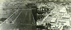
Bernard's Airport, also known as Bernard Airport, was a non-commercial airfield in Beaverton, Oregon, United States, from 1928 to 1969. In its early years, it was one of two private airports located in Beaverton, the other being Watts Field, about one-half mile to the south of Bernard's Airport. The Bernard Airport site was redeveloped in 1969 as "Bernard's Beaverton Mall", now known as Cedar Hills Crossing.

Arts & Communication Magnet Academy
Public school in Beaverton, Oregon, United States
Distance: Approx. 648 meters
Latitude and longitude: 45.494207,-122.793355
Arts & Communication Magnet Academy (ACMA) is a publicly funded arts magnet school in Beaverton, Oregon, United States. It is a member of the International Network of Schools for the Advancement of Arts Education. The school opened in 1992, in facilities which previously served as a Beaverton School District elementary school, C.E. Mason Elementary, opened in 1949.

Beaverton Downtown Historic District
Historic district in Beaverton, Oregon, U.S.
Distance: Approx. 661 meters
Latitude and longitude: 45.487377,-122.805585
The Beaverton Downtown Historic District comprises a primarily commercial and civic portion of downtown Beaverton, Oregon, United States. Beaverton's historic commercial core remains largely intact as a pedestrian-oriented business district constructed along the street pattern from the city's earliest plats. Significant buildings include a handful from the city's first decades (1868–1920) and a larger number from the period of profound transformation between the world wars (1920–1940).
Three Creeks, One Will
Sculpture in Beaverton, Oregon, U.S.
Distance: Approx. 524 meters
Latitude and longitude: 45.49031,-122.80724
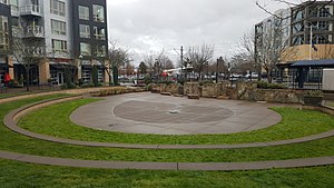
Three Creeks, One Will is an outdoor 2013 sculpture by Devin Laurence Field, installed in Beaverton, Oregon, United States.

Beaverton Bakery
Defunct bakery in Beaverton, Oregon, U.S.
Distance: Approx. 559 meters
Latitude and longitude: 45.48769444,-122.80336111
Beaverton Bakery was a bakery in Beaverton, Oregon, United States. The business was started by Charles Yeager in 1925. The business was well known locally for their wedding cakes and donuts along with a variety of other baked goods.

Patricia Reser Center for the Arts
Arts center in Beaverton, Oregon, U.S.
Distance: Approx. 448 meters
Latitude and longitude: 45.49130556,-122.80677778
The Patricia Reser Center for the Arts (previously known as the Beaverton Center for the Arts) is an arts center near The Round in Beaverton, Oregon, United States.

BG's Food Cartel
Food cart pod in Beaverton, Oregon, U.S.
Distance: Approx. 654 meters
Latitude and longitude: 45.48930556,-122.80833333
BG's Food Cartel (sometimes BG Food Cartel) is a food cart pod near The Round in Beaverton, Oregon, United States. The pod opened as Beaverton's first in 2018.

The Round (Beaverton, Oregon)
Mixed-use development in Beaverton, Oregon, U.S.
Distance: Approx. 498 meters
Latitude and longitude: 45.49083333,-122.80722222
The Round (also known as The Round at Beaverton Central) is a mixed-use development surrounding the Beaverton Central station in Beaverton, Oregon, United States. Nearby features include BG's Food Cartel and the Patricia Reser Center for the Arts.
Magna Kubo
Defunct Filipino restaurant in Beaverton, Oregon, U.S.
Distance: Approx. 622 meters
Latitude and longitude: 45.4873,-122.8042
Magna Kubo was a Filipino restaurant in Beaverton, Oregon. Owner Carlo Lamagna and chef Kevin Balonso opened the restaurant in 2023, as an off-shoot of Lamagna's Portland eatery Magna Kusina. Magna Kubo specialized in rotisserie-style meats and also served bistek, chicken wings, laing, and halo-halo.
Hapa Pizza
Restaurant in Beaverton, Oregon, U.S.
Distance: Approx. 711 meters
Latitude and longitude: 45.487646,-122.807226
Hapa Pizza is a restaurant in Beaverton, Oregon, United States. The business was included in The New York Times's 2024 list of the 22 best pizzerias in the United States.
Weather in this IP's area
clear sky
-1 Celsius
-3 Celsius
-3 Celsius
1 Celsius
1038 hPa
87 %
1038 hPa
1027 hPa
10000 meters
1.54 m/s
290 degree