192.154.64.82 - IP Lookup: Free IP Address Lookup, Postal Code Lookup, IP Location Lookup, IP ASN, Public IP
Country:
Region:
City:
Location:
Time Zone:
Postal Code:
ISP:
ASN:
language:
User-Agent:
Proxy IP:
Blacklist:
IP information under different IP Channel
ip-api
Country
Region
City
ASN
Time Zone
ISP
Blacklist
Proxy
Latitude
Longitude
Postal
Route
db-ip
Country
Region
City
ASN
Time Zone
ISP
Blacklist
Proxy
Latitude
Longitude
Postal
Route
IPinfo
Country
Region
City
ASN
Time Zone
ISP
Blacklist
Proxy
Latitude
Longitude
Postal
Route
IP2Location
192.154.64.82Country
Region
north carolina
City
winston-salem
Time Zone
America/New_York
ISP
Language
User-Agent
Latitude
Longitude
Postal
ipdata
Country
Region
City
ASN
Time Zone
ISP
Blacklist
Proxy
Latitude
Longitude
Postal
Route
Popular places and events near this IP address
Winston-Salem State University
Historically black university in Winston-Salem, North Carolina, US
Distance: Approx. 1774 meters
Latitude and longitude: 36.0895,-80.2251
Winston-Salem State University (WSSU) is a historically black public university in Winston-Salem, North Carolina. It is part of the University of North Carolina system.

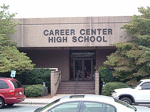
Career Center (Winston-Salem, North Carolina)
American alternate high school in North Carolina
Distance: Approx. 1745 meters
Latitude and longitude: 36.107166,-80.234796
The Career Center is a high school located in Winston-Salem, North Carolina. It offers an extension to the regular high school program. Classes offered include Advanced Placement courses, career, technical education (CTE) courses, English, and classes too small to be held at the regular high schools in the Winston-Salem/Forsyth County Schools program, such as Japanese and Chinese.
C. E. Gaines Center
Distance: Approx. 1767 meters
Latitude and longitude: 36.089,-80.2236
The C.E. Gaines Center is a basketball arena on the campus of Winston-Salem State University. It is named for former WSSU men's basketball coach Clarence "Bighouse" Gaines, who led the men's basketball team for 47 years. The facility has a capacity of 3,200 spectators and opened in 1978.
WSNC
Radio station in Winston-Salem, North Carolina
Distance: Approx. 1610 meters
Latitude and longitude: 36.09,-80.222
WSNC (90.5 FM) is a radio station broadcasting jazz, gospel, and talk programming. Licensed to Winston-Salem, North Carolina, United States, it serves the Piedmont Triad area. The station is currently owned by Winston-Salem State University.

Atkins High School (North Carolina)
Historic school building in North Carolina, United States
Distance: Approx. 944 meters
Latitude and longitude: 36.11083333,-80.22138889
Atkins High School located at Winston-Salem, Forsyth County, North Carolina, was dedicated on April 2, 1931, as a facility for African American students. The building, equipment and grounds were valued at that time at $400,000. This was paid primarily by the city, with a grant of $50,000 from the Rosenwald Fund.

Winston-Salem Preparatory Academy
American public school in North Carolina
Distance: Approx. 986 meters
Latitude and longitude: 36.1109,-80.2221
Winston-Salem Preparatory Academy (WSPA) is a public school located in Forsyth County, in Winston-Salem, North Carolina. Its building location is at the former site of Atkins High School.

Goler Metropolitan AME Zion Church
Historic church in North Carolina, United States
Distance: Approx. 1141 meters
Latitude and longitude: 36.09944444,-80.2275
Goler Metropolitan AME Zion Church, originally known as East Fourth Street Baptist Church, is a historic African Methodist Episcopal Zion church located at 1435 E. Fourth Street in Winston-Salem, Forsyth County, North Carolina. It was built in 1924, and is a front-gabled brick church with two prominent domed towers and flanking one-story hipped-roof wings in the Classical Revival style. The front facade features a prominent pedimented porch supported by stuccoed Doric order columns and Ionic order pilasters.

S. G. Atkins House
Historic house in North Carolina, United States
Distance: Approx. 1740 meters
Latitude and longitude: 36.09222222,-80.22916667
S. G. Atkins House is a historic home located at Winston-Salem, Forsyth County, North Carolina. The house was built about 1893, and is a two-story, three-bay, frame dwelling with rear additions. The front facade has a central gable and a hip-roofed porch.

George Black House and Brickyard
Historic house in North Carolina, United States
Distance: Approx. 1218 meters
Latitude and longitude: 36.11333333,-80.20972222
George Black House and Brickyard is a historic home and brickyard site located at Winston-Salem, Forsyth County, North Carolina. The house was built about 1900, and is a traditional one-story, three-bay, frame "triple-A" dwelling. The front facade features an almost full-width hip-roofed attached porch.

Union Station (Winston-Salem, North Carolina)
Historic building in North Carolina, US
Distance: Approx. 1599 meters
Latitude and longitude: 36.09333333,-80.22833333
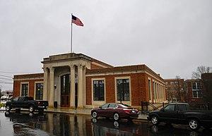
Union Station is a historic train station, currently serving as a bus station, located in Winston-Salem, Forsyth County, North Carolina.

Mars Hill Baptist Church
Historic church in North Carolina, United States
Distance: Approx. 1303 meters
Latitude and longitude: 36.09944444,-80.22944444
Mars Hill Baptist Church, also known as Fries Memorial Moravian Church, is a historic African-American Baptist church. It is located at Winston-Salem, Forsyth County, North Carolina, and was built in 1915. It is a T-shaped brick building with corner tower in the Gothic Revival style.

Reynoldstown Historic District (Winston-Salem, North Carolina)
Historic district in North Carolina, United States
Distance: Approx. 638 meters
Latitude and longitude: 36.105,-80.22277778
Reynoldstown Historic District, also known as Cameron Park, is a national historic district located at Winston-Salem, Forsyth County, North Carolina. The district encompasses 183 contributing buildings and 1 contributing structure (Cameron Avenue Bridge) in a planned residential development of the R. J. Reynolds Tobacco Company (RJR) and historically African-American residential section of Winston-Salem. The buildings date from about 1919 to 1949, and include notable examples of Colonial Revival, Tudor Revival, and Bungalow / American Craftsman style architecture.
Weather in this IP's area
overcast clouds
0 Celsius
-2 Celsius
-1 Celsius
1 Celsius
1025 hPa
44 %
1025 hPa
992 hPa
10000 meters
2.06 m/s
2.5 m/s
230 degree
100 %