Country:
Region:
City:
Latitude and Longitude:
Time Zone:
Postal Code:
IP information under different IP Channel
ip-api
Country
Region
City
ASN
Time Zone
ISP
Blacklist
Proxy
Latitude
Longitude
Postal
Route
IPinfo
Country
Region
City
ASN
Time Zone
ISP
Blacklist
Proxy
Latitude
Longitude
Postal
Route
MaxMind
Country
Region
City
ASN
Time Zone
ISP
Blacklist
Proxy
Latitude
Longitude
Postal
Route
Luminati
Country
ASN
Time Zone
Europe/London
ISP
British Telecommunications PLC
Latitude
Longitude
Postal
db-ip
Country
Region
City
ASN
Time Zone
ISP
Blacklist
Proxy
Latitude
Longitude
Postal
Route
ipdata
Country
Region
City
ASN
Time Zone
ISP
Blacklist
Proxy
Latitude
Longitude
Postal
Route
Popular places and events near this IP address

Bedford Modern School
Public school in Bedfordshire, England
Distance: Approx. 1017 meters
Latitude and longitude: 52.148,-0.482
Bedford Modern School (often called BMS or simply Modern) is a Headmasters' and Headmistresses' Conference independent school in Bedford, England. The school has its origins in The Harpur Trust, born from the endowments left by Sir William Harpur in the sixteenth century. BMS comprises a junior school (ages 6–11) and a senior school (ages 11–18).
Harpur Trust
Charity in Bedford, England
Distance: Approx. 1292 meters
Latitude and longitude: 52.15,-0.459
The Harpur Trust is a charity in Bedford, England. The stated aim of the charity is to help and support the people who live in and around Bedford, and to help them improve their lives by: providing and promoting education offering help and relief to anyone who is sick, in need, in hardship or distress providing recreational facilities with a social welfare purpose for the people of Bedford and its surroundings. Reorganised as a company limited by guarantee in 2012, it was previously called The Bedford Charity (The Harpur Trust) as its legal name, but was most often referred to as the Harpur Trust.
Brickhill
Human settlement in England
Distance: Approx. 986 meters
Latitude and longitude: 52.15725,-0.46078
Brickhill is a civil parish and electoral ward within northern Bedford in Bedfordshire, England. The boundaries of Brickhill are approximately Kimbolton Road to the east, Bedford Park and the old Bedford cemetery to the south, with Cemetery Hill and the Manton Heights Industrial Estate to the west. The Woodlands Park housing estate (off Tyne Crescent) became part of Brickhill parish in 2015.
St Thomas More Catholic School, Bedford
Academy in Bedford, Bedfordshire, England
Distance: Approx. 1016 meters
Latitude and longitude: 52.16176,-0.46342
St Thomas More Catholic School is a mixed secondary school and sixth form located in Bedford in the English county of Bedfordshire. The school is located on Tyne Crescent in the Brickhill area of north Bedford. The school has no specific catchment area due to it being a Catholic school (although it accepts pupils of all backgrounds), but attracts students from all over Bedford and the surrounding villages.
Bedford Greenacre Independent School
Private school in Bedford, Bedfordshire, England
Distance: Approx. 1427 meters
Latitude and longitude: 52.144,-0.482
Bedford Greenacre Independent School is a co-educational private day school located in Bedford, Bedfordshire, England. The school was formally created in May 2021 from a merger of Rushmoor School and St Andrew's School.
Harpur
Area of Bedford, England
Distance: Approx. 1024 meters
Latitude and longitude: 52.14695,-0.4767
Harpur is an electoral ward and area within the town of Bedford, England. The boundaries of Harpur are approximately Manton Lane to the north, De Parys Avenue to the east, Bromham Road to the south, with the Midland Main Line railway line to the west. Manton Heights, the Poets, the Prime Ministers, and the Black Tom neighbourhoods all lie within the boundaries of Harpur ward.
Stella Mann College of Performing Arts
Distance: Approx. 1714 meters
Latitude and longitude: 52.141,-0.48
Stella Mann College of Performing Arts is an independent, co-educational performing arts school and college specialising in dance and musical theatre. The college is located in the Harpur area of Bedford, Bedfordshire, England.
Bedford Park, Bedford
Distance: Approx. 1174 meters
Latitude and longitude: 52.1475,-0.46516
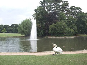
Bedford Park is a large urban park, located in the town of Bedford, Bedfordshire, England. The park is the largest urban park within the town, and it is owned and maintained by Bedford Borough Council. It is Grade II listed in Historic England's Register of Parks and Gardens.

Church of St Thomas of Canterbury, Clapham, Bedfordshire
Historic church in the United Kingdom
Distance: Approx. 1137 meters
Latitude and longitude: 52.1609,-0.4898
Church of St Thomas of Canterbury (also Clapham Parish Church, or Thomas à Becket) is a parish church and Grade I listed building in Clapham, Bedfordshire, England. It became a listed building on 13 July 1964. Though the church can be traced back before A.D. 1000, there is no record of the original patron saint, Thomas Becket having been so well accepted.
Bedford & County Golf Club
Golf club in Bedfordshire, England
Distance: Approx. 1278 meters
Latitude and longitude: 52.16722222,-0.47972222
Bedford & County Golf Club is a golf club to the northeast of Clapham, Bedfordshire, England. It was established in 1912. As of 1995 the course measured 6,290 yards.
Hill Rise, Bedford
Distance: Approx. 881 meters
Latitude and longitude: 52.148712,-0.470495
Hill Rise is a 0.9 hectare Local Nature Reserve (LNR) located in the Harpur area of Bedford. It is owned and managed by Bedford Borough Council. The site was the Bedfordshire Training Home for Girls, founded in 1882 to prepare poor girls for domestic service.
Park Wood, Bedford
Distance: Approx. 247 meters
Latitude and longitude: 52.156819,-0.471679
Park Wood is a 5.2 hectare Local Nature Reserve located in the Brickhill area of Bedford. It is owned by Bedford Borough Council and managed by the council with the assistance of the Friends of Park Wood. The site has diverse habitats with mature trees, grassland, scrub and ponds.
Weather in this IP's area
overcast clouds
14 Celsius
14 Celsius
13 Celsius
16 Celsius
1004 hPa
91 %
1004 hPa
996 hPa
10000 meters
1.83 m/s
3.18 m/s
107 degree
99 %
06:25:32
19:33:47


