Country:
 Brazil
Region:
City:
Latitude and Longitude:
Time Zone:
Postal Code:
IP information under different IP Channel
ip-api
Country
Region
City
ASN
Time Zone
ISP
Blacklist
Proxy
Latitude
Longitude
Postal
Route
IPinfo
Country
Region
City
ASN
Time Zone
ISP
Blacklist
Proxy
Latitude
Longitude
Postal
Route
MaxMind
Country
Region
City
ASN
Time Zone
ISP
Blacklist
Proxy
Latitude
Longitude
Postal
Route
Luminati
Country
BRRegion
sp
City
saobernardodocampo
ASN
Time Zone
America/Sao_Paulo
ISP
ITMINDS CONSULTORIA EM TECNOLOGIA DA INFORMACAO
Latitude
Longitude
Postal
db-ip
Country
Region
City
ASN
Time Zone
ISP
Blacklist
Proxy
Latitude
Longitude
Postal
Route
ipdata
Country
Region
City
ASN
Time Zone
ISP
Blacklist
Proxy
Latitude
Longitude
Postal
Route
Popular places and events near this IP address

Diadema, São Paulo
Municipality in Southeast, Brazil
Distance: Approx. 5088 meters
Latitude and longitude: -23.68611111,-46.61055556
Diadema (Portuguese pronunciation: [dʒi.ɐˈdemɐ], Diadem) is a municipality in São Paulo state, Brazil. Belonging to the ABCD Region of Greater São Paulo, it is 17 km (11 mi) distant from São Paulo's central point. Initially part of São Bernardo do Campo, Diadema became a city of its own in 1959.
Santo André, São Paulo
Municipality in Southeast, Brazil
Distance: Approx. 5098 meters
Latitude and longitude: -23.65722222,-46.53333333
Santo André (Portuguese pronunciation: [sɐ̃twɐ̃ˈdɾɛ], Saint Andrew) is a Brazilian municipality located in the Metropolitan Region of São Paulo. It is part of a group of municipalities known as the ABC Region. According to the most recent census in 2022, the population is estimated at 748,919 in an area of 175.8 km².

São Caetano do Sul
Municipality in Southeast Brazil, Brazil
Distance: Approx. 1307 meters
Latitude and longitude: -23.7,-46.55
São Caetano do Sul (or São Caetano) (Saint Cajetan of the South. Portuguese pronunciation: [sɐ̃w kajˈtɐnu du ˈsuw]) is a city in São Paulo state in Brazil. It is part of the Metropolitan Region of São Paulo.

São Bernardo do Campo
Municipality in Southeast, Brazil
Distance: Approx. 1307 meters
Latitude and longitude: -23.7,-46.55
São Bernardo do Campo (Portuguese pronunciation: [sɐ̃w beʁˈnaʁdu du ˈkɐ̃pu]) is a Brazilian municipality in the state of São Paulo. It is part of the Metropolitan Region of São Paulo. The population is 810,729 (2022 census) in an area of 409.51 km2 (158.11 sq mi).

ABC Region
Industrial region in Greater São Paulo, Brazil
Distance: Approx. 3830 meters
Latitude and longitude: -23.66583333,-46.54166667
The ABC Region is an industrial region in Greater São Paulo, Brazil. The name refers to three smaller cities south of São Paulo, capital of the Brazilian state of the same name. Originally, these three cities were Santo André, São Bernardo do Campo, and São Caetano do Sul.

Faculdade de Direito de São Bernardo do Campo
Distance: Approx. 757 meters
Latitude and longitude: -23.6891,-46.5579
College of Law of São Bernardo do Campo (in Portuguese: Faculdade de Direito de São Bernardo do Campo (FDSBC), also known as "Direito São Bernardo") is a public institution of higher education located in São Bernardo do Campo.

Centro Universitário da FEI
Distance: Approx. 3848 meters
Latitude and longitude: -23.725203,-46.579959
Centro Universitário da FEI is a higher education facility in São Bernardo do Campo, Brazil, offering undergraduate degrees in engineering, business administration, and computer sciences as well as master's degrees in mechanical engineering, electrical engineering, and administration; specialization courses are also offered. It is often ranked among the best Brazilian private engineering colleges and best overall in mechanical engineering, electrical engineering, and computer science. FEI is an abbreviation for Fundação Educacional Inaciana (Portuguese for Educational Foundation of Ignatius), but had meant in the past Faculdade de Engenharia Industrial (Portuguese for Faculty of Industrial Engineering).

ETEC Lauro Gomes
Vocational school, secondary school in São Bernardo do Campo, São Paulo, Brazil
Distance: Approx. 2271 meters
Latitude and longitude: -23.69,-46.54
ETEC Lauro Gomes, formerly known as ETE Lauro Gomes, ETI Lauro Gomes and Escola Técnica Industrial de São Bernardo do Campo is an educational facility located in São Bernardo do Campo, SP, Brazil. It offers secondary education and vocational education classes. It is named after Lauro Gomes de Almeida, mayor for São Bernardo do Campo between 1952 and 1954 and 1960 to 1963.

Sabina Escola Parque do Conhecimento
Science museum
Distance: Approx. 3565 meters
Latitude and longitude: -23.67903,-46.53129
The Sabina School Park of Knowledge (Portuguese: Sabina Escola Parque do Conhecimento) is a science museum in Santo André, São Paulo, Brazil. Other planetaria in Greater São Paulo include Professor Aristóteles Orsini Planetarium and Carmo Planetarium.
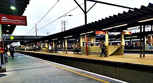
Pref. Celso Daniel-Santo André (CPTM)
Railway station in São Paulo, Brazil
Distance: Approx. 5851 meters
Latitude and longitude: -23.652244,-46.528221
Prefeito Celso Daniel-Santo André, or informally known only as Santo André, is a train station on CPTM Line 10 (Turquoise), in the city of Santo André.
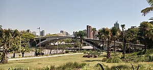
Cidade da Criança
Amusement park in Brazil
Distance: Approx. 913 meters
Latitude and longitude: -23.687825,-46.55725833
The Cidade da Criança (Children's City) is a Brazilian amusement park located in the center of São Bernardo do Campo, in the metropolitan region of São Paulo, behind the former Vera Cruz Film Studios. It was the first theme park in Brazil and in Latin America. It opened on October 10, 1968.

Estádio 1º de Maio (São Bernardo do Campo)
Football stadium in São Bernardo do Campo, Brazil
Distance: Approx. 765 meters
Latitude and longitude: -23.69994444,-46.55638889
Estádio 1.º de Maio is a football stadium in the centre of São Bernardo do Campo, Brazil, which is the home of São Bernardo. With a capacity of 15,159 it is the second-largest football stadium in the ABC region, behind Estádio Anacleto Campanella. Currently the capacity is limited to 12,578 since part of the South Stand is closed for renovation.
Weather in this IP's area
clear sky
20 Celsius
20 Celsius
19 Celsius
21 Celsius
1015 hPa
75 %
1015 hPa
927 hPa
10000 meters
2.57 m/s
40 degree
05:46:04
18:05:18