192.136.70.46 - IP Lookup: Free IP Address Lookup, Postal Code Lookup, IP Location Lookup, IP ASN, Public IP
Country:
Region:
City:
Location:
Time Zone:
Postal Code:
IP information under different IP Channel
ip-api
Country
Region
City
ASN
Time Zone
ISP
Blacklist
Proxy
Latitude
Longitude
Postal
Route
Luminati
Country
ASN
Time Zone
America/Chicago
ISP
STATE-OF-COLORADO-MNT-NETWORK
Latitude
Longitude
Postal
IPinfo
Country
Region
City
ASN
Time Zone
ISP
Blacklist
Proxy
Latitude
Longitude
Postal
Route
IP2Location
192.136.70.46Country
Region
colorado
City
lakewood
Time Zone
America/Denver
ISP
Language
User-Agent
Latitude
Longitude
Postal
db-ip
Country
Region
City
ASN
Time Zone
ISP
Blacklist
Proxy
Latitude
Longitude
Postal
Route
ipdata
Country
Region
City
ASN
Time Zone
ISP
Blacklist
Proxy
Latitude
Longitude
Postal
Route
Popular places and events near this IP address

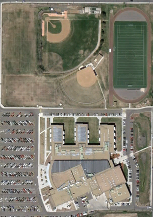
Lakewood High School (Colorado)
Public secondary school in Lakewood, Colorado, United States
Distance: Approx. 1705 meters
Latitude and longitude: 39.72833333,-105.10638889
Lakewood High School is a public secondary school located in Lakewood, Colorado, United States. It is part of Jefferson County Public Schools. Lakewood was ranked as the 111th best school in the nation by Newsweek in 2006, and as the 108th in 2008.

Crown Hill Park
Park in Colorado, United States
Distance: Approx. 1980 meters
Latitude and longitude: 39.75969,-105.09813
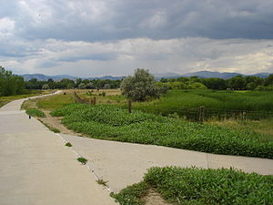
Crown Hill Park is a 242-acre (0.98 km2) recreation area operated by Jefferson County Open Space in unincorporated Jefferson County, Colorado. The park is located between the cities of Wheat Ridge and Lakewood. Within the borders of the park is a National Urban Wildlife Refuge.
Wheat Ridge High School
Public secondary school in Wheat Ridge, Colorado, United States
Distance: Approx. 2220 meters
Latitude and longitude: 39.763323,-105.104162
Wheat Ridge High School is a public secondary school operated by the Jefferson County School District R-1 in Wheat Ridge, Colorado, United States.

Tower of Memories
United States historic place
Distance: Approx. 1970 meters
Latitude and longitude: 39.75805556,-105.09472222
The Tower of Memories is a mausoleum located at Crown Hill Cemetery in unincorporated Jefferson County, Colorado, US. The seven-story building is 158 feet (48.16 m) tall; its entrance is at 29th Avenue and Wadsworth Boulevard. The building was designed with Gothic detailing by Charles A. Smith in 1926. After his firm failed in 1928, the architects William and Arthur Fisher were commissioned to continue the construction.
Denver Federal Center
Complex of United States federal agencies in Colorado, USA
Distance: Approx. 2893 meters
Latitude and longitude: 39.719632,-105.12105
The Denver Federal Center, in Lakewood, Colorado, is part of the General Services Administration and is home to about 6,200 employees of agencies of the federal government of the United States. The Center encompasses an area of about 670 acres (2.7 km2) and has 90 buildings with over 4,000,000 square feet (400,000 m2) of office, warehouse, lab and special use space. There are 28 different Federal agencies on-site, making it the largest concentration of Federal agencies outside of Washington, D.C. The major employers at the Center include the United States Department of the Interior (and its Bureau of Land Management, Bureau of Reclamation, and United States Geological Survey) and the General Services Administration.
Colorado School of Trades
Gunsmithing school in Colorado, United States
Distance: Approx. 378 meters
Latitude and longitude: 39.74186,-105.10421
The Colorado School of Trades is a private for-profit school in Lakewood, Colorado that focuses exclusively on gunsmithing. Graduates receive an Associate Degree. It was founded in 1947.
Jefferson High School (Edgewater, Colorado)
Public secondary school in Edgewater, Colorado, United States
Distance: Approx. 3161 meters
Latitude and longitude: 39.750786,-105.072276
Jefferson High School is a high school located in Edgewater, Colorado, United States. It is operated by Jefferson County Public Schools.
Denver Museum of Miniatures, Dolls and Toys
Toy museum in Lakewood, Colorado
Distance: Approx. 1500 meters
Latitude and longitude: 39.73015,-105.10908889
The Denver Museum of Miniatures, Dolls and Toys is a private, non-profit museum that is located in Lakewood, Colorado. The museum was founded in 1981. In 1987, the museum opened at its first location in cooperation with the Colorado Historical Society within the Pearce-McAllister Cottage.

Jefferson County Public Library
Public library in Colorado, United States
Distance: Approx. 614 meters
Latitude and longitude: 39.74707,-105.11358
Jefferson County Public Library (JCPL) serves Jefferson County, Colorado, United States, and is the third largest public library in the state. Its service area spans from the foothills of Colorado's Rocky Mountains to the edge of the metro Denver area. It serves a diverse set of Colorado communities, from Lakewood, (pop.
Oak station (RTD)
Light rail station in Lakewood, Colorado
Distance: Approx. 1237 meters
Latitude and longitude: 39.7373,-105.1199
Oak is an at-grade light rail station on the W Line of the RTD Rail system. It is located near the intersection of West Colfax Avenue and Oak Street, after which the station is named, in Lakewood, Colorado. The station is located within the Lakewood Industrial Park.
Garrison station (RTD)
Light rail station in Lakewood, Colorado
Distance: Approx. 1066 meters
Latitude and longitude: 39.7366,-105.0995
Garrison is an at-grade light rail station on the W Line of the RTD Rail system. It is located near the intersection of West 13th Avenue and Garrison Street, after which the station is named, in Lakewood, Colorado. The station opened on April 26, 2013, on the West Corridor, built as part of the Regional Transportation District (RTD) FasTracks public transportation expansion plan and voter-approved sales tax increase for the Denver metropolitan area.
Lakewood–Wadsworth station
Light rail station in Lakewood, Colorado
Distance: Approx. 2407 meters
Latitude and longitude: 39.7366,-105.0814
Lakewood–Wadsworth (sometimes stylized as Lakewood•Wadsworth) is an elevated light rail station on the W Line of the RTD Rail system. It is located alongside West 13th Avenue on a bridge over Wadsworth Boulevard, in Lakewood, Colorado, after which the station is named. The station opened on April 26, 2013, on the West Corridor, built as part of the Regional Transportation District (RTD) FasTracks public transportation expansion plan and voter-approved sales tax increase for the Denver metropolitan area.
Weather in this IP's area
heavy intensity rain
2 Celsius
-0 Celsius
2 Celsius
5 Celsius
1012 hPa
91 %
1012 hPa
817 hPa
10000 meters
2.57 m/s
220 degree
100 %


