Country:
Region:
City:
Latitude and Longitude:
Time Zone:
Postal Code:
IP information under different IP Channel
ip-api
Country
Region
City
ASN
Time Zone
ISP
Blacklist
Proxy
Latitude
Longitude
Postal
Route
Luminati
Country
ASN
Time Zone
America/Chicago
Latitude
Longitude
Postal
IPinfo
Country
Region
City
ASN
Time Zone
ISP
Blacklist
Proxy
Latitude
Longitude
Postal
Route
db-ip
Country
Region
City
ASN
Time Zone
ISP
Blacklist
Proxy
Latitude
Longitude
Postal
Route
ipdata
Country
Region
City
ASN
Time Zone
ISP
Blacklist
Proxy
Latitude
Longitude
Postal
Route
Popular places and events near this IP address

Rutgers Preparatory School
High school in Somerset County, New Jersey, US
Distance: Approx. 1256 meters
Latitude and longitude: 40.525135,-74.49627
Rutgers Preparatory School (also known as Rutgers Prep or RPS) is a private, coeducational, college preparatory day school established in 1766. The school educates students in pre-kindergarten through twelfth grade, located on a 41-acre (0.17 km2) campus along the banks of the Delaware and Raritan Canal in the Somerset section of Franklin Township, in Somerset County, in the U.S. state of New Jersey. Established in 1766, Rutgers Preparatory School is the oldest independent school in the state of New Jersey and the 16th-oldest in the country.
Meadows Foundation (New Jersey)
Distance: Approx. 1253 meters
Latitude and longitude: 40.525201,-74.496188
The Meadows Foundation of Somerset County, New Jersey is a nonprofit corporation founded in 1978. It oversaw the restoration of seven historic houses in Somerset.

Yurcak Field
Soccer-specific stadium
Distance: Approx. 1629 meters
Latitude and longitude: 40.518534,-74.463712
Yurcak Field is a 5,000 seat soccer-specific stadium on the main campus of Rutgers University–New Brunswick in Piscataway Township, New Jersey. Fully acknowledged as "The Soccer Stadium at Yurcak Field", it is named in honor of Ronald N. Yurcak, a 1965 All-American Rutgers Lacrosse player. The stadium opened on April 16, 1994 and is currently used by the Rutgers Scarlet Knights soccer and lacrosse teams, as well as professional teams of both sports.
TASSL
Distance: Approx. 1331 meters
Latitude and longitude: 40.522934,-74.467433
The Application Software Systems Laboratory (TASSL) is a research lab, as a part of Center for Advanced Information Processing (CAIP), and Department of Electrical and Computing Engineering at Rutgers University . It is under the direction of Dr. Manish Parashar and the current research fields include Autonomic Computing, Parallel Computing and Distributed Computing, Grid Computing, Peer-to-peer Computing, Adaptive Computing Systems, and Scientific Computation..

Van Wickle House
Historic house in New Jersey, United States
Distance: Approx. 885 meters
Latitude and longitude: 40.522887,-74.492728
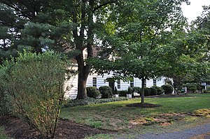
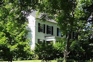
The Van Wickle House, also known as the Symen Van Wickle House, is a historical house located at 1289 Easton Avenue in the Somerset section of Franklin Township, Somerset County, New Jersey, United States. It was built in 1722 by Symen Van Wickle, also known as Symen Van Wicklin. The house, historically known as The Meadows, was added to the National Register of Historic Places on December 4, 1973.

Busch Campus of Rutgers University
Census-designated place in New Jersey, United States
Distance: Approx. 1458 meters
Latitude and longitude: 40.525,-74.46666667
Busch Campus is one of the five sub-campuses at Rutgers University's New Brunswick/Piscataway area campus, and is located entirely within Piscataway, New Jersey, US. Academic facilities and departments centered on this campus are primarily those related to the natural sciences: physics, pharmacy, engineering, psychology, mathematics and statistics, chemistry, geology, and biology. The Rutgers Medical School was also built on this campus in 1966, but four years later in 1970 was separated by the state and merged with the New Jersey Medical School and other health profession schools in Newark and New Brunswick to create the College of Medicine and Dentistry of New Jersey. Rutgers and the medical school, renamed Robert Wood Johnson Medical School in 1986, continued to share the land and facilities on the campus in a slightly irregular arrangement.

Ernest Mario School of Pharmacy
Distance: Approx. 1331 meters
Latitude and longitude: 40.52293,-74.46743
The Ernest Mario School of Pharmacy (EMSOP) is the pharmacy school of Rutgers University. It was founded in 1892 as the Newark College of Pharmacy and merged with Rutgers University in 1927 as the Rutgers College of Pharmacy. In 1971, the school moved to its current location in Piscataway, on the Busch Campus.

New Brunswick Marconi Station
Distance: Approx. 865 meters
Latitude and longitude: 40.5144,-74.4893
New Brunswick Marconi Station was located at JFK Boulevard and Easton Avenue just one mile from the New Brunswick border in Somerset, New Jersey.

Greek Orthodox Church of St. George (Piscataway, New Jersey)
Church building in New Jersey, U.S.
Distance: Approx. 1209 meters
Latitude and longitude: 40.51334167,-74.47194167
The Greek Orthodox Church of St. George of Piscataway, New Jersey is the largest Greek congregation in New Jersey, US. In 2016 the congregation celebrated its 100th anniversary as well as the 43rd anniversary of its Greek Festival. Its 48th Annual Greek festival takes place May 20–23, 2021.

Road Up Raritan Historic District
Historic district in New Jersey, United States
Distance: Approx. 986 meters
Latitude and longitude: 40.52638889,-74.49138889
The Road Up Raritan Historic District is a 69-acre (28 ha) historic district located along River Road in the township of Piscataway in Middlesex County, New Jersey. It is north of Raritan Landing, once an important inland port on the Raritan River during the 18th and 19th centuries. The name is taken from an earlier colonial era name for what was once a Lenape path, Assunpink Trail that became a main road parallel to the river.

Matthias Smock House
Historic house in New Jersey, United States
Distance: Approx. 683 meters
Latitude and longitude: 40.52388889,-74.48944444
The Matthias Smock House is a historic house located at 851 River Road in the township of Piscataway in Middlesex County, New Jersey, United States. It was documented by the Historic American Buildings Survey (HABS) in 1938. The house was added to the National Register of Historic Places on December 4, 1973, for its significance in architecture.

Isaac Onderdonk House
Historic house in New Jersey, United States
Distance: Approx. 1615 meters
Latitude and longitude: 40.5325,-74.49333333
The Isaac Onderdonk House, also known as the Walter C. and Julia Meuly House, is a historic house located at 685 River Road in the township of Piscataway in Middlesex County, New Jersey, United States. It was added to the National Register of Historic Places on October 30, 1973, for its significance in architecture. It was listed as a contributing property of the Road Up Raritan Historic District in 1997.
Weather in this IP's area
clear sky
14 Celsius
13 Celsius
12 Celsius
16 Celsius
1020 hPa
65 %
1020 hPa
1017 hPa
10000 meters
3.29 m/s
7.44 m/s
348 degree
06:35:29
16:47:51