192.119.4.163 - IP Lookup: Free IP Address Lookup, Postal Code Lookup, IP Location Lookup, IP ASN, Public IP
Country:
Region:
City:
Location:
Time Zone:
Postal Code:
IP information under different IP Channel
ip-api
Country
Region
City
ASN
Time Zone
ISP
Blacklist
Proxy
Latitude
Longitude
Postal
Route
Luminati
Country
Region
la
City
mansura
ASN
Time Zone
America/Chicago
ISP
CSMIII-BUNKIELA
Latitude
Longitude
Postal
IPinfo
Country
Region
City
ASN
Time Zone
ISP
Blacklist
Proxy
Latitude
Longitude
Postal
Route
IP2Location
192.119.4.163Country
Region
louisiana
City
alexandria
Time Zone
America/Chicago
ISP
Language
User-Agent
Latitude
Longitude
Postal
db-ip
Country
Region
City
ASN
Time Zone
ISP
Blacklist
Proxy
Latitude
Longitude
Postal
Route
ipdata
Country
Region
City
ASN
Time Zone
ISP
Blacklist
Proxy
Latitude
Longitude
Postal
Route
Popular places and events near this IP address
Alexandria Museum of Art
United States historic place
Distance: Approx. 86 meters
Latitude and longitude: 31.31194444,-92.44416667
The Alexandria Museum of Art (AMoA) of Alexandria, central Louisiana, United States opened its doors in 1977 in downtown Alexandria in the historic Rapides Bank and Trust Company Building (circa 1898). Rapides Bank and Trust Company Building is a historic bank building completed in 1898 in the Renaissance Revival style, and was added to the National Register of Historic Places on May 15, 1980. In 1998, AMoA expanded and constructed its grand foyer and offices as an annex to the Rapides Bank Building.
Bontemps African American Museum
Distance: Approx. 305 meters
Latitude and longitude: 31.3099,-92.4423
The Arna Bontemps African American Museum was a museum in the United States city of Alexandria, Louisiana. The museum was housed in the restored home that was the birthplace of the poet Arna Bontemps, renowned as one of the leaders of the Harlem Renaissance. The museum and cultural center was located at 1327 3rd Street, and was featured on the Louisiana African American Heritage Trail.
Bentley Hotel
United States historic place
Distance: Approx. 50 meters
Latitude and longitude: 31.31194444,-92.445
Bentley Hotel, usually known as the Hotel Bentley, is a classic Renaissance-style hotel located near City Hall in downtown Alexandria in central Louisiana.
Commercial Building (Alexandria, Louisiana)
United States historic place
Distance: Approx. 161 meters
Latitude and longitude: 31.31055556,-92.44361111
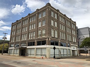
The Commercial Building in Alexandria, Louisiana, home of the Commercial Bank and Trust Company after it was built in 1915, is a historic commercial building located at the corner of Third Street and Johnston Street. It was added to the National Register of Historic Places in 1978. It is seven stories tall and was the city's first skyscraper.
Emmanuel Baptist Church (Alexandria, Louisiana)
Historic church in Louisiana, United States
Distance: Approx. 222 meters
Latitude and longitude: 31.31166667,-92.44722222
The Emmanuel Baptist Church in downtown Alexandria, Louisiana was built in 1950. It was added to the National Register of Historic Places on November 21, 2001. The building was designed by New Orleans architects Favrot & Reed.

Hemenway Furniture Co. Building
United States historic place
Distance: Approx. 140 meters
Latitude and longitude: 31.31222222,-92.44611111
Hemenway Furniture Co. Building is located in the central business district of Alexandria, Louisiana. It was added to the National Register of Historic Places in 1983.
Masonic Building (Alexandria, Louisiana)
United States historic place
Distance: Approx. 167 meters
Latitude and longitude: 31.31,-92.445
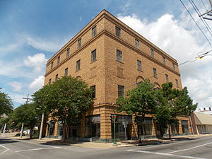
The Masonic Building in Alexandria, Louisiana, United States, was built in 1927. It was added to the National Register of Historic Places on January 16, 1986. It was designed by local architect Herman J. Duncan, of Sam Stone, Jr., & Co.

Rapides Opera House
United States historic place
Distance: Approx. 182 meters
Latitude and longitude: 31.31055556,-92.44333333
Rapides Opera House is located in Alexandria, Louisiana. It is a Romanesque building designed by Favrot & Livaudais and built in 1903. It was added to the National Register of Historic Places on June 11, 1981.

C.A. Schnack Jewelry Company Store
United States historic place
Distance: Approx. 44 meters
Latitude and longitude: 31.31111111,-92.445
The C.A. Schnack Jewelry Co. Store in Alexandria, Louisiana was listed on the National Register of Historic Places in 2000. It was designed by architect Herman J. Duncan and built by contractors Tudor and Ratcliff.
St. Francis Xavier Cathedral (Alexandria, Louisiana)
Historic church in Louisiana, United States
Distance: Approx. 291 meters
Latitude and longitude: 31.31230556,-92.44780556
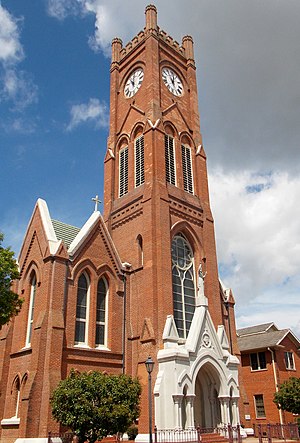
St. Francis Xavier Cathedral is the cathedral church of the Roman Catholic Diocese of Alexandria, located in Alexandria, Louisiana. The cathedral and related buildings was added to the National Register of Historic Places on 29 March 1984 as St.
KCJM-LP
Radio station in Louisiana, United States
Distance: Approx. 46 meters
Latitude and longitude: 31.31111111,-92.44472222
KCJM-LP (107.9 FM) was a radio station licensed to Alexandria, Louisiana, United States. The station was owned by M&M Community Development Inc., Alexandria Branch. The station was taken off the air in 2015, but the Federal Communications Commission was not made aware until June 2020, when a technical consultant informed it that the station's studio facilities had been emptied years prior.
Hearn Stage at The Kress Theatre
Distance: Approx. 167 meters
Latitude and longitude: 31.31,-92.445
Hearn Stage at The Kress Theatre is a small, blackbox performance space located at the corner of Fourth and Johnston streets in downtown Alexandria, Louisiana in the historic Rapides Foundation Building. The Kress Theatre gets its name from the building's former occupant, the Kress Five and Dime Store. Two local theatre collectives, City Park Players and Spectral Sisters Productions, are currently based out of The Kress Theatre.
Weather in this IP's area
clear sky
11 Celsius
10 Celsius
11 Celsius
11 Celsius
1020 hPa
70 %
1020 hPa
1016 hPa
10000 meters
3.09 m/s
340 degree


