192.114.84.37 - IP Lookup: Free IP Address Lookup, Postal Code Lookup, IP Location Lookup, IP ASN, Public IP
Country:
Region:
City:
Location:
Time Zone:
Postal Code:
IP information under different IP Channel
ip-api
Country
Region
City
ASN
Time Zone
ISP
Blacklist
Proxy
Latitude
Longitude
Postal
Route
Luminati
Country
Region
m
City
petahtikva
ASN
Time Zone
Asia/Jerusalem
ISP
Partner Communications Ltd.
Latitude
Longitude
Postal
IPinfo
Country
Region
City
ASN
Time Zone
ISP
Blacklist
Proxy
Latitude
Longitude
Postal
Route
IP2Location
192.114.84.37Country
Region
hamerkaz
City
ra'anana
Time Zone
Asia/Jerusalem
ISP
Language
User-Agent
Latitude
Longitude
Postal
db-ip
Country
Region
City
ASN
Time Zone
ISP
Blacklist
Proxy
Latitude
Longitude
Postal
Route
ipdata
Country
Region
City
ASN
Time Zone
ISP
Blacklist
Proxy
Latitude
Longitude
Postal
Route
Popular places and events near this IP address
Ra'anana
City in Israel
Distance: Approx. 5 meters
Latitude and longitude: 32.18333333,34.86666667
Ra'anana (Hebrew: רַעֲנָנָּה, lit. "Fresh") is an affluent city in the southern Sharon Plain of the Central District of Israel. It was founded in 1922 as an American-Jewish settlement, c.1 km south of the village of Tabsur, where an important World War I battle had taken place four years previously.
Open University of Israel
Distance-education university in Israel
Distance: Approx. 2072 meters
Latitude and longitude: 32.18861111,34.88777778
The Open University of Israel (Hebrew: האוניברסיטה הפתוחה, Ha-Universita ha-Ptuha) is a distance-education university in Israel. It is one of ten public universities in Israel recognized by the Council of Higher Education (CHE). The Open University does not require a matriculation certificate, psychometric exam, or other entrance exam for admission to undergraduate studies.

Tabsur
Village in Tulkarm, Mandatory Palestine
Distance: Approx. 1646 meters
Latitude and longitude: 32.19388889,34.87888889
Tabsur (Arabic: تبصر), also Khirbat 'Azzun (Arabic: خربة عزون), was a Palestinian village located 19 kilometres southwest of Tulkarm. In 1931, the village had 218 houses and an elementary school for boys. Its Palestinian population was expelled during the 1948 Arab-Israeli war.

Givat Hen
Moshav in central Israel
Distance: Approx. 1970 meters
Latitude and longitude: 32.1675,34.87611111
Givat Hen (Hebrew: גִּבְעַת חֵ"ן, lit. 'HN Hill') is a moshav in central Israel. Located near Ra'anana, it falls under the jurisdiction of Drom HaSharon Regional Council. In 2022 it had a population of 364.

Ramot HaShavim
Village in central Israel
Distance: Approx. 2533 meters
Latitude and longitude: 32.16888889,34.8875
Ramot HaShavim (Hebrew: רָמוֹת הַשָּׁבִים, lit. 'Heights of the Returnees') is a Jewish village in central Israel. Located between Hod HaSharon and Ra'anana and covering around 2,300 dunams, it falls under the jurisdiction of Drom HaSharon Regional Council. In 2022 it had a population of 1,709.
Karnei Oren Memorial Field
Stadium in Ra'anana, Israel
Distance: Approx. 655 meters
Latitude and longitude: 32.18653611,34.87250278
Karnei Oren Memorial Field, also known as Histadrut Field (as it is located at the corner of Keren Hayesod and Histadrut streets) or Ra'anana Stadium, is a multi-use stadium in Ra'anana, Israel. It is used mostly for football matches. The stadium was used previously by Hapoel Ra'anana, while playing in Liga Leumit, most recently in 2012–13, and it is currently used by Bnei Ra'anana, who play in Liga Bet.
Leket Israel
Israel-based charity
Distance: Approx. 1712 meters
Latitude and longitude: 32.194682,34.878923
Leket Israel, The National Food Bank, a registered nonprofit Israel-based charity, is the leading food rescue organization in Israel, serving 330,000+ needy people weekly. Leket Israel rescues surplus agricultural produce and collects excess cooked meals for redistribution to the needy throughout Israel via its network of 200+ nonprofit organization (NPO) partners.

Meir Hospital
Hospital in Kfar Saba, Israel
Distance: Approx. 2749 meters
Latitude and longitude: 32.18194444,34.89583333
Meir Medical Center (Hebrew: מרכז רפואי מאיר, Merkaz Refu'i Me'ir) is regional hospital in Kfar Saba, Israel. It is the seventh largest hospital complex in the country, and is part of a network of hospitals owned and operated by Clalit Health Services.
Ra'anana–South railway station
Railway station in Israel
Distance: Approx. 2283 meters
Latitude and longitude: 32.17277778,34.8875
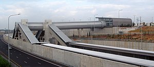
Ra'anana–South railway station is an Israel Railways passenger station at the boundary between Ra'anana, Kfar Saba and Kfar Malal. It serves the residents of the southern Sharon region. The station is located on the Sharon Railway, in the center of the large interchange connecting highways 4 and 531.
Ra'anana–West railway station
Railway station in Israel
Distance: Approx. 1532 meters
Latitude and longitude: 32.18027778,34.85083333
Ra'anana–West railway station is an Israel Railways passenger station in the median of Highway 531, between the cities of Ra'anana and Herzliya, as part of the Sharon Railway. The addition of this station and its sister station Ra'anana South, is intended to reduce travel time for Ra'anana residents to Tel-Aviv to approximately 11 minutes. The station was scheduled to open on 1 July 2018 but was delayed till 3 July.
2024 Ra'anana attack
Part of the Israeli–Palestinian conflict
Distance: Approx. 5 meters
Latitude and longitude: 32.18333333,34.86666667
On January 15, 2024, during the Israel–Hamas war, a combined vehicle-ramming and stabbing attack occurred in the industrial zone of Ra'anana. One civilian was killed and eighteen others were injured. The two attackers, Palestinian residents of Bani Na'im in the Hebron area, were arrested.

Ra'anana Park
Park in the Central District of Israel
Distance: Approx. 1734 meters
Latitude and longitude: 32.18722222,34.84888889
Ra'anana Park is a public park spanning 200 acres, which serves as the central park of the city of Ra'anana, Israel. Nestled at the western edge of Ahuza Street, on the western border of the city, the park adjoins Kfar Batya and the Lev Hapark neighborhood to the north. To the south and west, it borders the fields between Ra'anana and Herzliya.
Weather in this IP's area
clear sky
22 Celsius
21 Celsius
18 Celsius
22 Celsius
1021 hPa
38 %
1021 hPa
1020 hPa
10000 meters
1.54 m/s


