Country:
 Germany
Region:
City:
Latitude and Longitude:
Time Zone:
Postal Code:
IP information under different IP Channel
ip-api
Country
Region
City
ASN
Time Zone
ISP
Blacklist
Proxy
Latitude
Longitude
Postal
Route
IPinfo
Country
Region
City
ASN
Time Zone
ISP
Blacklist
Proxy
Latitude
Longitude
Postal
Route
MaxMind
Country
Region
City
ASN
Time Zone
ISP
Blacklist
Proxy
Latitude
Longitude
Postal
Route
Luminati
Country
DEASN
Time Zone
Europe/Berlin
ISP
Buchholz und Suenderhauf GbR
Latitude
Longitude
Postal
db-ip
Country
Region
City
ASN
Time Zone
ISP
Blacklist
Proxy
Latitude
Longitude
Postal
Route
ipdata
Country
Region
City
ASN
Time Zone
ISP
Blacklist
Proxy
Latitude
Longitude
Postal
Route
Popular places and events near this IP address

Operation Gold
US/UK intelligence-gathering operation
Distance: Approx. 2110 meters
Latitude and longitude: 52.41222222,13.52833333
Operation Gold (also known as Operation Stopwatch by the British) was a joint operation conducted by the American Central Intelligence Agency (CIA) and the British MI6 Secret Intelligence Service (SIS) in the 1950s to tap into landline communication of the Soviet Army headquarters in Berlin using a tunnel into the Soviet-occupied zone. This was a much more complex variation of the earlier Operation Silver project in Vienna. The plan was activated in 1954 because of fears that the Soviets might be launching a nuclear attack at any time, having already detonated a hydrogen bomb in August 1953 as part of the Soviet atomic bomb project.

Schönefeld
Municipality in Brandenburg, Germany
Distance: Approx. 2247 meters
Latitude and longitude: 52.38833333,13.50472222
Schönefeld (German pronunciation: [ˈʃøːnəˌfɛlt] , meaning beautiful field) is a suburban municipality in the Dahme-Spreewald district, Brandenburg, Germany. It borders the southeastern districts of Berlin. The municipal area encompasses the old Berlin Schönefeld Airport (SXF) and the new Berlin Brandenburg Airport (BER).

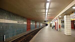
Lipschitzallee (Berlin U-Bahn)
Station of the Berlin U-Bahn
Distance: Approx. 3031 meters
Latitude and longitude: 52.425,13.463
Lipschitzallee is a Berlin U-Bahn station located on the U7. This station was opened in 1970 (architect Rümmler) and was planned to be named Heroldweg. However it was named Lipschitzallee (after the SPD politician Lipschitz).
Wutzkyallee (Berlin U-Bahn)
Station of the Berlin U-Bahn
Distance: Approx. 2278 meters
Latitude and longitude: 52.423,13.475
Wutzkyallee is a Berlin U-Bahn station located on the U7. Designed by R.G.Rümmler and opened in 1970 it should be named "Efeuweg"; however, it was opened with the current name. The next station is Zwickauer Damm.

Zwickauer Damm (Berlin U-Bahn)
Station of the Berlin U-Bahn
Distance: Approx. 1948 meters
Latitude and longitude: 52.42333333,13.48388889
Zwickauer Damm is a Berlin U-Bahn station located on the U7. Finished in 1970 by R. G. Rümmler it was the end of the line U7 until 1972 when Rudow station was opened. The next station is Rudow.

Rudow (Berlin U-Bahn)
Station of the Berlin U-Bahn
Distance: Approx. 911 meters
Latitude and longitude: 52.41611111,13.49527778
Rudow is a Berlin U-Bahn station located on the U7 line. There is a bus link to Berlin Schönefeld Airport, served by the line 171 and the express bus X7. Since 2015, the station has been under extended refurbishment to provide a better interchange between buses serving Brandenburg Airport/BER and the trains.

Altglienicke
Quarter of Berlin in Germany
Distance: Approx. 2582 meters
Latitude and longitude: 52.41666667,13.53333333
Altglienicke (German pronunciation: [altˈɡliːnɪkə] , literally Old Glienicke) is a locality (Ortsteil) of Berlin in the borough (Bezirk) of Treptow-Köpenick. Until 2001 it was part of the former borough of Treptow.
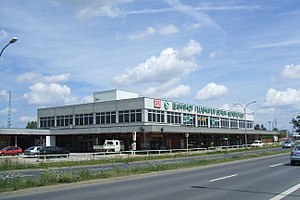
Schönefeld (bei Berlin) station
Railway station in Germany
Distance: Approx. 2114 meters
Latitude and longitude: 52.39138889,13.51277778
Schönefeld (bei Berlin) station (‹See Tfd›German: Bahnhof Schönefeld (bei Berlin)) (formerly named Berlin Schönefeld Airport station and BER Airport – Terminal 5 station) is a railway station in Schönefeld next to the former Berlin Schönefeld Airport (briefly renamed as Terminal 5 and now defunct), just outside Berlin. The station is on the Grünauer Kreuz–Berlin Brandenburg Airport railway and is served by S-Bahn lines S9 and S45. It is also served by RB 24 and RB 32.

Grünbergallee station
Railway station in Berlin, Germany
Distance: Approx. 3122 meters
Latitude and longitude: 52.3992,13.5416
Grünbergallee is a railway station on the Grünauer Kreuz–Berlin Brandenburg Airport railway in the Treptow-Köpenick district of Berlin. It is served by the S-Bahn line S45 and S9.

Rudow
Quarter of Berlin in Germany
Distance: Approx. 963 meters
Latitude and longitude: 52.41666667,13.5
Rudow (German: [ˈʁuːdoː] ) is a locality (Ortsteil) within the Berlin borough (Bezirk) of Neukölln.

Aeroflot Flight 892
1986 Tu-134 crash near Berlin
Distance: Approx. 2563 meters
Latitude and longitude: 52.4,13.53333333
Aeroflot Flight 892 was a scheduled international passenger flight from Minsk to East Berlin, which crashed on 12 December 1986 due to pilot error, killing seventy-two of the eighty-two passengers and crew on board.

Interflug Flight 102
1989 East German plane crash
Distance: Approx. 2660 meters
Latitude and longitude: 52.388333,13.52
Interflug Flight 102 ended in a crash involving an Ilyushin Il-62M on 17 June 1989. The aircraft, while attempting to take off from Berlin Schönefeld Airport, East Germany, crashed into obstacles on the ground at the end of its takeoff, costing 21 lives.
Weather in this IP's area
light rain
11 Celsius
10 Celsius
10 Celsius
12 Celsius
1020 hPa
89 %
1020 hPa
1015 hPa
10000 meters
3.09 m/s
40 degree
100 %
07:14:12
18:34:13