Country:
 USA
USARegion:
City:
Latitude and Longitude:
Time Zone:
Postal Code:
IP information under different IP Channel
ip-api
Country
Region
City
ASN
Time Zone
ISP
Blacklist
Proxy
Latitude
Longitude
Postal
Route
IPinfo
Country
Region
City
ASN
Time Zone
ISP
Blacklist
Proxy
Latitude
Longitude
Postal
Route
MaxMind
Country
Region
City
ASN
Time Zone
ISP
Blacklist
Proxy
Latitude
Longitude
Postal
Route
Luminati
Country
USASN
Time Zone
America/Chicago
ISP
BIO-RAD-ASN
Latitude
Longitude
Postal
db-ip
Country
Region
City
ASN
Time Zone
ISP
Blacklist
Proxy
Latitude
Longitude
Postal
Route
ipdata
Country
Region
City
ASN
Time Zone
ISP
Blacklist
Proxy
Latitude
Longitude
Postal
Route
Popular places and events near this IP address
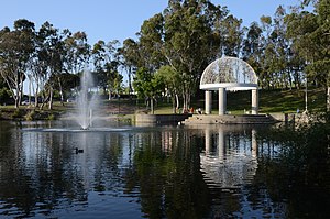
Hercules, California
City in California, United States
Distance: Approx. 1146 meters
Latitude and longitude: 38.01722222,-122.28861111
Hercules is a city in western Contra Costa County, California. Situated along the coast of San Pablo Bay, it is located in the eastern region of the San Francisco Bay Area, about 10 miles (16 km) north of Berkeley. As of the 2020 census, its population was 26,016, according to the United States Census Bureau.

Rodeo, California
Census-designated place in California, United States
Distance: Approx. 1445 meters
Latitude and longitude: 38.03305556,-122.26694444
Rodeo (; Spanish for "Cattle roundup") is a census-designated place (CDP) located in Contra Costa County, California, in the East Bay sub-region of the San Francisco Bay Area, on the eastern shore of San Pablo Bay, 25 miles northeast of San Francisco. The population was 9,653 at the 2020 census. The place is named for the rodeos common in the late 19th century.

Bio-Rad Laboratories
American biotechnology firm
Distance: Approx. 149 meters
Latitude and longitude: 38.0232,-122.277875
Bio-Rad Laboratories, Inc. is an American developer and manufacturer of specialized technological products for the life science research and clinical diagnostics markets. The company was founded in 1952 in Berkeley, California, by husband and wife team David and Alice Schwartz, both graduates of the University of California, Berkeley.
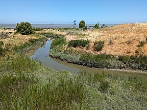
Refugio Creek
River in California, United States
Distance: Approx. 619 meters
Latitude and longitude: 38.02166667,-122.28527778
Refugio Creek (pronounced REH-foo-GEE-oh from Spanish refugio meaning: shelter) is a 4.4-mile-long (7.1 km) watercourse running through the Refugio Valley from the hills of western Contra Costa County, California.
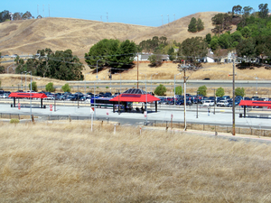
Hercules Transit Center
Distance: Approx. 1751 meters
Latitude and longitude: 38.01277778,-122.26527778
Hercules Transit Center is a major commuter hub in the western Contra Costa County city of Hercules, California. It is anchored by WestCAT bus services. The center was originally on San Pablo Avenue.
Rodeo Creek
River in California, United States
Distance: Approx. 1947 meters
Latitude and longitude: 38.03916667,-122.2675
Rodeo Creek is an 8.3-mile-long (13.4 km) intermittent stream in western Contra Costa County, California running through the town of Rodeo to San Pablo Bay.
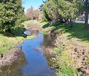
Pinole Creek
River in California, United States
Distance: Approx. 1910 meters
Latitude and longitude: 38.01416667,-122.29666667
Pinole Creek is a stream in western Contra Costa County, in the East Bay region of the San Francisco Bay Area, California. The creek has one of the last primarily undeveloped watersheds in the Bay Area.

Hercules station
Proposed railway station and ferry terminal in Hercules, California
Distance: Approx. 818 meters
Latitude and longitude: 38.0203,-122.2869
Hercules station (officially the Hercules Regional Intermodal Transit Center) is a proposed intermodal infill train station and ferry terminal in Hercules, California in Contra Costa County. It is to be the first direct Amtrak-to-ferry transit hub in the San Francisco Bay Area and will be constructed in between the existing Richmond and Martinez stations. By July 2018, three of the station's six construction phases had been complete, including street at Bay Trail approaches.

Chelsea Wetlands
Distance: Approx. 1784 meters
Latitude and longitude: 38.0143,-122.295
Chelsea Wetlands is a riparian marsh on lower Pinole Creek and a tidal wetland at its mouth on San Pablo Bay, in Contra Costa County, northern California. It is located in the Hercules/Pinole area, in the East Bay region of the San Francisco Bay Area.
Rancho El Pinole
Mexican land grant in California
Distance: Approx. 1731 meters
Latitude and longitude: 38.02,-122.26
Rancho El Pinole was a 17,761-acre (71.88 km2) Mexican land grant along Carquinez Strait in present-day Contra Costa County, California. It was given in 1842 by Governor Juan Alvarado to Ygnacio Martinez, a Californio military commander and politician. Rancho El Pinole extended over land that today includes most of the Franklin Ridge and towns of Crockett, Hercules, Martinez, Oleum, Pinole, Rodeo, Selby and Tormey.

Bernardo Fernandez House
Historic house in California, United States
Distance: Approx. 2077 meters
Latitude and longitude: 38.01108889,-122.29585
The Bernardo Fernandez House is a Victorian mansion located at 100 Tennent Ave in Pinole, California. It is listed on the National Register of Historic Places.

Bank of Pinole
United States historic place
Distance: Approx. 2290 meters
Latitude and longitude: 38.00567778,-122.29036944
The Bank of Pinole is located at 2361 San Pablo Ave. in Pinole, California. Located in Old Town Pinole The Bank of Pinole was built in 1915 by E.M. Downer, Sr.
Weather in this IP's area
clear sky
17 Celsius
17 Celsius
14 Celsius
21 Celsius
1013 hPa
84 %
1013 hPa
1011 hPa
10000 meters
5.66 m/s
190 degree
06:54:49
19:10:39