192.100.162.59 - IP Lookup: Free IP Address Lookup, Postal Code Lookup, IP Location Lookup, IP ASN, Public IP
Country:
Region:
City:
Location:
Time Zone:
Postal Code:
ISP:
ASN:
language:
User-Agent:
Proxy IP:
Blacklist:
IP information under different IP Channel
ip-api
Country
Region
City
ASN
Time Zone
ISP
Blacklist
Proxy
Latitude
Longitude
Postal
Route
db-ip
Country
Region
City
ASN
Time Zone
ISP
Blacklist
Proxy
Latitude
Longitude
Postal
Route
IPinfo
Country
Region
City
ASN
Time Zone
ISP
Blacklist
Proxy
Latitude
Longitude
Postal
Route
IP2Location
192.100.162.59Country
Region
nayarit
City
tepic
Time Zone
America/Mazatlan
ISP
Language
User-Agent
Latitude
Longitude
Postal
ipdata
Country
Region
City
ASN
Time Zone
ISP
Blacklist
Proxy
Latitude
Longitude
Postal
Route
Popular places and events near this IP address

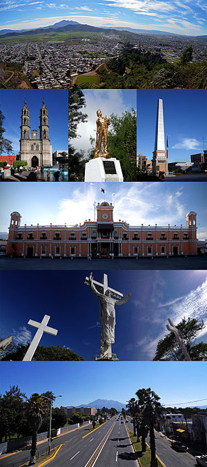
Tepic
City in Nayarit, Mexico
Distance: Approx. 1189 meters
Latitude and longitude: 21.50833333,-104.89305556
Tepic (Spanish pronunciation: [teˈpik] ) is the capital and largest city of the western Mexican state of Nayarit, as well as the seat of the Tepic Municipality. Located in the central part of the state, it stands at an altitude of 915 metres (3,002 ft) above sea level, on the banks of the Río Mololoa and the Río Tepic, approximately 225 kilometres (140 mi) north-west of Guadalajara, Jalisco. Nearby are the volcanoes of San Juan, Las Navajas, and Sangangüey.
Platanitos
Town in Nayarit, Mexico
Distance: Approx. 8059 meters
Latitude and longitude: 21.5214,-104.9744
Playa Platanitos a small beach town in the Mexican state of Nayarit. In the municipality of Compostela It is located about 20 miles south of San Blas and a few miles from the beach Las Tortugas meaning turtle. With its restaurants, small hotels and warm waters, Platanitos brings several thousand tourists each year.
Xalisco
Human settlement in Mexico
Distance: Approx. 5771 meters
Latitude and longitude: 21.44805557,-104.90000001
Xalisco (Spanish pronunciation: [xaˈlisko]) is a city and its surrounding municipality of the same name in the Mexican state of Nayarit. The city had a population of 21,899 in the 2005 census while the municipality has an area of 290.6 km2 (112.2 sq mi) and a population of 42,893. The municipality lies adjacent to the south side of Tepic, the state capital, and is part of the Tepic metropolitan area.

Roman Catholic Diocese of Tepic
Roman Catholic diocese in Mexico
Distance: Approx. 1614 meters
Latitude and longitude: 21.51189306,-104.89134611
The Roman Catholic Diocese of Tepic (Latin: Dioecesis Tepicensis)) is a suffragan Latin diocese in the ecclesiastical province of the Metropolitan Archdiocese of Guadalajara in western Mexico. Its cathedral episcopal see is the Catedral de la Purísima Concepción, dedicated to the Immaculate Conception, in Tepic, the capital of Nayarit state. It also has a Minor Basilica: Basílica de Nuestra Señora del Rosario de Talpa, dedicated to Our Lady of the Rosary, in Talpa de Allende, Jalisco.

Autonomous University of Nayarit
Academic publisher
Distance: Approx. 1224 meters
Latitude and longitude: 21.49194444,-104.89194444
The Autonomous University of Nayarit (in Spanish: Universidad Autónoma de Nayarit, UAN) is a Mexican public university based in the city of Tepic, Nayarit, that offers secondary education in addition to undergraduate and graduate education. The university offers 15 preparatory schools located across the major regions of the state. The university offers 33 undergraduate degrees and 28 postgraduate degrees.

2nd federal electoral district of Nayarit
Federal electoral district of Mexico
Distance: Approx. 1737 meters
Latitude and longitude: 21.5,-104.88333333
The 2nd federal electoral district of Nayarit (Distrito electoral federal 02 de Nayarit) is one of the 300 electoral districts into which Mexico is divided for elections to the federal Chamber of Deputies and one of three such districts in the state of Nayarit. It elects one deputy to the lower house of Congress for each three-year legislative session by means of the first-past-the-post system. Votes cast in the district also count towards the calculation of proportional representation ("plurinominal") deputies elected from the first region.
Estadio Olímpico Santa Teresita
Multi-use stadium in Tepic, Nayarit, Mexico
Distance: Approx. 2949 meters
Latitude and longitude: 21.52638889,-104.90055556
The Estadio Olímpico Santa Teresita is a multi-use stadium located in Tepic, Nayarit, Mexico. It is currently used mostly for football matches and is the home stadium for Coras F.C. The stadium has a capacity of 4,000 people.

Tepic Cathedral
Church in Tepic, Mexico
Distance: Approx. 1614 meters
Latitude and longitude: 21.5118,-104.8912
The Immaculate Conception Cathedral (Spanish: Catedral de la Purísima Concepción), also known as Tepic Cathedral, is the cathedral of the Roman Catholic Diocese of Tepic in Mexico. It is located on the main square, in the center of the city. It is famous for its Neo-Gothic style architecture.

Sierra de San Juan Biosphere Reserve
Distance: Approx. 7033 meters
Latitude and longitude: 21.475,-104.9625
The Sierra de San Juan Biosphere Reserve is a protected area in Nayarit state of western Mexico. It was established in 2003, and has an area of 198.01 km2. It lies just southwest of the city of Tepic.
Weather in this IP's area
overcast clouds
14 Celsius
13 Celsius
14 Celsius
14 Celsius
1014 hPa
29 %
1014 hPa
907 hPa
10000 meters
1.71 m/s
1.48 m/s
138 degree
91 %