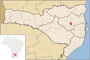
Country:
Region:
City:
Latitude and Longitude:
Time Zone:
Postal Code:
IP information under different IP Channel
ip-api
Country
Region
City
ASN
Time Zone
ISP
Blacklist
Proxy
Latitude
Longitude
Postal
Route
Luminati
Country
Region
sc
City
saobentodosul
ASN
Time Zone
America/Sao_Paulo
ISP
Instituto Federal Catarinense
Latitude
Longitude
Postal
IPinfo
Country
Region
City
ASN
Time Zone
ISP
Blacklist
Proxy
Latitude
Longitude
Postal
Route
db-ip
Country
Region
City
ASN
Time Zone
ISP
Blacklist
Proxy
Latitude
Longitude
Postal
Route
ipdata
Country
Region
City
ASN
Time Zone
ISP
Blacklist
Proxy
Latitude
Longitude
Postal
Route
Popular places and events near this IP address
Itajaí do Oeste River
River in Brazil
Distance: Approx. 2883 meters
Latitude and longitude: -27.21666667,-49.65
The Itajaí do Oeste River is a river of Santa Catarina state in southeastern Brazil.
Trombudo River
River in Brazil
Distance: Approx. 9058 meters
Latitude and longitude: -27.25,-49.7
The Trombudo River is a river of Santa Catarina state in southeastern Brazil.
Itajaí do Sul River
River in Santa Catarina, Brazil
Distance: Approx. 2883 meters
Latitude and longitude: -27.21666667,-49.65
The Itajaí do Sul River is a river of Santa Catarina state in southeastern Brazil.
Rio do Sul
Municipality in South, Brazil
Distance: Approx. 2883 meters
Latitude and longitude: -27.21666667,-49.65
Rio do Sul is a municipality in the state of Santa Catarina in the South region of Brazil. One of the postcards of the city is the Cathedral of St. John the Baptist.

Lontras
Municipality in South, Brazil
Distance: Approx. 9351 meters
Latitude and longitude: -27.16583333,-49.54194444
Lontras is a municipality in the state of Santa Catarina in the South region of Brazil.
Weather in this IP's area
overcast clouds
23 Celsius
24 Celsius
23 Celsius
23 Celsius
1009 hPa
84 %
1009 hPa
970 hPa
10000 meters
1.05 m/s
2.32 m/s
104 degree
92 %
05:22:49
18:41:50