191.5.145.221 - IP Lookup: Free IP Address Lookup, Postal Code Lookup, IP Location Lookup, IP ASN, Public IP
Country:
Region:
City:
Location:
Time Zone:
Postal Code:
ISP:
ASN:
language:
User-Agent:
Proxy IP:
Blacklist:
IP information under different IP Channel
ip-api
Country
Region
City
ASN
Time Zone
ISP
Blacklist
Proxy
Latitude
Longitude
Postal
Route
db-ip
Country
Region
City
ASN
Time Zone
ISP
Blacklist
Proxy
Latitude
Longitude
Postal
Route
IPinfo
Country
Region
City
ASN
Time Zone
ISP
Blacklist
Proxy
Latitude
Longitude
Postal
Route
IP2Location
191.5.145.221Country
Region
rio grande do sul
City
sao borja
Time Zone
America/Sao_Paulo
ISP
Language
User-Agent
Latitude
Longitude
Postal
ipdata
Country
Region
City
ASN
Time Zone
ISP
Blacklist
Proxy
Latitude
Longitude
Postal
Route
Popular places and events near this IP address

São Borja
Municipality in South, Brazil
Distance: Approx. 55 meters
Latitude and longitude: -28.66023333,-56.00383889
São Borja is a city in the Brazilian state of Rio Grande do Sul. São Borja is the oldest municipality in the Brazilian state of Rio Grande do Sul and was founded in 1682 by the Jesuits as the first of the Seven Places of the Missions, and named São Francisco de Borja, in honor of Saint Francis Borgia.
Integration Bridge
Bridge in Rio Grande do Sul, Brazil.
Distance: Approx. 5645 meters
Latitude and longitude: -28.61034444,-56.01495
The International Bridge of Integration, also known as International Bridge São Borja - St. Thomas, is a bridge across the Uruguay River, which connects the cities of São Borja in Brazil and Santo Tomé in Argentina.

São Borja Airport
Airport
Distance: Approx. 3024 meters
Latitude and longitude: -28.65472222,-56.03472222
São Borja Airport (IATA: JBS, ICAO: SSSB), also known as João Manoel Airport, is the airport serving São Borja, located in the Rio Grande do Sul state of Brazil.

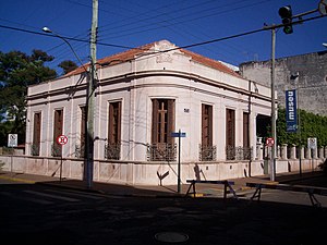
João Goulart's House
1927 house in Rio Grande do Sul, Brazil
Distance: Approx. 77 meters
Latitude and longitude: -28.65964,-56.00393
João Goulart's House is a big house built in 1927, where former Brazilian President João Goulart lived during his childhood and youth. It is located in the city of São Borja, in the state of Rio Grande do Sul. João Goulart's house is a historical heritage, protected by the State Institute of Historical and Artistic Heritage (IPHAE), on February 7, 1994, under process number 03/94.
Weather in this IP's area
scattered clouds
31 Celsius
30 Celsius
31 Celsius
31 Celsius
1007 hPa
36 %
1007 hPa
999 hPa
10000 meters
5.7 m/s
6.62 m/s
243 degree
46 %