Country:
 Costa Rica
Region:
City:
Latitude and Longitude:
Time Zone:
Postal Code:
IP information under different IP Channel
ip-api
Country
Region
City
ASN
Time Zone
ISP
Blacklist
Proxy
Latitude
Longitude
Postal
Route
IPinfo
Country
Region
City
ASN
Time Zone
ISP
Blacklist
Proxy
Latitude
Longitude
Postal
Route
MaxMind
Country
Region
City
ASN
Time Zone
ISP
Blacklist
Proxy
Latitude
Longitude
Postal
Route
Luminati
Country
 AR
ARASN
Time Zone
America/Argentina/Buenos_Aires
ISP
TELXIUS TELXIUS Cable
Latitude
Longitude
Postal
db-ip
Country
Region
City
ASN
Time Zone
ISP
Blacklist
Proxy
Latitude
Longitude
Postal
Route
ipdata
Country
Region
City
ASN
Time Zone
ISP
Blacklist
Proxy
Latitude
Longitude
Postal
Route
Popular places and events near this IP address

Juan Santamaría International Airport
Costa Rican airport serving San José located in Alajuela
Distance: Approx. 3593 meters
Latitude and longitude: 9.99388889,-84.20888889
Juan Santamaría International Airport (Spanish: Aeropuerto Internacional Juan Santamaría) (IATA: SJO, ICAO: MROC) is the primary airport serving San José, the capital of Costa Rica. The airport is located in Alajuela Province, 20 kilometres (12 mi; 11 nmi) northwest of downtown San José. It is named after Costa Rica's national hero, Juan Santamaría, a drummer boy who died in 1856 defending his country against forces led by William Walker, an American filibuster.

San José Costa Rica Temple
Distance: Approx. 2972 meters
Latitude and longitude: 9.986418,-84.184831
The San José Costa Rica Temple is the 87th operating temple of the Church of Jesus Christ of Latter-day Saints (LDS Church). The church's First Presidency announced on March 17, 1999, that a temple would be built in San José, Costa Rica. The announcement of the San José Costa Rica Temple made it the first temple in Costa Rica and the second temple in Central America.

Belén (canton)
Canton in Heredia province, Costa Rica
Distance: Approx. 3413 meters
Latitude and longitude: 9.9854406,-84.1768586
Belén is the seventh canton in the Heredia province of Costa Rica. The head city is in San Antonio district. It is part of the Greater Metropolitan Area, where the housing area constitutes at least 25% of the canton's surface.
Parque Valle del Sol
Distance: Approx. 1466 meters
Latitude and longitude: 9.95256,-84.20613
Parque Valle del Sol is a residential and golf community located in Santa Ana, Costa Rica.
American International School of Costa Rica
Distance: Approx. 3893 meters
Latitude and longitude: 9.9737,-84.1645
The American International School of Costa Rica is an American international school in Cariari, La Asunción District, Belén, Heredia Province, Costa Rica. Serving grade levels preschool through 12, the school as of 2015 has 220 students. It was established in 1970.

Centro de Conservación de Santa Ana
Distance: Approx. 3029 meters
Latitude and longitude: 9.936667,-84.192778
Centro de Conservación de Santa Ana (Santa Ana Conservation Center, CCSA) is a wilderness area of approximately 52 hectares (130 acres), located in the Uruca district, in the canton of Santa Ana, Costa Rica. It has an average altitude of 900 meters and is bounded to the east by the bed of the river Uruca. The site includes patches of one of the last remnants of dry tropical forest in the Central Valley, trails, Agricultural Historical Museum, soccer field, picnic area, a species of wild and domestic animals and a nursery of forest species.
San Rafael District, Alajuela
District in Alajuela canton, Alajuela province, Costa Rica
Distance: Approx. 2637 meters
Latitude and longitude: 9.9594822,-84.2221335
San Rafael is a district of the Alajuela canton, in the Alajuela province of Costa Rica.
San Antonio District, Belén
District in Belén canton, Heredia province, Costa Rica
Distance: Approx. 2012 meters
Latitude and longitude: 9.9781433,-84.1879207
San Antonio is a district of the Belén canton, in the Heredia province of Costa Rica.
La Asunción District
District in Belén canton, Heredia province, Costa Rica
Distance: Approx. 4024 meters
Latitude and longitude: 9.9788534,-84.1652601
La Asunción is a district of the Belén canton, in the Heredia province of Costa Rica.
La Ribera District
District in Belén canton, Heredia province, Costa Rica
Distance: Approx. 3846 meters
Latitude and longitude: 9.9938512,-84.1819931
La Ribera, also spelled La Rivera, just Ribera or Rivera, is a district of the Belén canton, in the Heredia province of Costa Rica.
Pozos
District in Santa Ana canton, San José province, Costa Rica
Distance: Approx. 1256 meters
Latitude and longitude: 9.9535857,-84.1925835
Pozos is a district in Santa Ana canton, San José province of Costa Rica. It was created in 1907. The principal avenue of the district carries the name of Lindora, which is also used to name the district and its surroundings.
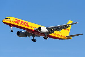
DHL de Guatemala Flight 7216
Aviation incident in 2022
Distance: Approx. 3561 meters
Latitude and longitude: 9.99502983,-84.2026
DHL de Guatemala Flight 7216 was an international cargo flight between Costa Rica's Juan Santamaría International Airport (IATA: SJO, ICAO: MROC) and Guatemala City's La Aurora International Airport (IATA: GUA, ICAO: MGGT). On 7 April 2022 (2022-04-07), the Boeing 757 operating the flight suffered a hydraulic failure, and crashed on landing at the Costa Rican airport. Neither of the two pilots were injured.
Weather in this IP's area
overcast clouds
21 Celsius
22 Celsius
20 Celsius
21 Celsius
1012 hPa
91 %
1012 hPa
916 hPa
10000 meters
5.14 m/s
80 degree
100 %
05:27:20
17:42:19