190.93.25.129 - IP Lookup: Free IP Address Lookup, Postal Code Lookup, IP Location Lookup, IP ASN, Public IP
Country:
Region:
City:
Location:
Time Zone:
Postal Code:
ISP:
ASN:
language:
User-Agent:
Proxy IP:
Blacklist:
IP information under different IP Channel
ip-api
Country
Region
City
ASN
Time Zone
ISP
Blacklist
Proxy
Latitude
Longitude
Postal
Route
db-ip
Country
Region
City
ASN
Time Zone
ISP
Blacklist
Proxy
Latitude
Longitude
Postal
Route
IPinfo
Country
Region
City
ASN
Time Zone
ISP
Blacklist
Proxy
Latitude
Longitude
Postal
Route
IP2Location
190.93.25.129Country
Region
penal-debe
City
debe
Time Zone
America/Port_of_Spain
ISP
Language
User-Agent
Latitude
Longitude
Postal
ipdata
Country
Region
City
ASN
Time Zone
ISP
Blacklist
Proxy
Latitude
Longitude
Postal
Route
Popular places and events near this IP address
Naparima College
Secondary school in San Fernando, Trinidad and Tobago
Distance: Approx. 8632 meters
Latitude and longitude: 10.275228,-61.469117
Naparima College (informally known as Naps) is a public secondary school for boys in Trinidad and Tobago. Located in San Fernando, the school was founded in 1894 but received official recognition in 1900. It was established by Dr.
Penal
Town in Trinidad and Tobago
Distance: Approx. 4136 meters
Latitude and longitude: 10.16666667,-61.46666667
Penal is a town in south Trinidad, Trinidad and Tobago. It lies south of San Fernando, Princes Town, and Debe, and north of Moruga, Morne Diablo and Siparia. Penal is noted as a heartland of Hindu and Indo-Trinidadian culture.

Debe
Town in Penal–Debe, Trinidad and Tobago
Distance: Approx. 0 meters
Latitude and longitude: 10.2,-61.45
Debe (or Débé) is a town in south Trinidad located in the region of Penal–Debe. Debe has grown from a small settlement into a key transit point which as has merged to some extent with Penal. A denomination high school was established by the Sanatan Dharma Maha Sabha (Parvati Girls College).
Victoria County, Trinidad and Tobago
County of Trinidad and Tobago
Distance: Approx. 7021 meters
Latitude and longitude: 10.263,-61.453
Victoria was a county on Trinidad island in Trinidad and Tobago. The county of Victoria was named in honour of Queen Victoria during the colonial period.
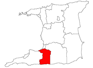
Penal–Debe
Region in Trinidad and Tobago
Distance: Approx. 4030 meters
Latitude and longitude: 10.169,-61.431
Penal–Debe region is a region of Trinidad. The local government body is Penal–Debe Regional Corporation, a Regional Corporation of Trinidad and Tobago. The region has a land area of 246.91 km².
Saint Benedict's College (Trinidad and Tobago)
Secondary school in Trinidad and Tobago
Distance: Approx. 6646 meters
Latitude and longitude: 10.2501,-61.483
St. Benedict's College is a secondary school located in La Romaine, Trinidad and Tobago. The school was founded by Dom Basil Matthews and first opened on September 11, 1956.
Borde Narve Village
Village in Trinidad and Tobago
Distance: Approx. 7878 meters
Latitude and longitude: 10.2434,-61.3932
Borde Narve Village is a fast-growing village centered on the Cipero Road in between San Fernando and Princes Town in Southern Trinidad. It is located in the Princes Town Regional Corporation. The village has been growing at a fast rate since 1999, thanks to its location almost equidistant from the two main towns.
Iere High School
Coeducational school in Trinidad and Tobago
Distance: Approx. 8112 meters
Latitude and longitude: 10.14752,-61.50136
Iere High School is one of five Presbyterian secondary schools in Trinidad and Tobago, and it is notably the only coeducational of the five. Iere has gained over 50 academic scholarships over its establishment in 1955. The school is usually a First-choice secondary school by primary school students when writing their SEA The school requires at least over 85% in the Secondary Entrance Examination.
Barrackpore, Trinidad and Tobago
Town in Penal-Debe, Trinidad and Tobago
Distance: Approx. 6217 meters
Latitude and longitude: 10.191,-61.394
Barrackpore is a town in southern Trinidad and Tobago. It is located southeast of San Fernando, east of Debe, and northeast of Penal, and is under the administrative authority of the Penal–Debe Regional Corporation. It is home to the 7 Pot Barrackpore Pepper.
Cipero Marl
Geologic formation in Trinidad and Tobago
Distance: Approx. 5478 meters
Latitude and longitude: 10.2,-61.5
The Cipero Marl is a geologic formation in Trinidad and Tobago. It preserves fossils dating back to the Early Oligocene to Burdigalian period.
Wilson Road Recreation Ground
Cricket ground in Penal, Trinidad and Tobago
Distance: Approx. 4630 meters
Latitude and longitude: 10.1685,-61.4224
Wilson Road Recreation Ground is a cricket ground located along Wilson Road in Penal, Trinidad and Tobago.
Dubisson Park
Cricket ground in Arima, Trinidad and Tobago
Distance: Approx. 7728 meters
Latitude and longitude: 10.2671,-61.4319
Dubisson Park is a public park and former major cricket venue in Sainte Madeleine, Trinidad and Tobago.
Weather in this IP's area
broken clouds
22 Celsius
23 Celsius
22 Celsius
22 Celsius
1014 hPa
94 %
1014 hPa
1011 hPa
10000 meters
2.9 m/s
8.48 m/s
68 degree
80 %
