Country:
 Chile
ChileRegion:
City:
Latitude and Longitude:
Time Zone:
Postal Code:
IP information under different IP Channel
ip-api
Country
Region
City
ASN
Time Zone
ISP
Blacklist
Proxy
Latitude
Longitude
Postal
Route
Luminati
Country
CLRegion
ar
City
temuco
ASN
Time Zone
America/Santiago
ISP
Sociedad de Telecomunicaciones Geonet Ltda.
Latitude
Longitude
Postal
IPinfo
Country
Region
City
ASN
Time Zone
ISP
Blacklist
Proxy
Latitude
Longitude
Postal
Route
db-ip
Country
Region
City
ASN
Time Zone
ISP
Blacklist
Proxy
Latitude
Longitude
Postal
Route
ipdata
Country
Region
City
ASN
Time Zone
ISP
Blacklist
Proxy
Latitude
Longitude
Postal
Route
Popular places and events near this IP address

Temuco
City in Araucanía, Chile
Distance: Approx. 5862 meters
Latitude and longitude: -38.73333333,-72.66666667
Temuco (Spanish pronunciation: [teˈmuko]) is a city and commune, capital of the Cautín Province and of the Araucanía Region in southern Chile. The city is located 670 kilometres (416 miles) south of Santiago. The city grew out from a fort of the same name established in 1881 during Chile's invasion of Araucanía.

Temuco Catholic University
University
Distance: Approx. 648 meters
Latitude and longitude: -38.73722222,-72.60055556
Catholic University of Temuco (Spanish: Universidad Católica de Temuco) is a university in Chile. It is a derivative university part of the Chilean Traditional Universities.
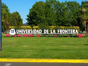
University of La Frontera
Chilean public university
Distance: Approx. 2390 meters
Latitude and longitude: -38.7474,-72.6177
University of the Frontier (Spanish: Universidad de La Frontera), or UFRO, is a public university in Temuco, Araucanía Region, Chile. It is a derivative university and part of the Chilean Traditional Universities. UFRO boasts a student body with a variety of abilities and from a variety of backgrounds, many of them are Mapuche descent.

Temuco Maquehue Airport
Airport
Distance: Approx. 5059 meters
Latitude and longitude: -38.76666667,-72.63611111
Maquehue Airport (Spanish: Aeropuerto Maquehue) (IATA: PZS, ICAO: SCTC) is an airport 5 kilometres (3.1 mi) southwest of Temuco, a city in the La Araucanía Region of Chile. Runway 06 has a 150 metres (490 ft) displaced threshold. The Temuco non-directional beacon (Ident: TCO) is 1.0 nautical mile (1.9 km) east of the airport.

Estadio Municipal Germán Becker
Distance: Approx. 2180 meters
Latitude and longitude: -38.74277778,-72.61972222
The Estadio Municipal Bicentenario Germán Becker Baechler is a stadium located in Temuco, Chile and owned by the Temuco municipality. It is the home ground of Deportes Temuco and also, the former ground of the defunct Unión Temuco football clubs. It was designed by Enrique Esteve and inaugurated on August 13, 1965.
Greater Temuco
Conurbation in Chile
Distance: Approx. 6209 meters
Latitude and longitude: -38.75,-72.66666667
Greater Temuco is a conurbation of the cities of Temuco and Padre Las Casas in the Araucanía Region of southern Chile.

Cerro Ñielol Natural Monument
Distance: Approx. 4915 meters
Latitude and longitude: -38.72805556,-72.54277778
Cerro Ñielol Natural Monument is a hill belonging to the Intermediate Depression and is located in the urban area of the city of Temuco, Province of Cautín, Araucanía Region, Chile. With a height of 115 and 335 m, the latter is the highest point of the city. On 89 acres a large variety of flora and fauna of the Valdivian temperate forest ecoregion can be seen, as well as important historical and cultural landmarks of Temuco.

Padre Las Casas, Chile
City and Commune in Araucanía, Chile
Distance: Approx. 3915 meters
Latitude and longitude: -38.76666667,-72.6
Padre Las Casas (Spanish pronunciation: [ˈpaðɾe las ˈkasas]) is a Chilean city and commune located in Cautín Province, Araucanía Region. Padre Las Casas spans a landlocked area of 400.7 km2 (155 sq mi).

Pueblo Nuevo, Temuco
Quarter in Araucanía, Chile
Distance: Approx. 1831 meters
Latitude and longitude: -38.72916667,-72.57833333
Pueblo Nuevo is a quarter of the City of Temuco, Chile. It is located in the northeast of the city, and corresponds to a residential area, with fragments used as warehouses, workshops, and electrical and transportation infrastructure. Its population was established there in the 1950s, but only in 2000 it was officially defined by the Municipality of Temuco in its Plan de desarrollo comunal (Communal Development Plan).
Las Araucarias, Temuco
Place in Cautín, Araucanía
Distance: Approx. 8825 meters
Latitude and longitude: -38.75823889,-72.69488889
Las Araucarias is a hamlet (Spanish: caserío) in Araucanía Region, Chile. It lies near the center of Araucanía region about 9.4 km west of downtown Temuco.
Weather in this IP's area
few clouds
9 Celsius
9 Celsius
9 Celsius
9 Celsius
1020 hPa
99 %
1020 hPa
1006 hPa
10000 meters
0.7 m/s
0.98 m/s
257 degree
17 %
06:29:18
20:40:24