190.82.118.82 - IP Lookup: Free IP Address Lookup, Postal Code Lookup, IP Location Lookup, IP ASN, Public IP
Country:
Region:
City:
Location:
Time Zone:
Postal Code:
ISP:
ASN:
language:
User-Agent:
Proxy IP:
Blacklist:
IP information under different IP Channel
ip-api
Country
Region
City
ASN
Time Zone
ISP
Blacklist
Proxy
Latitude
Longitude
Postal
Route
db-ip
Country
Region
City
ASN
Time Zone
ISP
Blacklist
Proxy
Latitude
Longitude
Postal
Route
IPinfo
Country
Region
City
ASN
Time Zone
ISP
Blacklist
Proxy
Latitude
Longitude
Postal
Route
IP2Location
190.82.118.82Country
Region
maule
City
curico
Time Zone
America/Santiago
ISP
Language
User-Agent
Latitude
Longitude
Postal
ipdata
Country
Region
City
ASN
Time Zone
ISP
Blacklist
Proxy
Latitude
Longitude
Postal
Route
Popular places and events near this IP address
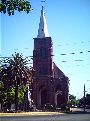
Curicó
City and Commune in Maule, Chile
Distance: Approx. 5 meters
Latitude and longitude: -34.98333333,-71.23333333
Curicó (Spanish pronunciation: [kuri'ko]) is a city located in Chile's central valley and serves as the capital of the Curicó Province, which is part of the Maule Region. Positioned between the provinces of Colchagua and Talca, the region stretches from the Pacific Ocean to the border with Argentina. The city is known for its distinctive products such as cakes, fruits, cement, sugar, tomato sauce, and high-quality export wines.
Romeral
Town and Commune in Maule, Chile
Distance: Approx. 9423 meters
Latitude and longitude: -34.93333333,-71.31666667
Romeral is a Chilean town and commune in Curicó Province, Maule Region. The commune spans and area of 1,597.1 km2 (617 sq mi).

Estadio La Granja
Sports venue in Chile
Distance: Approx. 1038 meters
Latitude and longitude: -34.97444444,-71.22972222
The Estadio La Granja is a sports venue which is located in Curicó, Maule Region, Chile. The stadium holds 8,278 people and is part of a large sporting complex which also features tennis courts, swimming pools, a gymnasium, a velodrome and some other sport fields. It is the home stadium of Curicó Unido; and the former home ground of Alianza de Curicó, Luis Cruz, and Badminton de Curicó.

Estación Curicó
Railway station in Curicó, Chile
Distance: Approx. 1218 meters
Latitude and longitude: -34.98341861,-71.24664889
Estación Curicó is a railway station of the Empresa de los Ferrocarriles del Estado, located in Curicó, Chile . It is the main railway station in the Curicó Province. It is located on Maipú street.
Los Lirios Airport
Airport
Distance: Approx. 8945 meters
Latitude and longitude: -34.90694444,-71.20277778
Los Lirios Airport Spanish: Aeropuerto Los Lirios, (ICAO: SCKI) is a rural airport 8 kilometres (5 mi) north of Curicó, a city in the Maule Region of Chile. The airport is 1.6 kilometres (1 mi) from the Teno River. The runway has 130 metres (430 ft) of unpaved overrun on the north end.
General Freire Airport
Airport
Distance: Approx. 2546 meters
Latitude and longitude: -34.96527778,-71.21611111
General Freire Airport (Spanish: Aeródromo General Freire, IATA: ZCQ, ICAO: SCIC) is an airport serving Curicó, a city in the Maule Region of Chile. The airport is within the northeast part of the city. Runway 01 has an 85 metres (279 ft) displaced threshold.
Parron Airport
Airport in Chile
Distance: Approx. 5589 meters
Latitude and longitude: -34.95877778,-71.17983333
Parron Airport (ICAO: SCRO) is a public use airport located near Parron, Maule, Chile.
Estación Molina
Railway station in Molina, Chile
Distance: Approx. 1218 meters
Latitude and longitude: -34.98341861,-71.24664889
Estación Molina, is a railway station of the Empresa de los Ferrocarriles del Estado, located in Molina, Chile. It is located on Luis Cruz Martinez avenue. Estación Molina is part of the Red Sur EFE, the TerraSur inter-city service has a stop here.
Estación San Javier
Railway station in San Javier, Chile
Distance: Approx. 1218 meters
Latitude and longitude: -34.98341861,-71.24664889
Estación San Javier, is a railway station of the Empresa de los Ferrocarriles del Estado, located in San Javier, Chile. It is located on José Manuel Balmaceda Ave. at General Barboza.
Instituto San Martín Curicó
Marist brothers, catholic school in Carmen , Curicó, Chile
Distance: Approx. 797 meters
Latitude and longitude: -34.98882778,-71.23885
Instituto San Martín Curicó in Chile is a primary and secondary school founded by the Marist Brothers in 1912.
Weather in this IP's area
clear sky
15 Celsius
15 Celsius
15 Celsius
17 Celsius
1014 hPa
77 %
1014 hPa
983 hPa
10000 meters
1.03 m/s
