190.80.86.60 - IP Lookup: Free IP Address Lookup, Postal Code Lookup, IP Location Lookup, IP ASN, Public IP
Country:
 Guyana
Region:
City:
Location:
Time Zone:
Postal Code:
ISP:
ASN:
language:
User-Agent:
Proxy IP:
Blacklist:
IP information under different IP Channel
ip-api
Country
Region
City
ASN
Time Zone
ISP
Blacklist
Proxy
Latitude
Longitude
Postal
Route
db-ip
Country
Region
City
ASN
Time Zone
ISP
Blacklist
Proxy
Latitude
Longitude
Postal
Route
IPinfo
Country
Region
City
ASN
Time Zone
ISP
Blacklist
Proxy
Latitude
Longitude
Postal
Route
IP2Location
190.80.86.60Country
gyRegion
east berbice-corentyne
City
new amsterdam
Time Zone
America/Guyana
ISP
Language
User-Agent
Latitude
Longitude
Postal
ipdata
Country
Region
City
ASN
Time Zone
ISP
Blacklist
Proxy
Latitude
Longitude
Postal
Route
Popular places and events near this IP address

New Amsterdam, Guyana
Town and regional capital in East Berbice-Corentyne, Guyana
Distance: Approx. 4 meters
Latitude and longitude: 6.25,-57.51666667
New Amsterdam (Dutch: Nieuw Amsterdam) is the regional capital of East Berbice-Corentyne, Guyana and one of the country's largest towns. It is 100 kilometres (62 mi) from the capital, Georgetown and located on the eastern bank of the Berbice River, 6 km (4 mi) upriver from its mouth at the Atlantic Ocean, and immediately south of the Canje River. New Amsterdam's population is 17,329 inhabitants as of 2012.

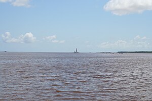
Berbice River
River in eastern Guyana
Distance: Approx. 4142 meters
Latitude and longitude: 6.28333333,-57.53333333
The Berbice River , located in eastern Guyana, is one of the country's major rivers. It rises in the highlands of the Rupununi region and flows northward for 595 kilometres (370 mi) through dense forests to the coastal plain. The river's tidal limit is between 160 and 320 km (99–199 mi) from the sea.
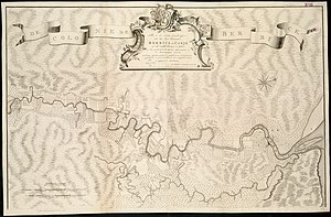
Berbice
1627–1815 Dutch colony in South America
Distance: Approx. 3430 meters
Latitude and longitude: 6.2337,-57.543
Berbice () is a region along the Berbice River in Guyana, which was between 1627 and 1792 a colony of the Dutch West India Company and between 1792 and 1815 a colony of the Dutch state. After having been ceded to the United Kingdom of Great Britain and Ireland in the latter year, it was merged with Demerara-Essequibo to form the colony of British Guiana in 1831. It became a county of British Guiana in 1838 till 1958.

Rosignol
Village in Guyana
Distance: Approx. 3703 meters
Latitude and longitude: 6.27361111,-57.54027778
Rosignol is a village on the west bank of the Berbice River in Mahaica-Berbice, Guyana. The town is important because it has a port, the Rosignol Stelling, that used to be the main crossing point on the western bank of the Berbice River. Major bus lines include Route No.

Canje River
River in Guyana
Distance: Approx. 1368 meters
Latitude and longitude: 6.2619,-57.5198
The Canje River (sometimes referred to as Canje Creek), located in northeastern Guyana, is the main tributary of the Berbice River. It runs roughly parallel to the Atlantic Ocean coast in East Berbice-Corentyne, region 6. The settlement of Baracara is on the Canje.
Mission Chapel, New Amsterdam
Distance: Approx. 542 meters
Latitude and longitude: 6.24647,-57.52007
Mission Chapel, a Congregational Church, was built around 1814 in New Amsterdam, Berbice, Guyana. Mission Chapel is located at 12 Chapel Street, New Amsterdam, Berbice.
Berbice High School
School in New Amsterdam, Guyana
Distance: Approx. 537 meters
Latitude and longitude: 6.2545224,-57.5150156
Berbice High School is a school in New Amsterdam, Guyana. Berbice High School is a school in New Amsterdam, Guyana. The Boys' School was established on 5 September 1916, on the ground floor of the residence occupied by Rev.
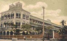
New Amsterdam Public Hospital
Hospital in Guyana
Distance: Approx. 674 meters
Latitude and longitude: 6.255,-57.51326
New Amsterdam Public Hospital in New Amsterdam, Guyana, is the country's biggest hospital after Georgetown Public Hospital. It's old building is one of the two surviving buildings designed by Cesar Castellani, an architect employed in the Public Works Department of British Guiana. Construction commenced in late 1881 with funds provided to the Public Works Department by the colonial administration.
Berbice Bridge
Bridge in North east Berbice
Distance: Approx. 3710 meters
Latitude and longitude: 6.281,-57.529
The Berbice Bridge is a pontoon bridge over the Berbice River near New Amsterdam in Guyana. The bridge is tolled and was opened on 23 December 2008. With the completion of the Berbice Bridge, and the earlier completion of the Coppename Bridge in Suriname in 1999, the Courantyne River is the only river between the Guyanese capital of Georgetown and the Surinamese capital of Paramaribo still left without a bridge.
New Amsterdam Airport
Airport in Guyana
Distance: Approx. 4808 meters
Latitude and longitude: 6.24444444,-57.47361111
New Amsterdam Airport (ICAO: SYNA) is an airport serving the city of New Amsterdam in the East Berbice-Corentyne Region of Guyana.
Welfare Centre Ground
Distance: Approx. 3321 meters
Latitude and longitude: 6.2445,-57.4872
The Welfare Centre Ground is a cricket ground in Rose Hall, Guyana.
Blairmont Sports Club Ground
Cricket and football ground in Blairmont, Guyana
Distance: Approx. 3010 meters
Latitude and longitude: 6.2503,-57.5439
Blairmont Sports Club Ground is a cricket and football ground in Blairmont, Guyana.
Weather in this IP's area
scattered clouds
24 Celsius
25 Celsius
24 Celsius
24 Celsius
1011 hPa
91 %
1011 hPa
1011 hPa
10000 meters
1.64 m/s
4.94 m/s
52 degree
40 %