Country:
 Chile
ChileRegion:
City:
Latitude and Longitude:
Time Zone:
Postal Code:
IP information under different IP Channel
ip-api
Country
Region
City
ASN
Time Zone
ISP
Blacklist
Proxy
Latitude
Longitude
Postal
Route
IPinfo
Country
Region
City
ASN
Time Zone
ISP
Blacklist
Proxy
Latitude
Longitude
Postal
Route
MaxMind
Country
Region
City
ASN
Time Zone
ISP
Blacklist
Proxy
Latitude
Longitude
Postal
Route
Luminati
Country
CLRegion
at
City
copiapo
ASN
Time Zone
America/Santiago
ISP
Telmex Servicios Empresariales S.A.
Latitude
Longitude
Postal
db-ip
Country
Region
City
ASN
Time Zone
ISP
Blacklist
Proxy
Latitude
Longitude
Postal
Route
ipdata
Country
Region
City
ASN
Time Zone
ISP
Blacklist
Proxy
Latitude
Longitude
Postal
Route
Popular places and events near this IP address

Atacama Region
Region of Chile
Distance: Approx. 881 meters
Latitude and longitude: -27.36666667,-70.33222222
The Atacama Region (Spanish: Región de Atacama, pronounced [ataˈkama]) is one of Chile's 16 first order administrative divisions. It comprises three provinces: Chañaral, Copiapó and Huasco. It is bordered to the north by Antofagasta, to the south by Coquimbo, to the east by the provinces of Catamarca, La Rioja and San Juan of Argentina, and to the west by the Pacific Ocean.

University of Atacama
Distance: Approx. 2209 meters
Latitude and longitude: -27.35666667,-70.3525
University of Atacama (Spanish: Universidad de Atacama) or UDA is a university in Chile. It is part of the Chilean Traditional Universities. UDA is in Copiapó, in the Third Region, Atacama.
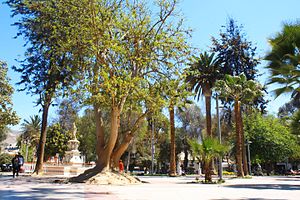
Copiapó
City and Commune in Atacama, Chile
Distance: Approx. 848 meters
Latitude and longitude: -27.36638889,-70.33305556
Copiapó (Spanish pronunciation: [kopjaˈpo]) is a city and commune in northern Chile, located about 65 kilometers east of the coastal town of Caldera. Founded on December 8, 1744, it is the capital of Copiapó Province and Atacama Region. Copiapó lies about 800 km north of Santiago by the Copiapó River, in the valley of the same name.

Roman Catholic Diocese of Copiapó
Catholic ecclesiastical territory
Distance: Approx. 858 meters
Latitude and longitude: -27.3661,-70.3333
The Roman Catholic Diocese of Copiapó (Latin: Copiapoën(sis)) is a diocese located in the city of Copiapó in the ecclesiastical province of La Serena in Chile.

Estadio Luis Valenzuela Hermosilla
Stadium in Copiapó, Chile
Distance: Approx. 1825 meters
Latitude and longitude: -27.37666667,-70.32083333
Estadio Luis Valenzuela Hermosilla is a multi-use stadium in Copiapó, Chile. It is currently used mostly for football matches and is the home ground of Club de Deportes Copiapó of the Chilean Primera División B. It also hosted Regional Atacama of the Chilean Primera División. The stadium has a capacity of 8,000 spectators.
Copiapó Solar Project
Solar thermal power project
Distance: Approx. 3288 meters
Latitude and longitude: -27.35,-70.31666667
The Copiapó Solar Project is a 390 megawatt (MW) net solar thermal power project to be located near Copiapó, about 65 kilometers east of the coastal town of Caldera. The project is being developed by SolarReserve, and is scheduled to reach commercial operation in 2019. The Copiapó project will comprise two 120 megawatt (MW), 130 MW gross) solar thermal towers with up to 14 hours thermal storage, combined with 150 MW of PV. The hybrid project will deliver over 1,700 gigawatt-hours (GW·h) annually, as non-intermittent baseload power, 24 hours a day.

Our Lady of the Rosary Cathedral, Copiapó
Church in Copiapó, Chile
Distance: Approx. 870 meters
Latitude and longitude: -27.3661,-70.3331
The Our Lady of the Rosary Cathedral (Spanish: Catedral Nuestra Señora del Rosario) Also Copiapó Cathedral Is the catholic cathedral of the Diocese of Copiapó in Chile. It is the largest temple in the city, and is located on the west side of Plaza Prat, at the intersection of Chacabuco and O'Higgins streets. Before the present cathedral there existed in the same place a small parish was built between 1748 and 1750, that in 1766 opened its doors.
Chilean Iron Belt
Distance: Approx. 9360 meters
Latitude and longitude: -27.366389,-70.433056
The Chilean Iron Belt is a geological province rich in iron ore deposits in northern Chile. It extends as a north-south beld along the western part of the Chilean regions of Coquimbo and Atacama, chiefly between the cities of La Serena and Taltal. The belt follows much of the Atacama Fault System and is about 600 km long and 25 km broad.

Museo Regional de Atacama
Distance: Approx. 1024 meters
Latitude and longitude: -27.36308611,-70.33998333
Museo Regional de Atacama is a museum in the Chilean city of Copiapó, the capital of Atacama Region. The museum had 2,117 visitors in 2020.
Weather in this IP's area
few clouds
17 Celsius
15 Celsius
17 Celsius
17 Celsius
1009 hPa
11 %
1009 hPa
967 hPa
10000 meters
5.07 m/s
3.94 m/s
254 degree
13 %
07:32:41
19:36:38