190.53.93.148 - IP Lookup: Free IP Address Lookup, Postal Code Lookup, IP Location Lookup, IP ASN, Public IP
Country:
Region:
City:
Location:
Time Zone:
Postal Code:
ISP:
ASN:
language:
User-Agent:
Proxy IP:
Blacklist:
IP information under different IP Channel
ip-api
Country
Region
City
ASN
Time Zone
ISP
Blacklist
Proxy
Latitude
Longitude
Postal
Route
db-ip
Country
Region
City
ASN
Time Zone
ISP
Blacklist
Proxy
Latitude
Longitude
Postal
Route
IPinfo
Country
Region
City
ASN
Time Zone
ISP
Blacklist
Proxy
Latitude
Longitude
Postal
Route
IP2Location
190.53.93.148Country
Region
francisco morazan
City
tegucigalpa
Time Zone
America/Tegucigalpa
ISP
Language
User-Agent
Latitude
Longitude
Postal
ipdata
Country
Region
City
ASN
Time Zone
ISP
Blacklist
Proxy
Latitude
Longitude
Postal
Route
Popular places and events near this IP address

Francisco Morazán Department
Department in Honduras
Distance: Approx. 2279 meters
Latitude and longitude: 14.1,-87.21666667
Francisco Morazán (Spanish pronunciation: [fɾanˈsisko moɾaˈsan], abbreviated FMO) is one of the departments of Honduras. It is located in the central part of the nation. The departmental capital is Tegucigalpa, which is also Honduras's national capital.

Toncontín International Airport
National airport in Tegucigalpa, Honduras
Distance: Approx. 2466 meters
Latitude and longitude: 14.06166667,-87.21694444
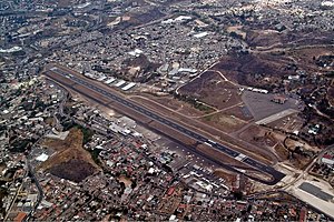
Toncontín Airport (IATA: TGU, ICAO: MHTG) formerly Toncontín International Airport, also known as Teniente Coronel Hernán Acosta Mejía Airport is a civil and military airport located 6 km (4 mi) from the centre of Tegucigalpa, Honduras. The History Channel programme Most Extreme Airports ranks it as the second most extreme airport in the world. The approach to the airport is considered to be one of the most difficult in the world to all aircraft, especially in inclement weather conditions.

National Congress of Honduras
National legislature of Honduras
Distance: Approx. 2467 meters
Latitude and longitude: 14.10375,-87.20495
The National Congress (Spanish: Congreso Nacional) is the legislative branch of the government of Honduras.

Estadio Nacional Chelato Uclés
Football stadium
Distance: Approx. 1886 meters
Latitude and longitude: 14.09833333,-87.20388889
The Estadio Nacional Chelato Uclés (English: Chelato Uclés National Stadium) is a multi-purpose stadium in Tegucigalpa, Honduras. It is used mostly for association football matches. The stadium has a capacity of 35,000 and is the home of football clubs Motagua and Olimpia.
Roman Catholic Archdiocese of Tegucigalpa
Latin Catholic archdiocese in Honduras
Distance: Approx. 2669 meters
Latitude and longitude: 14.1055,-87.2042
The Archdiocese of Tegucigalpa (Spanish: La arquidiócesis de Tegucigalpa) (1916 established, successor to the Diocese of Comayagua, erected 1561) is a Latin Church ecclesiastical territory or archdiocese of the Catholic Church in Honduras. Until 2023, it was the only metropolitan see in Honduras, with its ecclesiastical province covering the whole country. Its archepiscopal see is the Cathedral of St.

Universidad José Cecilio del Valle
Educational institution in Tegucigalpa, Honduras
Distance: Approx. 724 meters
Latitude and longitude: 14.0815,-87.2005
The Universidad José Cecilio del Valle (UJCV) is a private higher education institution in Honduras. It was established in 1978 through the Asociación Hondureña para el Fomento de la Educación Superior (AHFES). UJCV offers associate's degrees, as well as 4-to-5-year bachelor's degrees along with some master's programs.

TACA Flight 390
2008 aviation accident in Honduras
Distance: Approx. 1481 meters
Latitude and longitude: 14.0702,-87.2141
TACA Flight 390 was a scheduled flight on May 30, 2008, by TACA International from San Salvador, El Salvador, to Miami, Florida, United States, with intermediate stops at Tegucigalpa and San Pedro Sula in Honduras. The aircraft, an Airbus A320-233, overran the runway after landing at Tegucigalpa's Toncontín International Airport and rolled out into a street, crashing into an embankment and smashing several cars in the process. El Salvador's Civil Aviation Authority spearheaded the investigation, which attributed the accident to pilot error.

Tegucigalpa
Capital and largest city of Honduras
Distance: Approx. 2700 meters
Latitude and longitude: 14.10583333,-87.20472222
Tegucigalpa (UK: US: Spanish: [teɣusiˈɣalpa])—formally Tegucigalpa, Municipality of the Central District (Spanish: Tegucigalpa, Municipio del Distrito Central or Tegucigalpa, M.D.C.), and colloquially referred to as Tegus or Teguz—is the capital and largest city of Honduras along with its sister city, Comayagüela. Claimed on 29 September 1578 by the Spaniards, Tegucigalpa became the Honduran capital on 30 October 1880, under President Marco Aurelio Soto, when he moved the seat of government from Comayagua, which had been the Honduran capital since its independence in 1841. The 1936 constitution established Tegucigalpa and Comayagua as a Central District, and the current 1982 Honduran Constitution continues to define the sister cities as a Central District[c] that serves as the permanent national capital.

Tegucigalpa Cathedral
Church in Tegucigalpa, Honduras
Distance: Approx. 2665 meters
Latitude and longitude: 14.1055,-87.2045
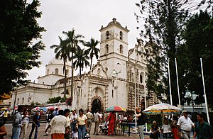
The St. Michael the Archangel Cathedral (Spanish: Catedral Metropolitana de San Míguel Arcángel) is a Catholic temple in Tegucigalpa, Honduras. It is well known for being the biggest Catholic church during colonial times and one of the most well preserved historical buildings in Honduras.
Escuela Nacional de Bellas Artes (Nicaragua)
Distance: Approx. 1881 meters
Latitude and longitude: 14.0986,-87.2072
Escuela Nacional de Bellas Artes (ENBA, or National School of Fine Arts) is a national fine arts institution located in Managua, Nicaragua. It was founded in 1938 as an apprentice-base learning workshop. Curricula established to meet educational standards set by the government were implemented in 1979.

Embassy of the United States, Tegucigalpa
Diplomatic mission
Distance: Approx. 3017 meters
Latitude and longitude: 14.10305556,-87.19
The Embassy of the United States in Tegucigalpa is the diplomatic mission of the United States of America in Honduras.

National Gallery of Art (Honduras)
Art museum in Honduras
Distance: Approx. 2756 meters
Latitude and longitude: 14.10644444,-87.20811111
The Honduran National Gallery of Art (Spanish: Galería Nacional de Arte, GNA) is an art museum in Tegucigalpa, Honduras. The Gallery was first opened on 31 July 1996. It is open to the public and as of 2019 was receiving 40,000 monthly visitors.
Weather in this IP's area
scattered clouds
23 Celsius
23 Celsius
23 Celsius
23 Celsius
1017 hPa
60 %
1017 hPa
869 hPa
10000 meters
9.26 m/s
14.4 m/s
330 degree
40 %
