190.213.147.67 - IP Lookup: Free IP Address Lookup, Postal Code Lookup, IP Location Lookup, IP ASN, Public IP
Country:
Region:
City:
Location:
Time Zone:
Postal Code:
ISP:
ASN:
language:
User-Agent:
Proxy IP:
Blacklist:
IP information under different IP Channel
ip-api
Country
Region
City
ASN
Time Zone
ISP
Blacklist
Proxy
Latitude
Longitude
Postal
Route
db-ip
Country
Region
City
ASN
Time Zone
ISP
Blacklist
Proxy
Latitude
Longitude
Postal
Route
IPinfo
Country
Region
City
ASN
Time Zone
ISP
Blacklist
Proxy
Latitude
Longitude
Postal
Route
IP2Location
190.213.147.67Country
Region
diego martin
City
petit valley
Time Zone
America/Port_of_Spain
ISP
Language
User-Agent
Latitude
Longitude
Postal
ipdata
Country
Region
City
ASN
Time Zone
ISP
Blacklist
Proxy
Latitude
Longitude
Postal
Route
Popular places and events near this IP address
Federation Park
Locale in Trinidad and Tobago
Distance: Approx. 2832 meters
Latitude and longitude: 10.67555556,-61.52611111
Federation Park is an upscale residential neighbourhood in northwestern Port of Spain, Trinidad and Tobago. Federation Park was built to house delegates to the Federal Parliament of the West Indies Federation. As a result of this, the streets in Federation Park are named for the various territories which made up the Federation.

Ellerslie Park
Distance: Approx. 2644 meters
Latitude and longitude: 10.6778,-61.5247
Ellerslie Park is an exclusive residential development in the northwestern corner of Port of Spain, Trinidad and Tobago. The development is in the shape of an oval with a single entrance. No two homes are the same, a result of each home being built to the specifications of its original owner.
Sixth Form Government Secondary School
Secondary school in Trinidad and Tobago
Distance: Approx. 3449 meters
Latitude and longitude: 10.6691,-61.5356
Sixth Form Government is a government secondary school offering advanced level studies, situated on Ethel Street, Saint James, Trinidad and Tobago. At night the same buildings function as the Polytechnic Institute, a night school for adult education.
Royal Botanic Gardens, Trinidad
Distance: Approx. 3527 meters
Latitude and longitude: 10.6744,-61.5143
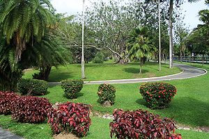
The Royal Botanic Gardens in Trinidad and Tobago is located in Port of Spain. The Gardens, which were established in 1818, are situated just north of the Queen's Park Savannah. This is one of the oldest Botanic Gardens in the world.
Audrey Jeffers Highway
Highway in Trinidad and Tobago
Distance: Approx. 3603 meters
Latitude and longitude: 10.6678,-61.5366
The Audrey Jeffers Highway is a highway in Trinidad and Tobago. It runs west from Downtown Port of Spain to Cocorite. The highway runs from the Hasely Crawford Stadium to the Cocorite area parallel to Mucurapo Road and the Western Main Road in St.
Emperor Valley Zoo
Zoo in St. Clair, Port of Spain
Distance: Approx. 3286 meters
Latitude and longitude: 10.6742,-61.5187
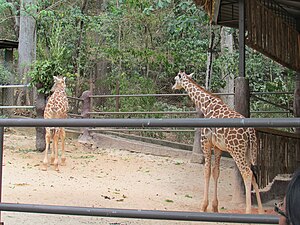
The Emperor Valley Zoo is the only zoo in Trinidad and Tobago. The 7.2-acre (2.91 ha) facility is located north of Queen's Park Savannah and west of the Royal Botanic Gardens, in Port of Spain. The zoo first opened on 8 November 1952, operated then by Governor Sir Hubert Rance.

Maraval
Distance: Approx. 1819 meters
Latitude and longitude: 10.7,-61.51666667
Maraval is one of the northern suburbs of Trinidad's capital, Port of Spain, a valley in northern Trinidad in Trinidad and Tobago. It is situated at the bottom of the hills of Paramin and located east of the Diego Martin valley to which it is connected directly by Morne Coco Road, and west of Santa Cruz valley, to which it is connected by Saddle Road.
Caribbean Public Health Agency
Regional public health agency headquartered in Trinidad and Tobago
Distance: Approx. 3064 meters
Latitude and longitude: 10.67388889,-61.52444444
The Caribbean Public Health Agency (CARPHA) is a regional public health agency headquartered in Trinidad and Tobago which was established by CARICOM leaders in July 2011 and began operation in 2013. CARPHA combines the functions of five pre-existing regional health institutions: The Caribbean Environmental Health Institute (CEHI), The Caribbean Epidemiology Centre (CAREC), The Caribbean Food and Nutrition Institute (CFNI), The Caribbean Health Research Centre (CHRC), and The Caribbean Research and Drug Treatment Laboratory (CRDTL).
List of ambassadors of China to Trinidad and Tobago
Chinese Ambassador
Distance: Approx. 3395 meters
Latitude and longitude: 10.671796,-61.521502
The Chinese Ambassador to Trinidad and Tobago is the official representative of the People's Republic of China to the Republic of Trinidad and Tobago.

Dibe, Trinidad and Tobago
Distance: Approx. 1855 meters
Latitude and longitude: 10.68333333,-61.53333333
Dibe is a village in north Trinidad located northwest of downtown Port of Spain, Trinidad and Tobago. The village is home to the poor and the rich, who respectively live on the surrounding hills and meadows, which has been described as living between a rock and a hard place. Upper Dibe, better known as “Cripple Creek” or ‘’’the Creek”’, has had a dark history with incessant gang warfare for over three decades.
Magnificent Seven (Port of Spain)
Distance: Approx. 3587 meters
Latitude and longitude: 10.671,-61.519
The Magnificent Seven is a group of seven mansions located west of the Queen's Park Savannah in northern Port of Spain, Trinidad and Tobago on Maraval Road in the St Clair neighborhood. They were built between 1902 and 1910 on land that was previously used as a government stock farm and are listed as heritage sites at the National Trust of Trinidad and Tobago. Stollmeyer's Castle was the first building in the neighborhood and took several years to complete, as was typical of the Magnificent Seven.

St Clair, Port of Spain
Business and residential district in Port of Spain, Trinidad and Tobago
Distance: Approx. 3550 meters
Latitude and longitude: 10.67046111,-61.52107778
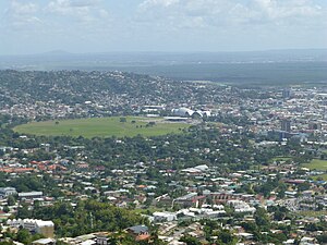
Saint Clair is a business and residential district between the Queen's Park Savannah and the Maraval River in Port of Spain, Trinidad and Tobago. It is home to most of the city's grandest and largest mansions and also home to the Magnificent Seven Houses. Federation Park and Ellerslie Park.
Weather in this IP's area
clear sky
23 Celsius
23 Celsius
23 Celsius
23 Celsius
1015 hPa
85 %
1015 hPa
1007 hPa
10000 meters
2.73 m/s
5.21 m/s
94 degree
2 %


