Country:
Region:
City:
Latitude and Longitude:
Time Zone:
Postal Code:
IP information under different IP Channel
ip-api
Country
Region
City
ASN
Time Zone
ISP
Blacklist
Proxy
Latitude
Longitude
Postal
Route
Luminati
Country
Region
co
City
chillan
ASN
Time Zone
America/Santiago
ISP
Telmex Servicios Empresariales S.A.
Latitude
Longitude
Postal
IPinfo
Country
Region
City
ASN
Time Zone
ISP
Blacklist
Proxy
Latitude
Longitude
Postal
Route
db-ip
Country
Region
City
ASN
Time Zone
ISP
Blacklist
Proxy
Latitude
Longitude
Postal
Route
ipdata
Country
Region
City
ASN
Time Zone
ISP
Blacklist
Proxy
Latitude
Longitude
Postal
Route
Popular places and events near this IP address

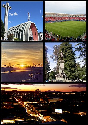
Chillán
Capital city of the Ñuble Region, Chile
Distance: Approx. 94 meters
Latitude and longitude: -36.6,-72.11666667
Chillán (Spanish pronunciation: [tʃiˈʝan]) is the capital city of Ñuble Region, Diguillín Province, Chile, located about 400 km (249 mi) south of the country's capital, Santiago, near the center of the country. It has been the capital of the new Ñuble Region since 6 September 2015. Within the city is a railway station, an intercity bus terminal named María Teresa, and a regimental military base.
General Bernardo O'Higgins Airport
Airport
Distance: Approx. 7828 meters
Latitude and longitude: -36.58333333,-72.0325
General Bernardo O'Higgins Airport (IATA: YAI, ICAO: SCCH) is an airport serving Chillán, a city in the Diguillín Province of Chile's Ñuble Region. The airport is 6 kilometres (3.7 mi) northeast of the city. The airport is named for Bernardo O'Higgins, the first Chilean head of state.

Estadio Municipal Nelson Oyarzún Arenas
Distance: Approx. 2135 meters
Latitude and longitude: -36.61805556,-72.1075
Estadio Bicentenario Municipal Nelson Oyarzún is a stadium located in Chillán, Chile and owned by the Chillán municipality. It is home to Ñublense football club. It is named after Nelson Oyarzún Arenas, a Ñublense coach.
Roman Catholic Diocese of San Bartolomé de Chillán
Catholic ecclesiastical territory
Distance: Approx. 1532 meters
Latitude and longitude: -36.6068,-72.1021
The Roman Catholic Diocese of San Bartolomé de Chillán (Latin: Sancti Bartholomaie de Chillán) is a diocese located in the city of Chillán in the ecclesiastical province of Concepción in Chile.
Chillán conurbation
Distance: Approx. 2300 meters
Latitude and longitude: -36.6208787,-72.12234341
Chillán conurbation or Gran Chillán (Greater Chillan) is a Chilean conurbation formatted for the communes of Chillán and Chillán Viejo in Diguillin Province in Ñuble Region.
Chillán Viejo
City and Commune in Ñuble, Chile
Distance: Approx. 3071 meters
Latitude and longitude: -36.62388889,-72.13583333
Chillán Viejo is a city and commune (Spanish: comuna) in the Diguillín Province of Chile Region of Ñuble According to the 2002 census, the population of the commune was 22,084 and it has an area of 292 km2 (113 sq mi).

Siege of Chillán
Distance: Approx. 2545 meters
Latitude and longitude: -36.61817778,-72.13561944
The siege of Chillán occurred from July 27th to August 10th, 1813, as patriot forces attempted to dislodge a determined band of royalist defenders. The failure of José Miguel Carrera to take the city would contribute to his removal from office by the junta later in the campaign.
Cato River
River in Chile
Distance: Approx. 6187 meters
Latitude and longitude: -36.55165,-72.08462
The Cato River is a river in Ñuble Region in the southern portion of Central Chile. It joins the Ñuble River about 1 km to the east of Chile Route 5. Close to its mouth is the city of Chillán.
Estación Chillán
Railway station in Chillán, Chile
Distance: Approx. 590 meters
Latitude and longitude: -36.60388889,-72.11222222
Estación Chillán is a railway station of the Empresa de los Ferrocarriles del Estado, located in Chillán, Chile. It is the main railway station in the Ñuble Region. It is located on Brasil avenue.
La Vertiente Airport (Chile)
Airport
Distance: Approx. 6902 meters
Latitude and longitude: -36.61277778,-72.04166667
La Vertiente Airport Spanish: Aeropuerto de La Vertiente, (ICAO: SCAV) was a public use airport located near Chillán, Bío Bío, Chile. Google Earth Historical Imagery (2/10/2012) shows a 600 metres (2,000 ft) grass runway. The (2/12/2013) imagery shows a pivot irrigation system installed and the central portion of the runway under cultivation.
St. Bartholomew Cathedral, Chillán
Church in Chillán, Chile
Distance: Approx. 1537 meters
Latitude and longitude: -36.6069,-72.1021
The St. Bartholomew Cathedral (Spanish: Catedral de San Bartolomé) Also Chillán Cathedral Is a temple of the Catholic Church, home of the Diocese of Chillán located in the center of the city of Chillán, Chile in front of the Plaza de Armas, in the corner of streets Arauco and Libertad. It is also a symbol and icon of the city, as a result of the city's progress after the Chillan earthquake of 1939.
Weather in this IP's area
broken clouds
16 Celsius
15 Celsius
16 Celsius
16 Celsius
1022 hPa
55 %
1022 hPa
1008 hPa
10000 meters
2.06 m/s
75 %
06:34:29
20:30:31


