Country:
Region:
City:
Latitude and Longitude:
Time Zone:
Postal Code:
IP information under different IP Channel
ip-api
Country
Region
City
ASN
Time Zone
ISP
Blacklist
Proxy
Latitude
Longitude
Postal
Route
Luminati
Country
Region
rm
City
lareina
ASN
Time Zone
America/Santiago
ISP
Manquehuenet
Latitude
Longitude
Postal
IPinfo
Country
Region
City
ASN
Time Zone
ISP
Blacklist
Proxy
Latitude
Longitude
Postal
Route
db-ip
Country
Region
City
ASN
Time Zone
ISP
Blacklist
Proxy
Latitude
Longitude
Postal
Route
ipdata
Country
Region
City
ASN
Time Zone
ISP
Blacklist
Proxy
Latitude
Longitude
Postal
Route
Popular places and events near this IP address

La Reina
Commune in Santiago Metro., Chile
Distance: Approx. 422 meters
Latitude and longitude: -33.45,-70.55
La Reina (Spanish: "The Queen"; distorted from Larraín) is a commune of Chile located in Santiago Province, Santiago Metropolitan Region, created in 1963 from an eastern portion of the Ñuñoa commune. It belongs to the Northeastern zone of Santiago de Chile. La Reina is a residential commune inhabited by mostly mid to upper-mid income families and high-income groups.

Villa Grimaldi
Former political prison in Chile
Distance: Approx. 1366 meters
Latitude and longitude: -33.46375,-70.54263889
Villa Grimaldi is considered the most important of DINA's many complexes that were used for the interrogation and torture of political prisoners during the governance of Augusto Pinochet. It is located at Avenida José Arrieta 8200 (now 8401) in Peñalolén, on the outskirts of Santiago, and was in operation from mid-1974 to mid-1978. About 4,500 detainees were brought to Villa Grimaldi during this time, at least 240 of whom "disappeared" or were killed by DINA. It was also the location of the headquarters of the Metropolitan Intelligence Brigade (BIM).

The Grange School, Santiago
Private school in La Reina, Santiago Metropolitan Region, Chile
Distance: Approx. 2534 meters
Latitude and longitude: -33.4375,-70.56722222
The Grange School is a private school in La Reina, Santiago, Chile. It was founded 4 June 1928, by John A. S. Jackson, an Anglo-Chilean born in Valparaíso and educated at Cheltenham College and at Cambridge University. In 2006, the British newspaper The Guardian listed The Grange School as one of the best UK-curriculum international schools in the world.
Prince of Wales Country Club
Distance: Approx. 3027 meters
Latitude and longitude: -33.43597778,-70.57250209
Prince of Wales Country Club is a Chilean sports and recreation club founded in 1925, taking its name from the then Prince of Wales, later to be King Edward VIII who opened the club. Originally it was located in Tobalaba and is now situated in Francisco Bilbao Avenue. The club provides multiple sports facilities including golf, rugby union, field hockey, tennis, football, squash and padel.
Eulogio Sánchez Airport
Airport in La Reina
Distance: Approx. 515 meters
Latitude and longitude: -33.45638889,-70.54666667
Eulogio Sánchez Airport (Spanish: Aeródromo Eulogio Sánchez) (ICAO: SCTB), also known as Tobalaba Airport, is an airport in La Reina, an eastern suburb of Santiago, Chile. It is two-thirds owned by the Club Aéreo de Santiago and one-third owned by the Club Aéreo de Carabineros de Chile. Also, it holds the headquarters of Airbus Helicopters Chile S.A. The airport consists of 120 acres on the eastern edge of the Santiago metropolitan area.

Príncipe de Gales metro station
Santiago metro station
Distance: Approx. 2886 meters
Latitude and longitude: -33.43913611,-70.57311111
Príncipe de Gales is an underground metro station on the Line 4 of the Santiago Metro, in Santiago, Chile. South of this station, Line 4 runs under Américo Vespucio Avenue, which in this section takes the name of Ossa Avenue. The station was opened on 30 November 2005 as part of the inaugural section of the line between Tobalaba and Grecia.

Simón Bolívar metro station (Santiago)
Santiago metro station
Distance: Approx. 2506 meters
Latitude and longitude: -33.44588611,-70.57202778
Simón Bolívar is an underground metro station on the Line 4 of the Santiago Metro, in Santiago, Chile. It is named for the nearby Simón Bolívar Avenue, which in turn is named after Simón Bolívar. The station was opened on 30 November 2005 as part of the inaugural section of the line between Tobalaba and Grecia.

Plaza Egaña metro station
Santiago metro station
Distance: Approx. 2306 meters
Latitude and longitude: -33.45341111,-70.57075278
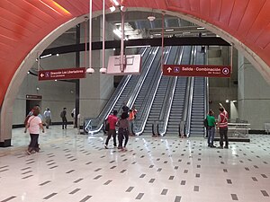
Plaza Egaña is a transfer station between the Line 3 and Line 4 of the Santiago Metro. It is located under Egaña Square. The Line 4 station was opened on 30 November 2005 as part of the inaugural section of the line between Tobalaba and Grecia.

Los Orientales metro station
Santiago metro station
Distance: Approx. 2833 meters
Latitude and longitude: -33.46237222,-70.57375
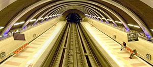
Los Orientales is an underground metro station on the Line 4 of the Santiago Metro, in Santiago, Chile. The station was opened on 30 November 2005 as part of the inaugural section of the line between Tobalaba and Grecia. Like in Plaza Egaña, there are columns between the two tracks that support a double barrel vaulted ceiling.
Colegio Monteverde (Chile)
School in Santiago, Chile
Distance: Approx. 2304 meters
Latitude and longitude: -33.472,-70.5514
Colegio Monteverde is a Chilean school located in Santiago.

Fernando Castillo Velasco metro station
Santiago metro station
Distance: Approx. 1122 meters
Latitude and longitude: -33.4525,-70.55805556
Fernando Castillo Velasco is an underground metro station and the southern terminal station of Line 3 of the Santiago Metro network, in Santiago, Chile. It is located underground, at the intersection of Alcalde Fernando Castillo Velasco Avenue with Loreley Street. It the current terminal station of Line 3, preceded by the Plaza Egaña station.

Andrée English School
Private school in La Reina, Santiago Metropolitan Region, Chile
Distance: Approx. 1368 meters
Latitude and longitude: -33.44027778,-70.55111111
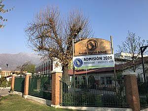
Andrée English School is a Private, Christian School in La Reina, Santiago, Chile which is considered bilingual due to its emphasis on English.
Weather in this IP's area
overcast clouds
20 Celsius
19 Celsius
20 Celsius
21 Celsius
1016 hPa
37 %
1016 hPa
940 hPa
10000 meters
0.89 m/s
2.68 m/s
96 %
06:30:03
20:24:44
