Country:
 Chile
ChileRegion:
City:
Latitude and Longitude:
Time Zone:
Postal Code:
IP information under different IP Channel
ip-api
Country
Region
City
ASN
Time Zone
ISP
Blacklist
Proxy
Latitude
Longitude
Postal
Route
IPinfo
Country
Region
City
ASN
Time Zone
ISP
Blacklist
Proxy
Latitude
Longitude
Postal
Route
MaxMind
Country
Region
City
ASN
Time Zone
ISP
Blacklist
Proxy
Latitude
Longitude
Postal
Route
Luminati
Country
CLRegion
rm
City
estacioncolina
ASN
Time Zone
America/Santiago
ISP
Gtd Internet S.A.
Latitude
Longitude
Postal
db-ip
Country
Region
City
ASN
Time Zone
ISP
Blacklist
Proxy
Latitude
Longitude
Postal
Route
ipdata
Country
Region
City
ASN
Time Zone
ISP
Blacklist
Proxy
Latitude
Longitude
Postal
Route
Popular places and events near this IP address

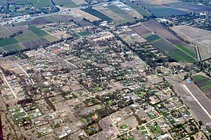
Quilicura
City and Commune in Santiago, Chile
Distance: Approx. 8554 meters
Latitude and longitude: -33.36666667,-70.73333333
Quilicura ( KIL-i-KOOR-ə; Spanish pronunciation: [kiliˈkuɾa]) is a commune of Chile located in capital Santiago. Founded in 1901, it was originally a satellite city on what were then the outskirts of the city of Santiago, but as urban sprawl has set in it is now quickly urbanizing from what was recently prime agricultural land.
Batuco, Santiago
Locality in Chile
Distance: Approx. 8193 meters
Latitude and longitude: -33.2308,-70.8089
Batuco is a locality of Chile, situated in the commune of Lampa. Its population was 16,784 as of the 2017 census.
Lipangui Airport
Airport
Distance: Approx. 9314 meters
Latitude and longitude: -33.33611111,-70.85138889
Lipangui Airport Spanish: Aeropuerto Lipangui, (ICAO: SCKL) is an airport 6 kilometres (3.7 mi) south-southeast of Lampa, a city in the Santiago Metropolitan Region of Chile. The Pudahuel VOR-DME (Ident: PDH) is 5.6 nautical miles (10.4 km) south-southeast of the airport.

Ferrocarril metro station
Santiago metro station
Distance: Approx. 9628 meters
Latitude and longitude: -33.36527778,-70.70527778
Ferrocarril is an underground metro station of Line 3 of the Santiago Metro network, in Santiago, Chile. It is an underground, between the Lo Cruzat and Los Libertadores stations on Line 3. It is located at the intersection of Manuel Antonio Matta Avenue with Pasaje 4.

Lo Cruzat metro station
Santiago metro station
Distance: Approx. 9628 meters
Latitude and longitude: -33.36527778,-70.70527778
Lo Cruzat is an underground metro station of Line 3 of the Santiago Metro network, in Santiago, Chile. It is an underground, between the Plaza Quilicura and Ferrocarril stations on Line 3. It is located at the intersection of Manuel Antonio Matta Avenue with Las Torres and Lo Cruzat Avenues.

Plaza Quilicura metro station
Santiago metro station
Distance: Approx. 8618 meters
Latitude and longitude: -33.36583333,-70.72888889
Plaza Quilicura is an underground metro station and the northern terminal station of Line 3 of the Santiago Metro network, in Santiago, Chile. It is an underground, preceded by Lo Cruzat station on Line 3. It is located at the intersection of Manuel Antonio Matta Avenue with Bernardo O'Higgins Avenues.
Weather in this IP's area
clear sky
31 Celsius
29 Celsius
29 Celsius
32 Celsius
1009 hPa
25 %
1009 hPa
955 hPa
10000 meters
5.66 m/s
170 degree
06:57:43
19:58:11