190.123.18.252 - IP Lookup: Free IP Address Lookup, Postal Code Lookup, IP Location Lookup, IP ASN, Public IP
Country:
Region:
City:
Location:
Time Zone:
Postal Code:
IP information under different IP Channel
ip-api
Country
Region
City
ASN
Time Zone
ISP
Blacklist
Proxy
Latitude
Longitude
Postal
Route
Luminati
Country
Region
bo
City
kralendijk
ASN
Time Zone
America/Kralendijk
ISP
SSCS BV
Latitude
Longitude
Postal
IPinfo
Country
Region
City
ASN
Time Zone
ISP
Blacklist
Proxy
Latitude
Longitude
Postal
Route
IP2Location
190.123.18.252Country
Region
bonaire
City
kralendijk
Time Zone
America/Kralendijk
ISP
Language
User-Agent
Latitude
Longitude
Postal
db-ip
Country
Region
City
ASN
Time Zone
ISP
Blacklist
Proxy
Latitude
Longitude
Postal
Route
ipdata
Country
Region
City
ASN
Time Zone
ISP
Blacklist
Proxy
Latitude
Longitude
Postal
Route
Popular places and events near this IP address

Bonaire
Dutch Caribbean island
Distance: Approx. 4 meters
Latitude and longitude: 12.15,-68.26666667
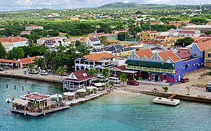
Bonaire ( bon-AIR, Dutch: [boːˈnɛːr(ə)] ; Papiamento: Boneiru [bʊˈne̝i̯ru]) is a Caribbean island in the Leeward Antilles, and is a special municipality (officially "public body") of the Netherlands. Its capital is the port of Kralendijk, on the west (leeward) coast of the island. Aruba, Bonaire and Curaçao form the ABC islands, 80 km (50 miles) off the coast of Venezuela.

Klein Bonaire
Small uninhabited islet in the Caribbean Sea
Distance: Approx. 4886 meters
Latitude and longitude: 12.15805556,-68.31083333
Klein Bonaire (Dutch for "Little Bonaire") is a small uninhabited islet off the west coast of the Caribbean island of Bonaire, and is part of the Dutch special municipality of Bonaire.

Kralendijk
Largest city in Bonaire, Caribbean Netherlands
Distance: Approx. 631 meters
Latitude and longitude: 12.14444444,-68.26555556
Kralendijk (Dutch pronunciation: [ˈkraːlə(n)dɛik]) is the capital and main port of the island of Bonaire in the Caribbean Netherlands. The language spoken in the town is Papiamentu, but Dutch and English are widely used. As of 2017, the town had a population of 10,620.
Flamingo International Airport
Airport in Bonaire, Caribbean Netherlands
Distance: Approx. 2113 meters
Latitude and longitude: 12.13111111,-68.26861111
Flamingo International Airport (IATA: BON, ICAO: TNCB), also called Bonaire International Airport, is an international airport located near Kralendijk on the island of Bonaire in the Caribbean Netherlands. It was once the hub for BonaireExel and CuraçaoExel before they were rebranded as Dutch Antilles Express, and served as a secondary hub for Dutch Antilles Express and Insel Air. The airport is the fourth largest in the Dutch Caribbean, after Queen Beatrix International Airport on Aruba, Princess Juliana International Airport on Sint Maarten and Curaçao International Airport on Curaçao and is now the largest airport in the Caribbean Netherlands, with F. D. Roosevelt Airport in Sint Eustatius being the second largest and Juancho E. Yrausquin Airport in Saba being the smallest.

Antriol
Neighbourhood in Kralendijk, Bonaire, Netherlands
Distance: Approx. 1188 meters
Latitude and longitude: 12.16,-68.2705
Antriol (also Entrejol) is a neighbourhood of Kralendijk on the island of Bonaire in the Netherlands Antilles. It used to be a separate village which merged with four other villages -- Nikiboko, Noord Saliña, Playa, and Tera Kora -- to form Kralendijk.

Hilma Hooker
Shipwreck in Bonaire in the Caribbean Netherlands
Distance: Approx. 5533 meters
Latitude and longitude: 12.10511111,-68.28852778
The Hilma Hooker is a shipwreck in Bonaire in the Caribbean Netherlands. It is a popular wreck diving site.

Municipal Stadium (Kralendijk)
Distance: Approx. 808 meters
Latitude and longitude: 12.15006111,-68.27412778
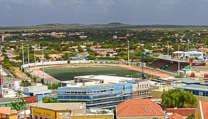
Municipal Stadium is a multi-use stadium in Kralendijk, on the island of Bonaire. It is currently used mostly for football matches. The stadium holds 3,000 people.

St. Bernard Church, Kralendijk
Church in Bonaire, Netherlands
Distance: Approx. 769 meters
Latitude and longitude: 12.1527,-68.2732
The St. Bernard Church (Papiamento: Parokia San Bernardo) is a religious building belonging to the Catholic Church and is located in the city of Kralendijk, the capital of the Caribbean island of Bonaire, a territory in the Caribbean Netherlands organised as a special municipality of the Netherlands in the Antilles. The temple follows the Roman or Latin rite and depends on the Catholic Diocese of Willemstad on the neighbouring island of Curaçao, a constituent country of the Kingdom of the Netherlands.
Our Lady of Coromoto Church, Antriol
Church in Bonaire, Netherlands
Distance: Approx. 2323 meters
Latitude and longitude: 12.1705,-68.27069444
The Our Lady of Coromoto Church (Papiamento: Parokia La Birgen di Coromoto) also known as the Parish of Our Lady of Coromoto is a religious building belonging to the Catholic Church and is located in the town of Antriol on the island of Bonaire, a dependent territory of the Kingdom of the Netherlands in the Caribbean Sea. It is one of two churches in the Diocese of Willemstad (Dioecesis Gulielmopolitana) are dedicated to the Marian devotion of Our Lady of Coromoto in neighboring Venezuela venerated as patroness. The other being the Church of Our Lady of Coromoto Charro in Curacao.

Bonaire National Marine Park
Marine park in Bonaire island
Distance: Approx. 3804 meters
Latitude and longitude: 12.1717,-68.2937
The Bonaire National Marine Park or BNMP is one of the oldest marine reserves in the world. It includes the sea around Bonaire and Klein Bonaire from the high water line to a depth of sixty meters (approximately 200 feet). The park was established in 1979 and covers 2700 hectares (6700 acres) and includes a coral reef, seagrass, and mangrove vegetation.

Belnem
Place in Bonaire, Netherlands
Distance: Approx. 3662 meters
Latitude and longitude: 12.1247,-68.2882
Belnem is a private community on the island of Bonaire. It is luxurious neighbourhood named after Harry Belafonte and Maurice Neme. Construction of Belnem started on 3 June 1966.

Fort Orange (Bonaire)
Fort in Kralendijk, Bonaire
Distance: Approx. 1100 meters
Latitude and longitude: 12.14883,-68.27674
Fort Orange (Dutch: Fort Oranje) is a military fortification in Kralendijk, Bonaire. Originally built in 1639 as a nameless fort by the Dutch West India Company, it is the oldest masonry structure on the island of Bonaire. The fort has never been used for its intended purpose.
Weather in this IP's area
scattered clouds
30 Celsius
34 Celsius
30 Celsius
30 Celsius
1010 hPa
66 %
1010 hPa
1009 hPa
10000 meters
6.17 m/s
110 degree
40 %
