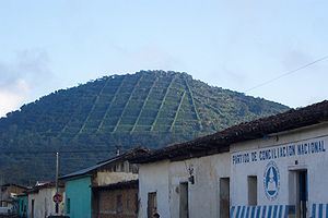
190.120.7.26 - IP Lookup: Free IP Address Lookup, Postal Code Lookup, IP Location Lookup, IP ASN, Public IP
Country:
Region:
City:
Location:
Time Zone:
Postal Code:
IP information under different IP Channel
ip-api
Country
Region
City
ASN
Time Zone
ISP
Blacklist
Proxy
Latitude
Longitude
Postal
Route
Luminati
Country
Region
sa
City
santaelena
ASN
Time Zone
America/El_Salvador
ISP
Navega.com S.A.
Latitude
Longitude
Postal
IPinfo
Country
Region
City
ASN
Time Zone
ISP
Blacklist
Proxy
Latitude
Longitude
Postal
Route
IP2Location
190.120.7.26Country
Region
ahuachapan
City
ahuachapan
Time Zone
America/El_Salvador
ISP
Language
User-Agent
Latitude
Longitude
Postal
db-ip
Country
Region
City
ASN
Time Zone
ISP
Blacklist
Proxy
Latitude
Longitude
Postal
Route
ipdata
Country
Region
City
ASN
Time Zone
ISP
Blacklist
Proxy
Latitude
Longitude
Postal
Route
Popular places and events near this IP address
Ahuachapán Department
Department of El Salvador
Distance: Approx. 7904 meters
Latitude and longitude: 13.867,-89.892
Ahuachapán (Spanish pronunciation: [awatʃaˈpan]) is a department of El Salvador in the west of the country. The capital is Ahuachapán. In the South it has the Apaneca-Ilamatepec Range and the Cerro Grande de Apaneca (Apaneca Grand Hill).
Ahuachapán
District in Ahuachapán Department, El Salvador
Distance: Approx. 755 meters
Latitude and longitude: 13.91666667,-89.85
Ahuachapán (Spanish pronunciation: [awatʃaˈpan]) is a city, district, and the capital of the Ahuachapán Department in western El Salvador. The district, including the city, covers an area of 244.84 km2 and as of 2007 has a population of 110,511 people. Situated near the Guatemalan border, it is the westernmost city in the country and is the center of an agricultural region producing primarily coffee.

Turín
District in Ahuachapán Department, El Salvador
Distance: Approx. 5896 meters
Latitude and longitude: 13.96666667,-89.81666667
Turín is a district in the Ahuachapán department of El Salvador.
Apaneca
District in Ahuachapán Department, El Salvador
Distance: Approx. 9318 meters
Latitude and longitude: 13.85,-89.8
Apaneca is a district in the Ahuachapán department of El Salvador. It has an area of 45.13 square kilometers. Its population is of 8,597 inhabitants (Estimated 2006).

Concepción de Ataco
District in Ahuachapán Department, El Salvador
Distance: Approx. 6117 meters
Latitude and longitude: 13.86666667,-89.85
Concepción de Ataco is a district and city within the Ahuachapán Department, El Salvador. It has an area of 61.03 km ² and a population of 18,101 inhabitants (est. 2006).
Tacuba
District in Ahuachapán Department, El Salvador
Distance: Approx. 9838 meters
Latitude and longitude: 13.9,-89.93333333
Tacuba is a district in the Ahuachapán department of El Salvador.
Estadio Simeón Magaña
Distance: Approx. 765 meters
Latitude and longitude: 13.9270357,-89.8490534
Estadio Simeón Magaña is a multi-use stadium in Ahuachapán Department, El Salvador. It is currently used mostly for football matches and is the home stadium of Once Deportivo. Once Municipal hierarchy decided to try to secure their own field so they turned to Arturo Simeón Magaña who owned the land around cancha El Zapotón where Once Municipal played.

Los Ausoles
Group of Hot Springs in El Salvador
Distance: Approx. 3088 meters
Latitude and longitude: 13.9154,-89.8171
Los Ausoles are a group of hot springs located 20 km (12 mi) north of Ahuachapán in El Salvador. The area has been described as "the capital of Central American geothermal." Many of the springs in the area produce heavy steam, and as of 1850, were described as "semi-fluid mass of mud and water in a state of ebullition, continually throwing large heavy bubbles to the surfaces; this heated mass is in some black, in others red, or of the ochry colour." There are many hot springs in the area, however, there are five main springs: El Zapote is a crater approximately 20 m (66 ft) in diameter Valdivieso is approximately 20 m (66 ft) in diameter and comprises 4 different openings. It is known for its blue colored sulfur.
Quezalapa
City in Ahuachapán Department, El Salvador
Distance: Approx. 8761 meters
Latitude and longitude: 13.84861111,-89.81416944
Quezalapa is a town in Ahuachapán, El Salvador. Quezalapa is the Nahuat word for the Quetzal bird. It is located 43 mi (or 70 km) West of San Salvador, the country's capital.
Weather in this IP's area
few clouds
27 Celsius
27 Celsius
27 Celsius
27 Celsius
1013 hPa
44 %
1013 hPa
941 hPa
10000 meters
0.38 m/s
1.48 m/s
261 degree
13 %

