190.113.114.94 - IP Lookup: Free IP Address Lookup, Postal Code Lookup, IP Location Lookup, IP ASN, Public IP
Country:
Region:
City:
Location:
Time Zone:
Postal Code:
ISP:
ASN:
language:
User-Agent:
Proxy IP:
Blacklist:
IP information under different IP Channel
ip-api
Country
Region
City
ASN
Time Zone
ISP
Blacklist
Proxy
Latitude
Longitude
Postal
Route
db-ip
Country
Region
City
ASN
Time Zone
ISP
Blacklist
Proxy
Latitude
Longitude
Postal
Route
IPinfo
Country
Region
City
ASN
Time Zone
ISP
Blacklist
Proxy
Latitude
Longitude
Postal
Route
IP2Location
190.113.114.94Country
Region
heredia
City
colon
Time Zone
America/Costa_Rica
ISP
Language
User-Agent
Latitude
Longitude
Postal
ipdata
Country
Region
City
ASN
Time Zone
ISP
Blacklist
Proxy
Latitude
Longitude
Postal
Route
Popular places and events near this IP address

University for Peace
University and international organization
Distance: Approx. 3445 meters
Latitude and longitude: 9.91944444,-84.27277778
The University for Peace (UPEACE) is an international university and intergovernmental organization established as a treaty organisation by the United Nations General Assembly in 1980. The university offers postgraduate, doctoral, and executive programmes related to the study of peace and conflict, environment and development, and international law. The headquarters of the University for Peace are located in a natural area near Ciudad Colón, Costa Rica.

Colón, Costa Rica
District in Mora canton, San José province, Costa Rica
Distance: Approx. 2307 meters
Latitude and longitude: 9.9096293,-84.2620424
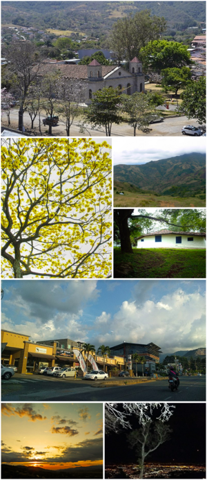
Colón, more commonly referred to as Ciudad Colón is a district and the head city of the Mora canton, in the San José province of Costa Rica. It is famous for its warm climate, proximity to nature and its surrounding mountains, folkloric traditions, horse riding, and multiculturalism.

Santa Ana (canton)
Canton in San José province, Costa Rica
Distance: Approx. 5054 meters
Latitude and longitude: 9.9184253,-84.1957531
Santa Ana (Spanish: Cantón de Santa Ana) is the ninth canton in the San José province of Costa Rica. It is located in the Central Valley. It borders with the Alajuela canton to the north, the Mora canton to the south and west, the Escazú canton to the east, as well as the Belén canton to the north east.
Parque Valle del Sol
Distance: Approx. 5726 meters
Latitude and longitude: 9.95256,-84.20613
Parque Valle del Sol is a residential and golf community located in Santa Ana, Costa Rica.
Uruca District, Santa Ana
District in Santa Ana canton, San José province, Costa Rica
Distance: Approx. 4838 meters
Latitude and longitude: 9.920405,-84.1979343
Uruca is a district of the Santa Ana canton, in the San José province of Costa Rica. It is popularly called "Río de Oro".
Piedades
District in Santa Ana canton, San José province, Costa Rica
Distance: Approx. 3631 meters
Latitude and longitude: 9.9160239,-84.2086038
Piedades is a district of the Santa Ana canton, in the San José province of Costa Rica.
Quitirrisí
District in Mora canton, San José province, Costa Rica
Distance: Approx. 3784 meters
Latitude and longitude: 9.8811276,-84.2377742
Quitirrisí is the seventh district of the Mora canton, in the San José province of Costa Rica. The district itself includes the Huetar indigenous territory of Quitirrisí. One of the touristic attractions of the district is the Rancho Biriteca, a cultural center to rescue and approach to the Huetar culture and handcrafting traditions.
Brasil District
District in Santa Ana canton, San José province, Costa Rica
Distance: Approx. 2846 meters
Latitude and longitude: 9.9380022,-84.2305868
Brasil is a district of the Santa Ana canton, in the San José province of Costa Rica.
Guácima
District in Alajuela canton, Alajuela province, Costa Rica
Distance: Approx. 5492 meters
Latitude and longitude: 9.9612881,-84.2587522
Guácima is a district of the Alajuela canton, in the Alajuela province of Costa Rica.
San Rafael District, Alajuela
District in Alajuela canton, Alajuela province, Costa Rica
Distance: Approx. 5407 meters
Latitude and longitude: 9.9594822,-84.2221335
San Rafael is a district of the Alajuela canton, in the Alajuela province of Costa Rica.
El Rodeo Protected Zone
Protected area in Costa Rica
Distance: Approx. 3384 meters
Latitude and longitude: 9.899,-84.268
El Rodeo Protected Zone (Spanish: Zona Protectora El Rodeo), is a protected area in Costa Rica, managed under the Central Conservation Area, it was created in 1976 by executive decree 6112-A.
Quitirrisí Protected Zone
Protected area in Costa Rica
Distance: Approx. 4235 meters
Latitude and longitude: 9.877,-84.245
Quitirrisí Protected Zone (Spanish: Zona Protectora Quitirrisí), is a protected area in Costa Rica, managed under the Central Conservation Area, it was created in 1982 by executive decree 13594-A.
Weather in this IP's area
few clouds
22 Celsius
22 Celsius
21 Celsius
22 Celsius
1013 hPa
77 %
1013 hPa
905 hPa
10000 meters
6.17 m/s
11.32 m/s
100 degree
20 %