Country:
 Colombia
Region:
City:
Latitude and Longitude:
Time Zone:
Postal Code:
IP information under different IP Channel
ip-api
Country
Region
City
ASN
Time Zone
ISP
Blacklist
Proxy
Latitude
Longitude
Postal
Route
IPinfo
Country
Region
City
ASN
Time Zone
ISP
Blacklist
Proxy
Latitude
Longitude
Postal
Route
MaxMind
Country
Region
City
ASN
Time Zone
ISP
Blacklist
Proxy
Latitude
Longitude
Postal
Route
Luminati
Country
CORegion
dc
City
bogota
ASN
Time Zone
America/Bogota
ISP
LIBERTY NETWORKS DE COLOMBIA S.A.S
Latitude
Longitude
Postal
db-ip
Country
Region
City
ASN
Time Zone
ISP
Blacklist
Proxy
Latitude
Longitude
Postal
Route
ipdata
Country
Region
City
ASN
Time Zone
ISP
Blacklist
Proxy
Latitude
Longitude
Postal
Route
Popular places and events near this IP address

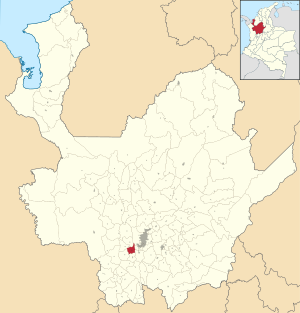
Amagá
Municipality and town in Antioquia Department, Colombia
Distance: Approx. 6836 meters
Latitude and longitude: 6.05,-75.7
Amagá (Spanish pronunciation: [amaˈɣa]) is a town and municipality in Antioquia Department, Colombia. It is part of the subregion of Southwestern Antioquia. The area was known for its coal and iron ore production and it hosted early iron works.
Angelópolis
Municipality and town in Antioquia Department, Colombia
Distance: Approx. 2715 meters
Latitude and longitude: 6.13333333,-75.7
Angelópolis (Spanish pronunciation: [aŋxeˈlopolis]) is a town and municipality in Antioquia Department, Colombia. It borders the municipalities of Armenia, Heliconia, and Medellín to the north; La Estrella and Caldas to the east; Amagá to the south; and Titiribí and Armenia to the west. Its municipal seat is 48 kilometers from the city of Medellín, the capital of the department of Antioquia.

Caldas, Antioquia
Municipality and town in Antioquia Department, Colombia
Distance: Approx. 8212 meters
Latitude and longitude: 6.09,-75.638
Caldas is a town and municipality in Antioquia Department, Colombia. Caldas is part of The Metropolitan Area of Medellín. It is the seat of the Roman Catholic Diocese of Caldas.

La Estrella, Antioquia
Municipality and town in Antioquia Department, Colombia
Distance: Approx. 7807 meters
Latitude and longitude: 6.16666667,-75.66666667
La Estrella is a town and municipality in Antioquia Department, Colombia. La Estrella is part of The Metropolitan Area of the Aburrá Valley. The population was estimated to be 75,517 in 2020.

Medellín River
River in Colombia
Distance: Approx. 8206 meters
Latitude and longitude: 6.09,-75.63805556
The Medellín River (Spanish: Río Medellín), called Porce River (Spanish: Río Porce) during most of its course, is a river that flows through the Colombian city of Medellín and its metropolitan area. For many years an organization called Mi Río (My River) was involved in river cleanup projects. For the river's first 60 kilometres (37 mi), it is referred to as the Medellín, and after that it is known as the Porce.

Roman Catholic Diocese of Caldas
Diocese of the Catholic Church in Colombia
Distance: Approx. 8340 meters
Latitude and longitude: 6.0918,-75.6363
The Diocese of Caldas (Latin: Caldensis) is a Latin Church ecclesiastical territory or diocese in Colombia. The episcopal see is the city of Caldas. The Diocese of Caldas is a suffragan diocese in the ecclesiastical province of the metropolitan Archdiocese of Medellín.
Weather in this IP's area
overcast clouds
16 Celsius
16 Celsius
15 Celsius
16 Celsius
1016 hPa
90 %
1016 hPa
812 hPa
10000 meters
0.48 m/s
0.64 m/s
200 degree
97 %
05:48:33
17:46:12