Country:
 Colombia
Region:
City:
Latitude and Longitude:
Time Zone:
Postal Code:
IP information under different IP Channel
ip-api
Country
Region
City
ASN
Time Zone
ISP
Blacklist
Proxy
Latitude
Longitude
Postal
Route
IPinfo
Country
Region
City
ASN
Time Zone
ISP
Blacklist
Proxy
Latitude
Longitude
Postal
Route
MaxMind
Country
Region
City
ASN
Time Zone
ISP
Blacklist
Proxy
Latitude
Longitude
Postal
Route
Luminati
Country
CORegion
dc
City
bogota
ASN
Time Zone
America/Bogota
ISP
LIBERTY NETWORKS DE COLOMBIA S.A.S
Latitude
Longitude
Postal
db-ip
Country
Region
City
ASN
Time Zone
ISP
Blacklist
Proxy
Latitude
Longitude
Postal
Route
ipdata
Country
Region
City
ASN
Time Zone
ISP
Blacklist
Proxy
Latitude
Longitude
Postal
Route
Popular places and events near this IP address

Cúcuta
Municipality of Colombia in North Santander
Distance: Approx. 235 meters
Latitude and longitude: 7.89416667,-72.50388889
Cúcuta (Spanish: [ˈkukuta] ), officially San José de Cúcuta, is a Colombian municipality, capital of the department of Norte de Santander and nucleus of the Metropolitan Area of Cúcuta. The city is located in the homonymous valley, at the foot of the Eastern Ranges of the Colombian Andes, on the border with Venezuela. It comprises an area of approximately 1119 km2, with an urban area of 64 km2 (divided into 10 communes) and a rural area of 1055 km2 (divided into 10 townships).

Estadio General Santander
Distance: Approx. 16 meters
Latitude and longitude: 7.894478,-72.501717
General Santander Stadium (Estadio General Santander) is a multi-purpose stadium in Cúcuta, Colombia. It is currently used mostly for football matches. The stadium has a capacity of 32,163 people.

Santander Park
Park in Cúcuta, Colombia
Distance: Approx. 988 meters
Latitude and longitude: 7.886,-72.504
Santander Park (Spanish: Parque Santander) is located in Cúcuta, Colombia. The park is bordered by 5th and 6th Avenue and 10th and 11th Street and was previously the location of the Grand Square of San José de Guasimales, a site hosting principal events and public spectacles in Cúcuta. In the center of the park is a bronze statue of the Cúcuta-born Francisco de Paula Santander, created by the German sculptor Carl Bornr and unveiled on August 5, 1890.

1875 Cúcuta earthquake
Earthquake in Colombia and Venezuela
Distance: Approx. 633 meters
Latitude and longitude: 7.9,-72.5
The 1875 Cúcuta earthquake (also known as earthquake of the Andes) occurred on 18 May at 11:15 AM. It completely demolished Cúcuta, Villa del Rosario (Colombia), San Antonio del Tachira and Capacho (Venezuela). The earthquake killed many Venezuelans in San Cristóbal, La Mulata, Rubio, Michelena, La Grita, Colón, amongst others, and was felt in both Bogotá and Caracas. That day, the city of Cúcuta and the town of Villa del Rosario, in the Norte de Santander department (Colombia) and the municipalities of San Antonio del Táchira and Capacho, Táchira State (Venezuela) were destroyed totally by this catastrophic earthquake.

Norte de Santander Department
Department of Colombia
Distance: Approx. 633 meters
Latitude and longitude: 7.9,-72.5
North Santander (Spanish: Norte de Santander) (Spanish pronunciation: [ˈnoɾte ðe santanˈdeɾ]) is a department of Northeastern Colombia. It is in the north of the country, bordering Venezuela. Its capital is Cúcuta, one of the country's major cities.
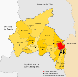
Roman Catholic Diocese of Cúcuta
Diocese of the Catholic Church in Colombia
Distance: Approx. 947 meters
Latitude and longitude: 7.8863,-72.5037
The Roman Catholic Diocese of Cúcuta (Latin: Cucutensis) is a diocese located in the city of Cúcuta in the ecclesiastical province of Nueva Pamplona in Colombia.

Cathedral of Cúcuta
Church in Cucuta, Colombia
Distance: Approx. 932 meters
Latitude and longitude: 7.8864,-72.5035
The Cathedral of San José de Cúcuta is a Catholic cathedral in the city of Cúcuta (Colombia). It lies in the center of the town, in front of Santander Park and close to the city hall. It is considered to be the historic and cultural heart of the city.

Tienditas Bridge
Road bridge between Columbia and Venezuela
Distance: Approx. 5785 meters
Latitude and longitude: 7.876726,-72.452541
Tienditas International Bridge (Spanish: Puente Internacional Tienditas) is a vehicular and pedestrian bridge connecting Táchira, Venezuela with Norte de Santander, Colombia.
Venezuela Aid Live
Distance: Approx. 5636 meters
Latitude and longitude: 7.875924,-72.454295
Venezuela Aid Live was a concert to benefit Venezuela in Cúcuta, Colombia, a city near the Venezuelan border, on 22 February 2019. The all-day concert, called Música por Venezuela: Ayuda y Libertad (transl. Music for Venezuela: Aid and Freedom), was organized by Richard Branson and Bruno Ocampo, and featured over thirty of the best known Latin American artists from nine countries. The concert's slogan was, "Let the stars shine for all".

Francisco de Paula Santander International Bridge
Bridge
Distance: Approx. 4932 meters
Latitude and longitude: 7.9163,-72.4628
The Francisco de Paula Santander International Bridge (Spanish: Puente internacional Francisco de Paula Santander) is a road bridge connecting Colombia with Venezuela across the Táchira River. One of five bridges across the border between the two countries, it is about 210 meters long, with two lanes of traffic and a width of 7.3 meters. It connects Cúcuta in North Santander, Colombia and Ureña in Táchira, Venezuela.

Fundación de Estudios Superiores Comfanorte
Private university of Cúcuta, Colombia
Distance: Approx. 1471 meters
Latitude and longitude: 7.88138889,-72.50222222
FESC University (officially in Spanish: Fundación de Estudios Superiores Comfanorte, «Comfanorte Higher Studies Foundation»), commonly known as FESC, is a private Colombian university structured as a foundation. It serves the educational needs of the people of Norte de Santander and Colombia and operates under the regulations of Law 1740 of 2014 and Law 30 of 1992 of the Ministry of Education of Colombia. The main campus is located in Cúcuta, Norte de Santander, with an additional campus in the municipality of Ocaña.
Norte de Santander and City of Cucutá Museum
Art museum in Cucutá, Colombia
Distance: Approx. 1269 meters
Latitude and longitude: 7.883444,-72.499447
The Norte de Santander and City of Cucutá Museum (Spanish: Museo Norte de Santander y Ciudad de Cucutá) is a museum located in northeastern Colombia. The museum is in charge of exhibiting art and photographs of the department of Norte de Santander. The museum is dedicated to preserving the regional heritage.
Weather in this IP's area
scattered clouds
26 Celsius
26 Celsius
24 Celsius
26 Celsius
1012 hPa
89 %
1012 hPa
978 hPa
10000 meters
3.09 m/s
160 degree
40 %
05:37:04
17:32:02