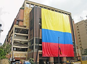
Country:
 Colombia
Region:
City:
Latitude and Longitude:
Time Zone:
Postal Code:
IP information under different IP Channel
ip-api
Country
Region
City
ASN
Time Zone
ISP
Blacklist
Proxy
Latitude
Longitude
Postal
Route
IPinfo
Country
Region
City
ASN
Time Zone
ISP
Blacklist
Proxy
Latitude
Longitude
Postal
Route
MaxMind
Country
Region
City
ASN
Time Zone
ISP
Blacklist
Proxy
Latitude
Longitude
Postal
Route
Luminati
Country
CORegion
dc
City
bogota
ASN
Time Zone
America/Bogota
ISP
LIBERTY NETWORKS DE COLOMBIA S.A.S
Latitude
Longitude
Postal
db-ip
Country
Region
City
ASN
Time Zone
ISP
Blacklist
Proxy
Latitude
Longitude
Postal
Route
ipdata
Country
Region
City
ASN
Time Zone
ISP
Blacklist
Proxy
Latitude
Longitude
Postal
Route
Popular places and events near this IP address

Gimnasio Moderno
School in Bogotá, Colombia
Distance: Approx. 1669 meters
Latitude and longitude: 4.65944444,-74.05583333
The Gimnasio Moderno is a private mixed gender elite-traditional and liberal, primary and secondary school located in Bogotá, Colombia. It was founded in 1914 by Colombians following the leading initiative of Agustín Nieto Caballero.

United States of Colombia
1863–1886 state in South America
Distance: Approx. 1767 meters
Latitude and longitude: 4.65,-74.05
United States of Colombia (Spanish: Estados Unidos de Colombia) was the name adopted in 1863 by the Constitución de Rionegro for the Granadine Confederation, after years of civil war. Colombia became a federal state itself composed of nine "sovereign states.” It comprised the present-day nations of Colombia and Panama and parts of northwestern Brazil. After several more years of intermittent civil wars, it was replaced by the more centralist Republic of Colombia in 1886, predecessor to modern Colombia.

Rosales, Bogotá
Barrio in Distrito Capital, Colombia
Distance: Approx. 859 meters
Latitude and longitude: 4.66013889,-74.04836111
Rosales is a barrio in the Chapinero locality of Bogotá.
2003 El Nogal Club bombing
Terrorist attack in Colombia in 2003
Distance: Approx. 1105 meters
Latitude and longitude: 4.66015,-74.05074
The 2003 El Nogal Club bombing was a terrorist attack that occurred in Bogotá, Colombia. On 7 February 2003, a car containing 200 kg of explosives that was parked in a garage on the third floor of the multi-story El Nogal club, an elite, high-class social and business club, exploded, killing 36 people and wounding more than 200. There were approximately 600 people in the building at the time of the explosion.

Granadine Confederation
1858–1863 federal state in Central and South America
Distance: Approx. 1767 meters
Latitude and longitude: 4.65,-74.05
The Granadine Confederation (Spanish: Confederación Granadina) was a short-lived federal republic established in 1858 as a result of a constitutional change replacing the Republic of New Granada. It consisted of the present-day nations of Colombia and Panama and parts of northwestern Brazil. In turn, the Granadine Confederation was replaced by the United States of Colombia after another constitutional change in 1863.

Gran Colombia
Republic in South and Central America from 1819 to 1831
Distance: Approx. 1767 meters
Latitude and longitude: 4.65,-74.05
Gran Colombia (Spanish pronunciation: [ˈɡɾaŋ koˈlombja] , "Great Colombia"), or Greater Colombia, officially the Republic of Colombia (Spanish: República de Colombia), was a state that encompassed much of northern South America and part of southern North America (aka southern Central America) from 1819 to 1831. It included present-day Colombia, mainland Ecuador (i.e. excluding the Galápagos Islands), Panama, and Venezuela, along with parts of northern Peru, northwestern Brazil, and claimed the Essequibo region.

93 Park
Park in Bogotá, Colombia
Distance: Approx. 1722 meters
Latitude and longitude: 4.67694444,-74.04861111
93 Park or 93rd Street Park (Parque de la calle 93, commonly known as Parque de la 93) is a commercial and recreational park located at the 93rd Street (calle 93) in El Chicó, in the north of Bogota, Colombia. It is an upmarket area popular for shopping, nightlife and restaurants.
HJCK
Radio station
Distance: Approx. 1613 meters
Latitude and longitude: 4.67055556,-74.05388889
HJCK El Mundo en Bogotá is a Colombian cultural radio station, founded 15 September 1950 and based in Bogotá. HJCK became an online-only station in 2005. HJCK was founded by intellectuals Eduardo Caballero Calderón, Hernando and Alfonso Martínez Rueda, Alfonso Peñaranda, Gonzalo Rueda Caro, Álvaro Castaño Castillo and his wife, Gloria Valencia de Castaño, as the first privately owned cultural radio station in Colombia.

Centro Andino
Shopping mall in Bogotá, Colombia
Distance: Approx. 1366 meters
Latitude and longitude: 4.6668,-74.0531
The Centro Andino is a shopping mall located in the El Retiro neighborhood of Bogotá, Colombia. It is one of the largest shopping malls in Bogotá and Southern America. Centro Andino consists of both a business center and a shopping mall with a size of 19,486 m2 (209,750 sq ft) and 17,316 m2 (186,390 sq ft) respectively.
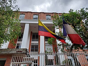
Lycée français Louis Pasteur (Colombia)
French international school in Bogota, Colombia
Distance: Approx. 782 meters
Latitude and longitude: 4.6677,-74.0468
The Lycée français Louis Pasteur (Spanish: Liceo Francés Louis Pasteur) is a French international school in Bogotá, Colombia. It serves the levels maternelle until lycée (senior high school).
Taipei Commercial Office in Bogotá, Colombia
Distance: Approx. 1487 meters
Latitude and longitude: 4.6750761,-74.0476239
The Taipei Commercial Office in Bogotá, Colombia (Chinese: 駐哥倫比亞代表處; pinyin: Zhù Gēlúnbǐyǎ Dàibiǎo Chù) (Spanish: Oficina Comercial de Taipéi en Bogotá, Colombia) represents the interests of Taiwan in Colombia in the absence of formal diplomatic relations, functioning as a de facto embassy. Until 1980, Colombia recognised Taiwan as the Republic of China, which, in addition to its embassy in Bogotá, had a consulate general in Barranquilla. In that year, it established diplomatic relations with the People's Republic of China.

Embassy of the Philippines, Bogotá
Diplomatic mission of the Philippines in Colombia
Distance: Approx. 1301 meters
Latitude and longitude: 4.67188889,-74.04925
The Embassy of the Philippines in Bogotá is the diplomatic mission of the Republic of the Philippines to the Republic of Colombia. Opened in 2024, it is currently located in the barrio (neighborhood) of El Chicó, part of the locality of Chapinero in northern Bogotá.
Weather in this IP's area
few clouds
12 Celsius
12 Celsius
12 Celsius
12 Celsius
1017 hPa
100 %
1017 hPa
730 hPa
9000 meters
20 %
05:40:48
17:40:36