Country:
 Brazil
Region:
City:
Latitude and Longitude:
Time Zone:
Postal Code:
IP information under different IP Channel
ip-api
Country
Region
City
ASN
Time Zone
ISP
Blacklist
Proxy
Latitude
Longitude
Postal
Route
IPinfo
Country
Region
City
ASN
Time Zone
ISP
Blacklist
Proxy
Latitude
Longitude
Postal
Route
MaxMind
Country
Region
City
ASN
Time Zone
ISP
Blacklist
Proxy
Latitude
Longitude
Postal
Route
Luminati
Country
BRASN
Time Zone
America/Sao_Paulo
ISP
Desktop Sigmanet Comunicacao Multimidia SA
Latitude
Longitude
Postal
db-ip
Country
Region
City
ASN
Time Zone
ISP
Blacklist
Proxy
Latitude
Longitude
Postal
Route
ipdata
Country
Region
City
ASN
Time Zone
ISP
Blacklist
Proxy
Latitude
Longitude
Postal
Route
Popular places and events near this IP address

São Paulo (state)
State of Brazil
Distance: Approx. 9693 meters
Latitude and longitude: -22.07,-48.43361111
São Paulo (, Brazilian Portuguese: [sɐ̃w ˈpawlu] ) is one of the 26 states of the Federative Republic of Brazil and is named after Saint Paul of Tarsus. It is located in the Southeast Region and is bordered by the states of Minas Gerais to the north and northeast, Paraná to the south, Rio de Janeiro to the east and Mato Grosso do Sul to the west, in addition to the Atlantic Ocean to the southeast. It is divided into 645 municipalities, and its.

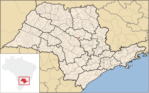
Boa Esperança do Sul
Place in São Paulo, Brazil
Distance: Approx. 3 meters
Latitude and longitude: -21.9925,-48.39083333
Boa Esperança do Sul is a municipality in the Brazilian state of São Paulo. The population in 2020 was 15,018 and the area is 691.017 square kilometres (266.803 sq mi). The elevation is 490 metres (1,610 ft).
Trabiju
Municipality in Southeast, Brazil
Distance: Approx. 7903 meters
Latitude and longitude: -22.04166667,-48.33555556
Trabiju is a municipality in the state of São Paulo in Brazil. The population is 1,738 (2020 est.) in an area of 63.4 km². The elevation is 548 m.
Weather in this IP's area
clear sky
37 Celsius
37 Celsius
37 Celsius
37 Celsius
1010 hPa
26 %
1010 hPa
959 hPa
10000 meters
4.25 m/s
4.23 m/s
172 degree
6 %
05:51:59
18:12:42