189.84.220.77 - IP Lookup: Free IP Address Lookup, Postal Code Lookup, IP Location Lookup, IP ASN, Public IP
Country:
Region:
City:
Location:
Time Zone:
Postal Code:
ISP:
ASN:
language:
User-Agent:
Proxy IP:
Blacklist:
IP information under different IP Channel
ip-api
Country
Region
City
ASN
Time Zone
ISP
Blacklist
Proxy
Latitude
Longitude
Postal
Route
db-ip
Country
Region
City
ASN
Time Zone
ISP
Blacklist
Proxy
Latitude
Longitude
Postal
Route
IPinfo
Country
Region
City
ASN
Time Zone
ISP
Blacklist
Proxy
Latitude
Longitude
Postal
Route
IP2Location
189.84.220.77Country
Region
espirito santo
City
linhares
Time Zone
America/Sao_Paulo
ISP
Language
User-Agent
Latitude
Longitude
Postal
ipdata
Country
Region
City
ASN
Time Zone
ISP
Blacklist
Proxy
Latitude
Longitude
Postal
Route
Popular places and events near this IP address

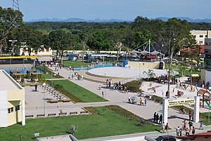
Linhares
Municipality in Southeast, Brazil
Distance: Approx. 488 meters
Latitude and longitude: -19.38944444,-40.06777778
Linhares is a municipality in the state of Espírito Santo, Brazil, 135 kilometres (84 mi) north of the state capital, Vitória. It is the largest municipality by area in the state, at 9,501.6 km2, and has a population of 176,688 people as of 2020. The municipality is named in honor of Rodrigo de Souza Coutinho, Count of Linhares, who was a minister in the Brazilian government in the first two decades of the 19th century.
Estádio Joaquim Calmon
Distance: Approx. 989 meters
Latitude and longitude: -19.395,-40.0639
Estádio Joaquim Calmon is a sports stadium in Linhares, Espírito Santo, Brazil. It is the home of Linhares Futebol Clube.
Goytacazes National Forest
National forest in Espírito Santo, Brazil
Distance: Approx. 6827 meters
Latitude and longitude: -19.451761,-40.079265
The Goytacazes National Forest (Portuguese: Floresta Nacional de Goytacazes) is a national forest in the state of Espírito Santo, Brazil.

Linhares Regional Airport
Airport
Distance: Approx. 3955 meters
Latitude and longitude: -19.35527778,-40.07138889
Antônio Edson de Azevedo Lima Regional Airport (IATA: LHN, ICAO: SNLN), is the airport serving Linhares, Brazil. It is managed by contract by Infraero.
Weather in this IP's area
few clouds
24 Celsius
25 Celsius
24 Celsius
24 Celsius
1015 hPa
90 %
1015 hPa
1011 hPa
10000 meters
2.08 m/s
4.53 m/s
72 degree
20 %