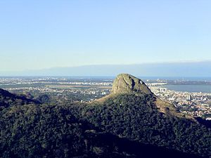
Country:
Region:
City:
Latitude and Longitude:
Time Zone:
Postal Code:
IP information under different IP Channel
ip-api
Country
Region
City
ASN
Time Zone
ISP
Blacklist
Proxy
Latitude
Longitude
Postal
Route
IPinfo
Country
Region
City
ASN
Time Zone
ISP
Blacklist
Proxy
Latitude
Longitude
Postal
Route
MaxMind
Country
Region
City
ASN
Time Zone
ISP
Blacklist
Proxy
Latitude
Longitude
Postal
Route
Luminati
Country
Region
es
City
cariacica
ASN
Time Zone
America/Sao_Paulo
ISP
Dinamica Telecomunicacoes Ltda
Latitude
Longitude
Postal
db-ip
Country
Region
City
ASN
Time Zone
ISP
Blacklist
Proxy
Latitude
Longitude
Postal
Route
ipdata
Country
Region
City
ASN
Time Zone
ISP
Blacklist
Proxy
Latitude
Longitude
Postal
Route
Popular places and events near this IP address

Cariacica
Municipality in Southeast, Brazil
Distance: Approx. 376 meters
Latitude and longitude: -20.26388889,-40.42
Cariacica is a municipality in the state of Espírito Santo, Brazil, part of the Greater Vitória metropolitan area.
Estádio Kléber Andrade
Distance: Approx. 8849 meters
Latitude and longitude: -20.33277778,-40.38527778
Estádio Estadual Kléber José de Andrade, also known as Estádio Kléber Andrade, is a football stadium located in Cariacica, Espírito Santo, Brazil. The stadium was built in 1983 and is able to hold 21,152 people. Estádio Kléber Andrade is owned by the Espírito Santo State Government.
São Miguel River (Espírito Santo)
River in Brazil
Distance: Approx. 7087 meters
Latitude and longitude: -20.2,-40.4
The São Miguel River is a river of Espírito Santo state in eastern Brazil.
Duas Bocas Biological Reserve
Protected area in Espírito Santo, Brazil
Distance: Approx. 9215 meters
Latitude and longitude: -20.274729,-40.507749
The Duas Bocas Biological Reserve (Portuguese: Reserva Biológica de Duas Bocas) is a biological reserve in the state of Espírito Santo, Brazil. It protects an area of Atlantic Forest, the source of a drinking water supply.

Fonte Grande State Park
Distance: Approx. 9715 meters
Latitude and longitude: -20.300668,-40.338149
The Fonte Grande State Park Portuguese: Parque Estadual da Fonte Grande is a state park in the state of Espírito Santo, Brazil.
TV Capixaba
Television station in Espírito Santo, Brazil
Distance: Approx. 9918 meters
Latitude and longitude: -20.30847222,-40.34069444
TV Capixaba is a Brazilian television station based in Vila Velha, but licensed in Vitória, respectively the city and capital of the state of Espírito Santo. It operates on channel 10 (digital UHF 16) and is affiliated with Rede Bandeirantes. Belonging to Rede Capixaba de Comunicação, the media arm of Grupo Sá Cavalcante, it generates its programming for around 80% of Espírito Santo.
Weather in this IP's area
clear sky
23 Celsius
23 Celsius
23 Celsius
24 Celsius
1012 hPa
81 %
1012 hPa
1006 hPa
10000 meters
5.14 m/s
350 degree
05:20:45
17:40:12
