Country:
 Brazil
Region:
City:
Latitude and Longitude:
Time Zone:
Postal Code:
IP information under different IP Channel
ip-api
Country
Region
City
ASN
Time Zone
ISP
Blacklist
Proxy
Latitude
Longitude
Postal
Route
IPinfo
Country
Region
City
ASN
Time Zone
ISP
Blacklist
Proxy
Latitude
Longitude
Postal
Route
MaxMind
Country
Region
City
ASN
Time Zone
ISP
Blacklist
Proxy
Latitude
Longitude
Postal
Route
Luminati
Country
BRASN
Time Zone
America/Sao_Paulo
ISP
SECURITYSERVICES
Latitude
Longitude
Postal
db-ip
Country
Region
City
ASN
Time Zone
ISP
Blacklist
Proxy
Latitude
Longitude
Postal
Route
ipdata
Country
Region
City
ASN
Time Zone
ISP
Blacklist
Proxy
Latitude
Longitude
Postal
Route
Popular places and events near this IP address

São Paulo Museum of Art
Art museum in São Paulo, Brazil
Distance: Approx. 525 meters
Latitude and longitude: -23.56111111,-46.65583306
The São Paulo Museum of Art (Portuguese: Museu de Arte de São Paulo, or MASP) is an art museum located on Paulista Avenue in the city of São Paulo, Brazil. It is well known for its headquarters, a 1968 concrete and glass structure designed by Lina Bo Bardi, whose main body is supported by two lateral beams over a 74 metres (243 ft) freestanding space. It is considered a landmark of the city and a main symbol of modern Brazilian architecture.

Paulista Avenue
Avenue in São Paulo
Distance: Approx. 506 meters
Latitude and longitude: -23.56138889,-46.65638889
Paulista Avenue (Avenida Paulista in Portuguese, Paulista being the demonym for those born in the state of São Paulo) is one of the most important avenues in São Paulo, Brazil. It stretches 2.8 kilometres (1.7 mi) and runs northwest to southeast. Its northwest point is Praça Marechal Cordeiro de Farias (pt) at its intersection with Rua da Consolação and its southeast point is Praça Oswaldo Cruz (pt) at its intersection with Treze de Maio, Bernardino de Campos, Desembargador Eliseu Guilherme, and Dr.
Congregação Israelita Paulista
Synagogue in São Paulo
Distance: Approx. 446 meters
Latitude and longitude: -23.554,-46.66
The Congregação Israelita Paulista (English: São Paulo Hebrew Congregation) in São Paulo, is the largest synagogue in Latin America, serving more than 2000 families. Established in 1936 by a group of refugees from Nazi Germany, it is a Reform synagogue, but also has ties with the Conservative movement. The rabbinate of the congregation that follows the liberal movements of Judaism (although not only affiliated to the Reform Movement, but also affiliated to the Conservative Movement), - is currently composed by rabbis Michel Schlesinger, Ruben Sternschein, Rogério Cukierman, and Tamara Schagas.
Edifício Grande Avenida
Building in São Paulo,Brasil
Distance: Approx. 361 meters
Latitude and longitude: -23.5602,-46.6571
Edifício Grande Avenida or Grande Avenida Building is a building located at 1754 Avenida Paulista in São Paulo, Brazil. The building was founded in 1964. Characterized by one of the remarkable architectural styles in town, the building sustained two fires during its history.
Escola de Economia de São Paulo
Distance: Approx. 677 meters
Latitude and longitude: -23.5599,-46.6534
The Escola de Economia de São Paulo (São Paulo School of Economics – EESP) is a Brazilian private economics higher education institution founded in April, 2003, in São Paulo by the Fundação Getúlio Vargas.

Consolação (São Paulo Metro)
São Paulo Metro station
Distance: Approx. 135 meters
Latitude and longitude: -23.557516,-46.66091
Consolação is a station on Line 2 (Green) of the São Paulo Metro. A moving walkway connects to Paulista station on Line 4 (Yellow).
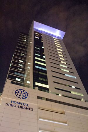
Hospital Sírio-Libanês
Hospital in SP, Brazil
Distance: Approx. 549 meters
Latitude and longitude: -23.55694444,-46.65444444
The Hospital Sírio-Libanês (Syrian-Lebanese Hospital) is a Brazilian private hospital, located in the Bela Vista neighborhood, in the central region of São Paulo. The hospital was founded by the large Syrian and Lebanese community of São Paulo in 1965. It is one of the most well-known health facilities in Brazil due to the high quality of care.

Torre da TV Bandeirantes
Monument in Rua Minas Gerais, 454, São Paulo, Brazil
Distance: Approx. 657 meters
Latitude and longitude: -23.55555556,-46.66555556
The Maria Helena Mendes de Barros Saad Tower, more commonly known as Torre da TV Bandeirantes, or Torre da Band, is a television and radio lattice tower located in the district of Consolação, near the Avenida Paulista in São Paulo, Brazil. Owned by the Brazilian media company Grupo Bandeirantes de Comunicação, the tower is 212 m (696 ft) high, making it the tallest tower in São Paulo and one of the tallest towers in Latin America. Its name is in honor of the wife of the founder of Rede Bandeirantes, João Saad.
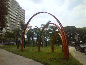
Marechal Cordeiro de Farias Square
Public square in São Paulo, Brazil
Distance: Approx. 563 meters
Latitude and longitude: -23.55480556,-46.66398333
Marechal Cordeiro de Farias Square (Portuguese: Praça Marechal Cordeiro de Farias) is a square located in the Higienópolis neighborhood of the district of Consolação, São Paulo, Brazil. It begins at the terminus of Paulista Avenue, and has corners on Minas Gerais, Itápolis avenues and Angelica street. The square is named after the Marshal Osvaldo Cordeiro de Farias (1901-1981), a Brazilian revolutionary, politician, and former governor of the State of Rio Grande do Sul.

Parque Trianon
Distance: Approx. 533 meters
Latitude and longitude: -23.5622,-46.6572
Parque Trianon (officially Parque Tenente Siqueira Campos) is a park located on Paulista Avenue in São Paulo, Brazil.
St. Louis College, Sao Paulo
Jesuit, catholic school in São Paulo, São Paulo, Brazil
Distance: Approx. 184 meters
Latitude and longitude: -23.556575,-46.66061389
St. Louis College (Portuguese: Colégio São Luís), is a Brazilian Catholic school located in the city of São Paulo. It was founded by the Jesuits in 1867.

Rua Augusta (São Paulo)
Distance: Approx. 139 meters
Latitude and longitude: -23.55694444,-46.65897222
Rua Augusta is a street in São Paulo, Brazil, connecting the neighborhood of Jardins to the city's downtown. The upper part of the street, near Jardins is known as an upscale shopping street; the stretch known as Baixo Augusta (Lower Augusta), between the Paulista Avenue and Praça Roosevelt, is known by its nightlife, with clubs, bars and live music venues.
Weather in this IP's area
clear sky
23 Celsius
23 Celsius
22 Celsius
23 Celsius
1017 hPa
74 %
1017 hPa
926 hPa
9000 meters
2.06 m/s
50 degree
1 %
05:58:55
18:01:45