Country:
Region:
City:
Latitude and Longitude:
Time Zone:
Postal Code:
IP information under different IP Channel
ip-api
Country
Region
City
ASN
Time Zone
ISP
Blacklist
Proxy
Latitude
Longitude
Postal
Route
IPinfo
Country
Region
City
ASN
Time Zone
ISP
Blacklist
Proxy
Latitude
Longitude
Postal
Route
MaxMind
Country
Region
City
ASN
Time Zone
ISP
Blacklist
Proxy
Latitude
Longitude
Postal
Route
Luminati
Country
ASN
Time Zone
America/Mexico_City
ISP
SERVICIO Y EQUIPO EN TELEFONIA INTERNET Y TV S.A. DE C.V.
Latitude
Longitude
Postal
db-ip
Country
Region
City
ASN
Time Zone
ISP
Blacklist
Proxy
Latitude
Longitude
Postal
Route
ipdata
Country
Region
City
ASN
Time Zone
ISP
Blacklist
Proxy
Latitude
Longitude
Postal
Route
Popular places and events near this IP address

La Paz, Baja California Sur
City in Mexico
Distance: Approx. 224 meters
Latitude and longitude: 24.14222222,-110.31083333
La Paz (pronounced [la ˈpas] , English: "peace") is the capital and largest city of the Mexican state of Baja California Sur, with a 2020 census population of 250,141 inhabitants, making it the most populous city in the state. La Paz City is located in La Paz Municipality—the fourth-largest municipality in Mexico, by area and populace (with a reported 292,241 inhabitants), covering an area of 20,275 km2 (7,828 sq mi). For air travelers, La Paz is served by Manuel Márquez de León International Airport, with connecting flights to some of Mexico's main cities (Guadalajara, Mexico City, Monterrey, Tijuana), as well as other destinations across the north-northwest of the country (including Chihuahua City, Ciudad Juárez, Ciudad Obregón, Culiacán, Hermosillo, Mazatlán and Querétaro, among others).

La Paz International Airport
International Airport in La Paz, Baja California, Mexico
Distance: Approx. 9269 meters
Latitude and longitude: 24.0725,-110.36222222
La Paz International Airport (Spanish: Aeropuerto Internacional de La Paz); officially Aeropuerto Internacional Manuel Márquez de León (Manuel Márquez de León International Airport) (IATA: LAP, ICAO: MMLP) is an international airport located in La Paz, Baja California Sur, Mexico, situated along the western shore of the Gulf of California. It serves as the primary air traffic gateway to the city of La Paz and is a focus city for the regional airline Calafia Airlines. The airport also accommodates military facilities for the Mexican Army and the Mexican Navy and supports various tourism, flight training, and general aviation activities.

Roman Catholic Diocese of La Paz en la Baja California Sur
Roman Catholic diocese in Mexico
Distance: Approx. 2126 meters
Latitude and longitude: 24.1617,-110.313
The Roman Catholic Diocese of La Paz en la Baja California Sur (Latin: Dioecesis Paciensis in California Inferiori Meridionali) (erected 21 March 1988) is a suffragan diocese of the Archdiocese of Tijuana. It was a suffragan of the Archdiocese of Hermosillo until 25 November 2006.
Autonomous University of Baja California Sur
Distance: Approx. 4650 meters
Latitude and longitude: 24.100874,-110.315121
The Autonomous University of Baja California Sur (in Spanish: Universidad Autónoma de Baja California Sur, UABCS) is a Mexican public university based in the state of Baja California Sur. Its library holds over 42,000 volumes. The university was created by Ángel César Mendoza Arámburo, the Governor of Baja California Sur, whose bill was published into law on 31 December 1975.

First federal electoral district of Baja California Sur
Federal electoral district of Mexico
Distance: Approx. 1676 meters
Latitude and longitude: 24.13333333,-110.3
The first federal electoral district of Baja California Sur (Distrito electoral federal 01 de Baja California Sur) is one of the 300 electoral districts into which Mexico is divided for elections to the federal Chamber of Deputies and one of two such districts in the state of Baja California Sur. It elects one deputy to the lower house of Congress for each three-year legislative session by means of the first-past-the-post system. Votes cast in the district also count towards the calculation of proportional representation ("plurinominal") deputies elected from the first region.

Battle of La Paz
Battle between the U.S. and Mexico as part of the Pacific Coast Camapaign
Distance: Approx. 1676 meters
Latitude and longitude: 24.13333333,-110.3
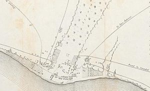
The Battle of La Paz was an engagement of the Pacific Coast Campaign during the Mexican–American War. The belligerents were United States Army troops against Mexican militia, commanded by Mexican Army officers. The battle occurred on November 16 and 17, 1847.

Siege of La Paz
Distance: Approx. 224 meters
Latitude and longitude: 24.14222222,-110.31083333
The siege of La Paz was a Mexican siege of their city of La Paz in Baja California Sur. Mexican militia forces attempted to destroy the United States Army garrison, occupying the peninsular town. The siege occurred over twelve days in November and December 1847, at the end of the Mexican–American War.

Cathedral of La Paz, Baja California Sur
Church in La Paz, Mexico
Distance: Approx. 2126 meters
Latitude and longitude: 24.1617,-110.3128
The Our Lady of Peace Cathedral (Spanish: Catedral de Nuestra Señora de la Paz) or La Paz Cathedral is a Catholic church in the center of the city of La Paz, Baja California Sur, western Mexico that is the seat of the Diocese of La Paz. It is located where the mission was founded by the Jesuits in the eighteenth century. The current church was built in the second half of the 19th century, under the orders of Bishop Francisco Francisco Escalante y Moreno.
Weather in this IP's area
clear sky
24 Celsius
24 Celsius
24 Celsius
24 Celsius
1014 hPa
57 %
1014 hPa
1010 hPa
10000 meters
3.6 m/s
3.9 m/s
195 degree
06:20:20
17:51:54