188.95.5.138 - IP Lookup: Free IP Address Lookup, Postal Code Lookup, IP Location Lookup, IP ASN, Public IP
Country:
Region:
City:
Location:
Time Zone:
Postal Code:
IP information under different IP Channel
ip-api
Country
Region
City
ASN
Time Zone
ISP
Blacklist
Proxy
Latitude
Longitude
Postal
Route
Luminati
Country
ASN
Time Zone
Europe/Berlin
ISP
Manage Now GmbH
Latitude
Longitude
Postal
IPinfo
Country
Region
City
ASN
Time Zone
ISP
Blacklist
Proxy
Latitude
Longitude
Postal
Route
IP2Location
188.95.5.138Country
Region
baden-wurttemberg
City
neckarsulm
Time Zone
Europe/Berlin
ISP
Language
User-Agent
Latitude
Longitude
Postal
db-ip
Country
Region
City
ASN
Time Zone
ISP
Blacklist
Proxy
Latitude
Longitude
Postal
Route
ipdata
Country
Region
City
ASN
Time Zone
ISP
Blacklist
Proxy
Latitude
Longitude
Postal
Route
Popular places and events near this IP address
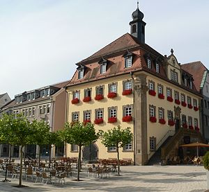
Neckarsulm
Town in Baden-Württemberg, Germany
Distance: Approx. 294 meters
Latitude and longitude: 49.19169444,9.22455556
Neckarsulm (German pronunciation: [nɛkaʁˈzʊlm]) is a city in northern Baden-Württemberg, Germany, near Heilbronn, and part of the district of Heilbronn. As of 2016, Neckarsulm had 26,800 inhabitants. The name Neckarsulm derives from the city's location where the Neckar and Sulm rivers meet.

Sulm (Germany)
River in Germany
Distance: Approx. 1366 meters
Latitude and longitude: 49.2,9.21666667
The Sulm is a river in the Heilbronn district of Baden-Württemberg, Germany. It is an unnavigable right tributary of the Neckar. It rises in the Löwenstein Mountains and after 26.3 kilometres (16.3 mi) distance and 315 metres (1,033 ft) elevation drop flows into the Neckar at Bad Friedrichshall, near Untereisesheim and Neckarsulm.

Neckarsulm TDS Office Tower
Distance: Approx. 1027 meters
Latitude and longitude: 49.18138889,9.23305556
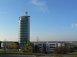
Neckarsulm TDS Office Tower is a high-rise office building in Neckarsulm, Germany. Built between 1997 and 1999, the tower stands at 70 metres (230 ft) tall with 20 floors. Neckarsulm TDS Office Tower houses the offices of TDS AG, dsb AG and the LIDL training center.
Obereisesheim transmitter
Radio transmission facility in Neckarsulm, Germany
Distance: Approx. 2084 meters
Latitude and longitude: 49.19105,9.19681
Obereisesheim transmitter was a facility of SWR used for mediumwave broadcasting on 711 kHz with a power of 5 kilowatts. It was located near Neckarsulm, Germany. Obereisesheim transmitter, which is situated at 49°11'28" N and 9°11'47" E, used as aerial a 74 metre tall ground-fed, insulated mast radiator, which was a lattice steel mast with triangular cross section and guyed in 3 levels.

Heilbronn Power Station
Coal-fired power Station in Hellbronn, Germany
Distance: Approx. 1908 meters
Latitude and longitude: 49.17722222,9.20638889
Heilbronn Power Station is a coal-fired power station in Heilbronn, Germany. It is operated by EnBW Kraftwerke AG, until 1997 by EVS, and has seven units. Specifically, Unit 7 is the largest coal-fired unit used by EnBW. The capacity of the three units is 950 MW, two units with a capacity of approx.
Untereisesheim
Municipality in Baden-Württemberg, Germany
Distance: Approx. 3578 meters
Latitude and longitude: 49.21666667,9.2
Untereisesheim is a municipality in the district of Heilbronn in Baden-Württemberg in Germany.

Deutsches Zweirad- und NSU-Museum
Museum in Germany
Distance: Approx. 346 meters
Latitude and longitude: 49.19156,9.2224
The Deutsches Zweirad- und NSU-Museum in Neckarsulm, Germany has a collection of historic motorcycles and bicycles in a five-story split-level building dating to 13th Century. Motorcycles representing 50 manufacturers are displayed, including a reproduction of the 1885 Daimler Einspur, the first gasoline, internal combustion motorcycle, and an 1894 Hildebrand & Wolfmüller, the first production motorcycle. There is also an exhibit of NSU Motorenwerke AG vehicles.

Scheuerberg
Distance: Approx. 2194 meters
Latitude and longitude: 49.19722222,9.25277778
Scheuerberg is a mountain of Baden-Württemberg, Germany.
Wartberg (Heilbronn)
Distance: Approx. 3346 meters
Latitude and longitude: 49.15972222,9.235
The Wartberg is a hill in Baden-Württemberg, Germany.
Lein (Neckar)
River in Germany
Distance: Approx. 2845 meters
Latitude and longitude: 49.1671,9.2054
Lein is a river of Baden-Württemberg, Germany. It is a left tributary of the Neckar near Heilbronn.
Neckarsulm station
Railway station in Neckarsulm, Germany
Distance: Approx. 388 meters
Latitude and longitude: 49.1887,9.22
Neckarsulm station is a railway station in the municipality of Neckarsulm, located in the Heilbronn district in Baden-Württemberg, Germany.
Neckarsulm Nord station
Railway station in Neckarsulm, Germany
Distance: Approx. 1446 meters
Latitude and longitude: 49.2019,9.2287
Neckarsulm Nord station (German: Haltepunkt Neckarsulm Nord) is a railway station in the municipality of Neckarsulm, located in the Heilbronn district in Baden-Württemberg, Germany. It is adjacent to the major Audi motor factory.
Weather in this IP's area
broken clouds
3 Celsius
-0 Celsius
3 Celsius
5 Celsius
1037 hPa
61 %
1037 hPa
1009 hPa
10000 meters
3.55 m/s
4.82 m/s
339 degree
78 %


