Country:
Region:
City:
Latitude and Longitude:
Time Zone:
Postal Code:
IP information under different IP Channel
ip-api
Country
Region
City
ASN
Time Zone
ISP
Blacklist
Proxy
Latitude
Longitude
Postal
Route
Luminati
Country
ASN
Time Zone
Europe/London
ISP
TNSI-AS-19305
Latitude
Longitude
Postal
IPinfo
Country
Region
City
ASN
Time Zone
ISP
Blacklist
Proxy
Latitude
Longitude
Postal
Route
db-ip
Country
Region
City
ASN
Time Zone
ISP
Blacklist
Proxy
Latitude
Longitude
Postal
Route
ipdata
Country
Region
City
ASN
Time Zone
ISP
Blacklist
Proxy
Latitude
Longitude
Postal
Route
Popular places and events near this IP address
Mount St Mary's Catholic High School, Leeds
Voluntary aided school in Leeds, West Yorkshire, England
Distance: Approx. 513 meters
Latitude and longitude: 53.79386,-1.52688
Mount Saint Mary's School is a Roman Catholic secondary school in Leeds, England.

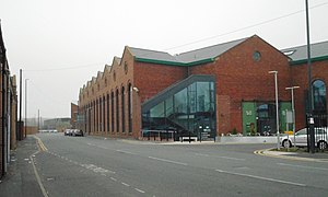
Royal Armouries Museum
Royal Armouries Museum in Leeds, West Yorkshire, England
Distance: Approx. 164 meters
Latitude and longitude: 53.791866,-1.532258
The Royal Armouries Museum in Leeds, West Yorkshire, England, is a national museum that holds the National Collection of Arms and Armour. It is part of the Royal Armouries family of museums, with other sites at the Royal Armouries' traditional home in the Tower of London, and the National Collection of Artillery at Fort Nelson, Hampshire. The Royal Armouries is a non-departmental public body sponsored by the Department for Culture, Media and Sport.

Leeds Dock
Distance: Approx. 183 meters
Latitude and longitude: 53.7918,-1.5335
Leeds Dock (formerly New Dock and previously Clarence Dock) is a mixed development with retail, office and leisure presence by the River Aire in central Leeds, West Yorkshire, England. It has a large residential population in waterside apartments.

The Calls
Street and area of Leeds, West Yorkshire, England
Distance: Approx. 561 meters
Latitude and longitude: 53.794,-1.538
The Calls is an area and street by the River Aire in Leeds city centre, West Yorkshire, England. This district falls within the City and Hunslet ward of the City of Leeds Council. Formerly an area of industry in Leeds, it has now been regenerated with a mixture of uses: primarily offices, residential and leisure.

Mount St Mary's Church, Leeds
Church in Leeds, West Yorkshire, England
Distance: Approx. 533 meters
Latitude and longitude: 53.794,-1.526707
Mount St Mary's Church or the Church of the Immaculate Virgin Mary is a Grade II* listed building and a redundant Roman Catholic church in Leeds, West Yorkshire, England. It was founded in 1851 and designed by Joseph Hansom, with extensions by Edward Pugin. It is next to Mount St Mary's Catholic High School, Leeds.

Alf Cooke printworks
Grade II listed building in Leeds, England
Distance: Approx. 346 meters
Latitude and longitude: 53.78875,-1.5365
The Alf Cooke printworks is a grade II listed former industrial building by Thomas Ambler, now the Printworks Campus of Leeds City College in Leeds, West Yorkshire, England. It was built in 1881 and rebuilt after a fire in 1894.

St Saviour Church, Richmond Hill
Church in Leeds, England
Distance: Approx. 427 meters
Latitude and longitude: 53.7918,-1.526
St Saviour Church in Richmond Hill, Leeds, West Yorkshire, England is an active Anglican parish church in the archdeaconry of Leeds and the Diocese of Leeds.

The Tetley
Distance: Approx. 541 meters
Latitude and longitude: 53.792093,-1.5397462
The Tetley was a contemporary art gallery in Leeds, England, located in the art deco headquarters of the former Tetley's Brewery. The gallery was opened on Friday 28 November 2013 and closed on 17 December 2023. The charity running it, named Project Space Leeds (from a project which ran from 2006 to 2012) has now rebranded as Yorkshire Contemporary.

University Technical College Leeds
University technical college in Leeds, West Yorkshire, England
Distance: Approx. 287 meters
Latitude and longitude: 53.7881,-1.534
University Technical College Leeds is a university technical college (UTC) in Hunslet, Leeds, England, which opened in September 2016. The UTC is sponsored by the University of Leeds and several local employers. The college forms part of an educational hub in the north of Hunslet, with Leeds City College's Printworks Campus using the former Alf Cooke printworks building, Leeds College of Building's Cudbear Street site, and the Ruth Gorse Academy all in close proximity to each other.

Armouries Square
Distance: Approx. 112 meters
Latitude and longitude: 53.7914,-1.5319
Armouries Square is a large public square in central Leeds, West Yorkshire, United Kingdom, adjacent to the Royal Armouries Museum, after which it is named. It was opened as part of a regeneration project which sought to update the area around Leeds Dock with the square being a hard-standing display area for displays by the Royal Armouries Museum.

Aire Park
Park in West Yorkshire, England
Distance: Approx. 537 meters
Latitude and longitude: 53.7919,-1.5398
Aire Park is a planned 24 acres (9.7 ha) mixed-use development in Hunslet, south of the city centre of Leeds, West Yorkshire, England. It is being developed by the international real estate organisation Vastint, and will mostly occupy the abandoned brownfield site of the former Tetley's Brewery. It is named after the River Aire, which flows nearby.
The Ruth Gorse Academy
Academy in Leeds, West Yorkshire, England
Distance: Approx. 218 meters
Latitude and longitude: 53.79083333,-1.53527778
The Ruth Gorse Academy is a mixed secondary school located in Leeds, West Yorkshire, England. The school forms part of the Gorse Academies Trust which also includes The Farnley Academy, The Morley Academy and Elliott Hudson College.
Weather in this IP's area
broken clouds
11 Celsius
10 Celsius
10 Celsius
12 Celsius
1021 hPa
89 %
1021 hPa
1018 hPa
8000 meters
1.54 m/s
210 degree
75 %
07:14:25
16:25:01
