188.93.204.34 - IP Lookup: Free IP Address Lookup, Postal Code Lookup, IP Location Lookup, IP ASN, Public IP
Country:
Region:
City:
Location:
Time Zone:
Postal Code:
ISP:
ASN:
language:
User-Agent:
Proxy IP:
Blacklist:
IP information under different IP Channel
ip-api
Country
Region
City
ASN
Time Zone
ISP
Blacklist
Proxy
Latitude
Longitude
Postal
Route
db-ip
Country
Region
City
ASN
Time Zone
ISP
Blacklist
Proxy
Latitude
Longitude
Postal
Route
IPinfo
Country
Region
City
ASN
Time Zone
ISP
Blacklist
Proxy
Latitude
Longitude
Postal
Route
IP2Location
188.93.204.34Country
Region
somogy
City
igal
Time Zone
Europe/Budapest
ISP
Language
User-Agent
Latitude
Longitude
Postal
ipdata
Country
Region
City
ASN
Time Zone
ISP
Blacklist
Proxy
Latitude
Longitude
Postal
Route
Popular places and events near this IP address

Bonnya
Village in Southern Transdanubia, Hungary
Distance: Approx. 7379 meters
Latitude and longitude: 46.59326,17.90248
Bonnya (German: Bonna / Punnia) is a village in Somogy county, Hungary.

Igal, Hungary
Place in Southern Transdanubia, Hungary
Distance: Approx. 792 meters
Latitude and longitude: 46.53886,17.93988
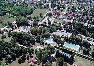
Igal is a town in Somogy county, Hungary. Igal is 43 km south of Zamárdi. Igal Spa has 12 pools with adventure elements.

Kazsok
Village in Southern Transdanubia, Hungary
Distance: Approx. 6151 meters
Latitude and longitude: 46.47964,17.96509
Kazsok is a village in Somogy county, Hungary.

Somogyacsa
Village in Southern Transdanubia, Hungary
Distance: Approx. 6689 meters
Latitude and longitude: 46.59081,17.9551
Somogyacsa is a village in Somogy county, Hungary. A population estimated to be about 160 people as of 2022.

Somogyszil
Village in Southern Transdanubia, Hungary
Distance: Approx. 5037 meters
Latitude and longitude: 46.51538,17.99988
Somogyszil (German: Sil) is a village in Somogy county, Hungary.

Magyaratád
Village in Southern Transdanubia, Hungary
Distance: Approx. 7628 meters
Latitude and longitude: 46.4679,17.90265
Magyaratád is a small village in Somogy county, Hungary.

Büssü
Village in Southern Transdanubia, Hungary
Distance: Approx. 8485 meters
Latitude and longitude: 46.45746,17.96307
Büssü (Hungarian pronunciation: [ˈbyʃːy]) is a village in Somogy county, Hungary.

Gadács
Village in Southern Transdanubia, Hungary
Distance: Approx. 5180 meters
Latitude and longitude: 46.5401,18.00516
Gadács (German: Gadatsch) is a village in Somogy county, Hungary.

Ráksi
Village in Southern Transdanubia, Hungary
Distance: Approx. 2223 meters
Latitude and longitude: 46.51701,17.9191
Ráksi is a village in Somogy county, Hungary.

Somogydöröcske
Village in Southern Transdanubia, Hungary
Distance: Approx. 8029 meters
Latitude and longitude: 46.58727,18.00565
Somogydöröcske is a village in Somogy county, Hungary.

Szentgáloskér
Village in Southern Transdanubia, Hungary
Distance: Approx. 5298 meters
Latitude and longitude: 46.5049,17.88154
Szentgáloskér is a village in Somogy county, Hungary.
Várong
Place in Southern Transdanubia, Hungary
Distance: Approx. 8287 meters
Latitude and longitude: 46.52527778,18.04638889
Várong is a village in Tolna county, Hungary. A few vikings from Russia were settled here.
Weather in this IP's area
broken clouds
-0 Celsius
-0 Celsius
-0 Celsius
-0 Celsius
1032 hPa
85 %
1032 hPa
1011 hPa
10000 meters
0.79 m/s
1.08 m/s
209 degree
82 %