Country:
 Great Britain
Region:
City:
Latitude and Longitude:
Time Zone:
Postal Code:
IP information under different IP Channel
ip-api
Country
Region
City
ASN
Time Zone
ISP
Blacklist
Proxy
Latitude
Longitude
Postal
Route
IPinfo
Country
Region
City
ASN
Time Zone
ISP
Blacklist
Proxy
Latitude
Longitude
Postal
Route
MaxMind
Country
Region
City
ASN
Time Zone
ISP
Blacklist
Proxy
Latitude
Longitude
Postal
Route
Luminati
Country
GBRegion
eng
City
southsea
ASN
Time Zone
Europe/London
ISP
AllPoints Fibre Networks Limited
Latitude
Longitude
Postal
db-ip
Country
Region
City
ASN
Time Zone
ISP
Blacklist
Proxy
Latitude
Longitude
Postal
Route
ipdata
Country
Region
City
ASN
Time Zone
ISP
Blacklist
Proxy
Latitude
Longitude
Postal
Route
Popular places and events near this IP address
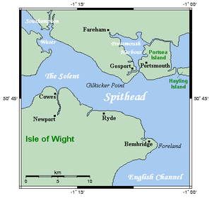
Portsea Island
Island off the southern coast of Hampshire, England
Distance: Approx. 1142 meters
Latitude and longitude: 50.81,-1.07
Portsea Island is a flat and low-lying natural island 24.5 square kilometres (9.5 sq mi; 6,100 acres) in area, just off the southern coast of Hampshire in England. Portsea Island contains the majority of the city of Portsmouth. Portsea Island has the third-largest population of all the islands in the British Isles after the mainlands of Great Britain and Ireland; it also has the highest population density of any British Isle, and Portsmouth has the highest population density of any city in the UK outside of London.

Portsmouth North (UK Parliament constituency)
Parliamentary constituency in the United Kingdom, 1974 onwards
Distance: Approx. 1142 meters
Latitude and longitude: 50.83,-1.07
Portsmouth North is a constituency represented in the House of Commons of the UK Parliament by Amanda Martin of the Labour Party since 2024.

Hilsea railway station
Railway station in Hampshire, England
Distance: Approx. 1055 meters
Latitude and longitude: 50.828174,-1.058818
Hilsea railway station is a railway station on Airport Service Road, Hilsea, Portsmouth, England serving the northern end of Portsea Island, including a large industrial estate nearby. The station was once the closest to Portsmouth Airport, which was closed in 1973. It is located on the Portsmouth Direct line which runs between London Waterloo and Portsmouth Harbour.

Stamshaw
Suburb of Portsmouth, Hampshire, England
Distance: Approx. 1017 meters
Latitude and longitude: 50.820847,-1.080793
Stamshaw is a residential district of Portsmouth, located on the north western corner of Portsea Island in southern England. Much of it consists of dense rows of "two up, two down" terraced housing built during the late 19th century and early 20th century for dockyard workers and their families. Due to the rising cost of houses in the south in recent years, it has become one of the key areas for first time buyers.

Mayfield School, Portsmouth
Community comprehensive school in Portsmouth, Hampshire, England
Distance: Approx. 285 meters
Latitude and longitude: 50.8204,-1.0704
Mayfield School is a mixed all-through school for pupils ages 4 to 16 located in North End, Portsmouth.
Moneyfields F.C.
Association football club in England
Distance: Approx. 729 meters
Latitude and longitude: 50.81451,-1.06074
Moneyfields Football Club is a football club based in Portsmouth, England. Affiliated to the Hampshire FA, they were founded in 1987 as Portsmouth Civil Service, before adopting their current name in 1994. The club are currently members of the Isthmian League South Central Division and play at the John Jenkins Stadium.

North End, Hampshire
Neighbourhood of Portsmouth, Hampshire, England
Distance: Approx. 989 meters
Latitude and longitude: 50.816921,-1.079586
North End is a district in the city of Portsmouth, located on Portsea Island in Hampshire. The area developed rapidly as a part of the city after a horse-drawn tram route was opened between Portsmouth and Cosham. The area is mainly residential, being composed of mainly late Victorian to early 20th-century buildings.

Copnor
Suburb of Portsmouth, Hampshire, England
Distance: Approx. 1049 meters
Latitude and longitude: 50.811,-1.062
Copnor is an area of Portsmouth, England, located on the eastern side of Portsea Island. The population of Copnor Ward at the 2011 Census was 13,608. As Copenore, it was one of the three villages listed as being on Portsea Island in the Domesday book.

Hilsea
Suburb of Portsmouth, Hampshire, England
Distance: Approx. 1142 meters
Latitude and longitude: 50.83,-1.07
Hilsea is a district of the city of Portsmouth in the English county of Hampshire. Hilsea is home to one of Portsmouth's main sports and leisure facilities – the Mountbatten centre. Trafalgar School (formerly the City of Portsmouth Boys' School) is also in Hilsea.
Admiral Lord Nelson School
Academy in Copnor, Portsmouth, Hampshire, England
Distance: Approx. 900 meters
Latitude and longitude: 50.818,-1.054
Admiral Lord Nelson School is a mixed co-educational secondary school in Portsmouth, Hampshire, England. The school, located on the eastern side of Portsmouth on Dundas Lane, opposite Ocean retail park and running parallel to the Eastern Road, is situated next to Langstone Harbour, and was constructed on a green field site. Named after Horatio Nelson, admiral and hero of the British Royal Navy, with which it has already built ties, it was established in 1995 and specialises in Business and Enterprise to provide education for 11- to 16-year-old students.

Alexandra Park, Portsmouth
Distance: Approx. 1194 meters
Latitude and longitude: 50.825762,-1.080726
Alexandra Park, Portsmouth, was opened in 1907 and was a place of recreation for the people of Portsea Island. It provided lawns, flowers beds, paths and seats; it was an area to escape the toils of inner city life in the early twentieth century. The park was named after Queen Alexandra.

Hilsea Barracks
Distance: Approx. 933 meters
Latitude and longitude: 50.82838,-1.06682
Hilsea Barracks was a military installation at Hilsea in Portsmouth.
Weather in this IP's area
light rain
14 Celsius
14 Celsius
13 Celsius
15 Celsius
1011 hPa
95 %
1011 hPa
1011 hPa
10000 meters
2.24 m/s
4.92 m/s
185 degree
100 %
07:32:33
18:05:50