Country:
Region:
City:
Latitude and Longitude:
Time Zone:
Postal Code:
IP information under different IP Channel
ip-api
Country
Region
City
ASN
Time Zone
ISP
Blacklist
Proxy
Latitude
Longitude
Postal
Route
IPinfo
Country
Region
City
ASN
Time Zone
ISP
Blacklist
Proxy
Latitude
Longitude
Postal
Route
MaxMind
Country
Region
City
ASN
Time Zone
ISP
Blacklist
Proxy
Latitude
Longitude
Postal
Route
Luminati
Country
Region
eng
City
portsmouth
ASN
Time Zone
Europe/London
ISP
AllPoints Fibre Networks Limited
Latitude
Longitude
Postal
db-ip
Country
Region
City
ASN
Time Zone
ISP
Blacklist
Proxy
Latitude
Longitude
Postal
Route
ipdata
Country
Region
City
ASN
Time Zone
ISP
Blacklist
Proxy
Latitude
Longitude
Postal
Route
Popular places and events near this IP address

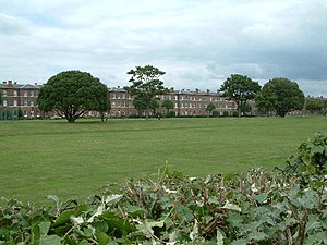
Fort Cumberland (England)
Palmerston fort in Southsea
Distance: Approx. 617 meters
Latitude and longitude: 50.78888889,-1.0325
Fort Cumberland is a pentagonal artillery fortification erected to guard the entrance to Langstone Harbour, east of the Dockyard of Portsmouth on the south coast of England. It was sited to protect the Royal Navy Dockyard, by preventing enemy forces from landing in Langstone Harbour and attacking from the landward side. Fort Cumberland is widely recognised as the finest example of a bastion trace fort in England.
Sinah, Hayling Island
Human settlement in England
Distance: Approx. 1729 meters
Latitude and longitude: 50.790117,-1.015652
Sinah is the area at the southwestern end of Hayling Island. It incorporates the Ferrypoint, Sinah Beach, The Kench, Sinah Warren, and Sinah Common. It is bounded to the east by West Town.
Eastney
Human settlement in England
Distance: Approx. 806 meters
Latitude and longitude: 50.783333,-1.05
Eastney is a district in the south-east corner of Portsmouth, England, on Portsea Island. Its electoral ward is called Eastney and Craneswater. At the 2011 Census the population of this ward was 13,591.
Milton, Portsmouth
Suburb in England
Distance: Approx. 1769 meters
Latitude and longitude: 50.79482,-1.05879
Milton is a residential area of the English city of Portsmouth, Hampshire, England, on the south eastern side of Portsea Island. Milton is bordered on the eastern coast of Portsea Island by Langstone Harbour, with Eastney to the south-east, Southsea to the south-west, Baffins to the north and Fratton to the north-west. The name 'Milton' has Saxon origins, originally Middletūn meaning "middle settlement", as it was located midway between the larger Saxon village of Froddington (now Fratton) and Eastney.
Royal Marines Museum
Distance: Approx. 1063 meters
Latitude and longitude: 50.785,-1.054
The Royal Marines Museum is a museum on the history of the Royal Marines from their beginnings in 1664 through to the present day. A registered charity, it is also a designated service museum under the terms of the National Heritage Act 1983 and receives Grant-in-Aid from the Ministry of Defence. During 2011 it formally became part of the National Museum of the Royal Navy, an executive non-departmental public body of the Ministry of Defence.
Mary Rose Academy
Special school in Portsmouth, Hampshire, England
Distance: Approx. 1424 meters
Latitude and longitude: 50.79296,-1.05487
Mary Rose Academy (formerly Mary Rose School) is a 2-19 special school with academy status, located in Portsmouth, Hampshire, England. It opened in February 2007 and educates 110 pupils. The opening of Mary Rose School, due for September 2006, was delayed by design and construction issues.

Eastney Beam Engine House
Distance: Approx. 639 meters
Latitude and longitude: 50.7889,-1.0457
Eastney Beam Engine House is a Grade II -listed Victorian engine house in Portsmouth, Hampshire, England. Dating from 1887, it contains two 150 hp James Watt & Co. beam engines.
Portsmouth Lifeboat Station
Lifeboat station on the South coast of England in the UK
Distance: Approx. 1293 meters
Latitude and longitude: 50.79519444,-1.02980556
Portsmouth Lifeboat Station is located on Eastney Point near Southsea, in the English county of Hampshire. The station is owned and operated by the RNLI and is an Inshore lifeboat station. The station is facing Langstone Harbour on one of the tributaries flowing into the Solent.

Eastney Barracks
Distance: Approx. 1113 meters
Latitude and longitude: 50.7855,-1.0547
Eastney Barracks was a military installation occupied by the Royal Marines and located at Eastney near Portsmouth.

St James' Hospital, Portsmouth
Hospital in Hampshire, England
Distance: Approx. 1487 meters
Latitude and longitude: 50.79644,-1.05006
St James' Hospital was a mental health facility at Milton, Portsmouth, Hampshire, England. It was managed by Solent NHS Trust. The main structure is a Grade II listed building.

The Kench, Hayling Island
Distance: Approx. 1714 meters
Latitude and longitude: 50.79361111,-1.01861111
The Kench, Hayling Island is a 6-hectare (15-acre) Local Nature Reserve on Hayling Island in Hampshire. It is owned by Hampshire County Council and managed by Hampshire Countryside Service. It is part of Chichester and Langstone Harbours Ramsar site and Special Protection Area, Solent Maritime Special Area of Conservation and Langstone Harbour Site of Special Scientific Interest.

Milton Locks
Distance: Approx. 906 meters
Latitude and longitude: 50.793,-1.042
Milton Locks is a 1-hectare (2.5-acre) nature reserve in Milton in Hampshire. It is managed by the Hampshire and Isle of Wight Wildlife Trust. This site on Portsea Island has grassland, a wood and a beach.
Weather in this IP's area
broken clouds
17 Celsius
17 Celsius
16 Celsius
18 Celsius
1004 hPa
78 %
1004 hPa
1004 hPa
10000 meters
3.58 m/s
7.15 m/s
202 degree
79 %
06:29:21
19:34:30

