188.66.62.195 - IP Lookup: Free IP Address Lookup, Postal Code Lookup, IP Location Lookup, IP ASN, Public IP
Country:
Region:
City:
Location:
Time Zone:
Postal Code:
ISP:
ASN:
language:
User-Agent:
Proxy IP:
Blacklist:
IP information under different IP Channel
ip-api
Country
Region
City
ASN
Time Zone
ISP
Blacklist
Proxy
Latitude
Longitude
Postal
Route
db-ip
Country
Region
City
ASN
Time Zone
ISP
Blacklist
Proxy
Latitude
Longitude
Postal
Route
IPinfo
Country
Region
City
ASN
Time Zone
ISP
Blacklist
Proxy
Latitude
Longitude
Postal
Route
IP2Location
188.66.62.195Country
Region
skane lan
City
staffanstorp
Time Zone
Europe/Stockholm
ISP
Language
User-Agent
Latitude
Longitude
Postal
ipdata
Country
Region
City
ASN
Time Zone
ISP
Blacklist
Proxy
Latitude
Longitude
Postal
Route
Popular places and events near this IP address

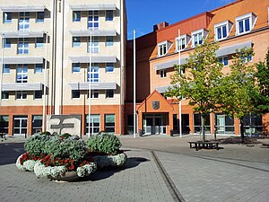
Staffanstorp Municipality
Municipality in Scania County, Sweden
Distance: Approx. 1128 meters
Latitude and longitude: 55.63333333,13.2
Staffanstorp Municipality (Swedish: Staffanstorps kommun) is a municipality in Scania County, southern Sweden. Its seat is located in the town Staffanstorp. The municipality was formed by the local government reform of 1952, when 12 original units, created out of parishes in 1863, were amalgamated.

Staffanstorp
Place in Skåne, Sweden
Distance: Approx. 1128 meters
Latitude and longitude: 55.63333333,13.2
Staffanstorp is a locality and the seat of Staffanstorp Municipality, Skåne County, Sweden with 14,808 inhabitants in 2010. Staffanstorp is the largest Scanian settlement that never acquired town privileges before their abolishment in Sweden in 1971.

Uppåkra
Distance: Approx. 3505 meters
Latitude and longitude: 55.66666667,13.17
Uppåkra is a village and parish in Staffanstorp Municipality, in Scania, southern Sweden, located five kilometres south of Lund. The village is known for its Iron Age archaeological site, which has been actively excavated since 1996.

Jakriborg
Housing estate in Hjärup, Sweden
Distance: Approx. 5754 meters
Latitude and longitude: 55.675,13.13472222
Jakriborg is a housing estate in Hjärup, Staffanstorp Municipality between Malmö and Lund in Scania, southern Sweden. The area was built in the late 1990s by the real estate firm Jakri AB and had been growing ever since. Jakri AB was founded by two brothers, Jan Berggren and Krister Berggren.

Hjärup
Place in Skåne, Sweden
Distance: Approx. 3645 meters
Latitude and longitude: 55.66666667,13.16666667
Hjärup (Swedish pronunciation: [ˈjɛ̌ːrɵp]) is, with its more than 4,250 inhabitants, the second largest locality in Staffanstorp Municipality, Scania, Sweden. Hjärup has a station on the Pågatågen system. The locality has a suburban character with semi-detached houses initially built in the 1960s–1970s on Lundaslätten, the fertile plain south of Lund, initially on land sold off from the farm Hjerup.

Åkarp
Place in Skåne, Sweden
Distance: Approx. 5694 meters
Latitude and longitude: 55.65,13.11666667
Åkarp () is a locality situated in Burlöv Municipality, Skåne County, Sweden with 5,617 inhabitants in 2010. It is situated approximately 8 km northeast of Malmö and 13 km southwest of Lund. It has a railway station where the Skåne commuter rail network stops.

Kyrkheddinge
Place in Skåne, Sweden
Distance: Approx. 3870 meters
Latitude and longitude: 55.65,13.26666667
Kyrkheddinge is a locality situated in Staffanstorp Municipality, Skåne County, Sweden with 276 inhabitants in 2010. It is situated about 9 km (6 mi) southeast of Lund and 6 km (4 mi) west-southwest of Dalby.

Klågerup
Place in Skåne, Sweden
Distance: Approx. 5496 meters
Latitude and longitude: 55.6,13.25
Klågerup is a locality situated in Svedala Municipality, Skåne County, Sweden with 1,904 inhabitants in 2010. It is located next to road 108. This was the scene of the Klågerup Riots of 1811.
Bergströmshusen
Place in Skåne, Sweden
Distance: Approx. 4405 meters
Latitude and longitude: 55.67777778,13.17361111
Bergströmshusen is a locality situated in Staffanstorp Municipality, Skåne County, Sweden with 209 inhabitants in 2010.
Grevie och Beden
Place in Skåne, Sweden
Distance: Approx. 1969 meters
Latitude and longitude: 55.62694444,13.22027778
Grevie och Beden (or Beden-Grevie) is a locality situated in Staffanstorp Municipality, Skåne County, Sweden with 241 inhabitants in 2010.

Uppåkra temple
Distance: Approx. 3355 meters
Latitude and longitude: 55.66483056,13.16994722
Remains of an Iron Age building interpreted as the possible remains of a temple were excavated in Uppåkra, south of Lund in Scania, Sweden, from 2000–2004. The building was rebuilt six times on the same floor plan, on the site of an older (3rd century) longhouse, and was likely in existence during the 6th to 10th centuries. It measured 13 by 6,5 meters (33 ft x 16.5 ft) and had three doors.

Stora Råby Church
Distance: Approx. 4931 meters
Latitude and longitude: 55.68583333,13.225
Stora Råby Church (Swedish: Stora Råby kyrka) is a medieval Lutheran church in the outskirts of Lund in the province of Scania, Sweden. It belongs to the Diocese of Lund.
Weather in this IP's area
clear sky
5 Celsius
3 Celsius
5 Celsius
5 Celsius
997 hPa
100 %
997 hPa
993 hPa
10000 meters
2.57 m/s
140 degree