Country:
 Belgium
Region:
City:
Latitude and Longitude:
Time Zone:
Postal Code:
IP information under different IP Channel
ip-api
Country
Region
City
ASN
Time Zone
ISP
Blacklist
Proxy
Latitude
Longitude
Postal
Route
IPinfo
Country
Region
City
ASN
Time Zone
ISP
Blacklist
Proxy
Latitude
Longitude
Postal
Route
MaxMind
Country
Region
City
ASN
Time Zone
ISP
Blacklist
Proxy
Latitude
Longitude
Postal
Route
Luminati
Country
BERegion
wal
City
tubize
ASN
Time Zone
Europe/Brussels
ISP
Sewan Belgium SA
Latitude
Longitude
Postal
db-ip
Country
Region
City
ASN
Time Zone
ISP
Blacklist
Proxy
Latitude
Longitude
Postal
Route
ipdata
Country
Region
City
ASN
Time Zone
ISP
Blacklist
Proxy
Latitude
Longitude
Postal
Route
Popular places and events near this IP address
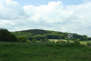
Vaalserberg
Highest point in mainland Netherlands and tripoint with Belgium and Germany
Distance: Approx. 4140 meters
Latitude and longitude: 50.75472222,6.02083333
The Vaalserberg (Dutch pronunciation: [ˈvaːlsərˌbɛr(ə)x]) is a hill with a height of 322.4 metres (1,058 ft) above NAP and is the highest point in the European part of the Netherlands. The Vaalserberg is located in the province of Limburg, at the south-easternmost edge of the country, near the town of Vaals (after which it is named). The Vaalserberg was the highest point anywhere in the Netherlands until the Caribbean island of Saba, with its 887 m (2,910 ft) high volcano, was incorporated into the country as a "special municipality" in 2010.

Neutral Moresnet
1816–1921 small Belgian–Prussian condominium
Distance: Approx. 1440 meters
Latitude and longitude: 50.73027778,6.01333333
Neutral Moresnet (French pronunciation: [mɔʁɛsnɛt], [mɔʁɛsnɛ], German pronunciation: [ˈmɔʁəsnɛt], [ˌmɔʁəsˈnɛt]) was a small Belgian–Prussian condominium in western Europe that existed from 1816 to 1921 and was administered jointly by the United Kingdom of the Netherlands (Belgium after its independence in 1830) and the Kingdom of Prussia. It was 1.5 kilometres (1 mi) wide and 5 kilometres (3 mi) long, with an area of 3.6 square kilometres (900 acres). After 1830, the territory's northernmost border point at Vaalserberg connected it to a quadripoint shared additionally with the Dutch Province of Limburg, the Prussian Rhine Province, and the Belgian Liège Province.

Kelmis
Municipality in German-speaking Community of Belgium, Belgium
Distance: Approx. 2312 meters
Latitude and longitude: 50.7,6
Kelmis (German pronunciation: [ˈkɛlmɪs]; French: La Calamine, pronounced [la kalamin]) is a municipality located in the Belgian province of Liège, named for the historical deposits of calamine (zinc ore) nearby. As of 2011, the population was 10,881; the area is 18.1 square kilometres (7.0 sq mi), and the population density is 601.2 inhabitants per square kilometre (1,557/sq mi). The municipality comprises the following sub-municipalities: Kelmis proper, Hergenrath, and Neu-Moresnet.

Lontzen
Municipality in German-speaking Community of Belgium, Belgium
Distance: Approx. 4007 meters
Latitude and longitude: 50.68333333,6
Lontzen (German pronunciation: [ˈlɔntsn̩]) is a municipality located in East Belgium. On January 1, 2018 Lontzen had a total population of 5,695. The total area is 28.73 km2 which gives a population density of 198 inhabitants per km2.

Eynatten
Distance: Approx. 3988 meters
Latitude and longitude: 50.7,6.06666667
Eynatten is a village in the Belgian municipality of Raeren, part of the German-speaking Community of Belgium. Eynatten is on the border to Germany, 6 kilometres (3.7 miles) south from Aachen. Around half of the population are non-Belgians, most of them Germans.

Aachen II
Federal electoral district of Germany
Distance: Approx. 3577 meters
Latitude and longitude: 50.71666667,5.96666667
Aachen II is an electoral constituency (German: Wahlkreis) represented in the Bundestag. It elects one member via first-past-the-post voting. Under the current constituency numbering system, it is designated as constituency 87.

Hauset
Distance: Approx. 3810 meters
Latitude and longitude: 50.70972222,6.07
Hauset is a village in the Belgian municipality of Raeren, part of the German-speaking Community of Belgium. The village is around 260m over Mean Sea Level, along the small river Geul and borders the Forest of Aachen. The population, around 1700 inhabitants, is German-speaking and is about half of German citizens who come from the Aachen region.

Viaduct of Moresnet
Bridge
Distance: Approx. 2462 meters
Latitude and longitude: 50.71861111,5.9825
The Viaduct of Moresnet, also known as the Geul Valley bridge is a railway bridge above and on the southern side of the village of Moresnet, within the municipality of Plombières, Province of Liège, close to the three-way Belgian frontier with Germany and the Netherlands. The bridge crosses the Geul Valley. It is a Truss bridge with a maximum height above the valley floor of around 52 metres (171 ft) and a length of 1,107 metres (3,632 ft).

Hammer Bridge
Bridge
Distance: Approx. 2621 meters
Latitude and longitude: 50.70344444,6.04711111
The Hammer Bridge is a 220 metres (722 ft) long railway bridge on the Weser Valley line crossing the Geul valley a few hundred meters to the south of Hergenrath. Today it is in the German speaking part of Belgium. Before frontier changes mandated in 1919 shifted the frontier between Belgium and Germany approximately 36 km (23 miles) along the railway line in a southerly direction the bridge was in Germany.
Hergenrath
Section of Kelmis, Belgium
Distance: Approx. 1542 meters
Latitude and longitude: 50.7077,6.0327
Hergenrath (German pronunciation: [ˈhɛʁɡn̩ˌʁaːt]) or Hergenraedt (Standard Dutch: Hergenraat; Limburgish: Herjent) is a village and sub-municipality in Belgium. It is located in the municipality of Kelmis in Liège Province, part of Wallonia. It is part of the German-speaking Community of Belgium.

Neu-Moresnet
Village in German-speaking Community of Belgium, Belgium
Distance: Approx. 484 meters
Latitude and longitude: 50.719,6.0239
Neu-Moresnet is a village and sub-municipality of Kelmis in the German-speaking community of the province of Liège, Wallonia, Belgium. The village was founded as Prussian-Moresnet (German: Preußisch-Moresnet) as part of the Lower Rhine Province. In 1919, after World War I, it was awarded to Belgium, and renamed Neu-Moresnet.

Moresnet (village)
Village in Wallonia, Belgium
Distance: Approx. 2339 meters
Latitude and longitude: 50.7198,5.9844
Moresnet is a village and sub-municipality of Plombières in the province of Liège, Wallonia, Belgium. It was originally a German speaking village. Nowadays French is the official language.
Weather in this IP's area
light rain
14 Celsius
14 Celsius
13 Celsius
15 Celsius
1009 hPa
85 %
1009 hPa
984 hPa
10000 meters
8.6 m/s
14.71 m/s
230 degree
100 %
07:36:33
19:14:17