188.65.221.155 - IP Lookup: Free IP Address Lookup, Postal Code Lookup, IP Location Lookup, IP ASN, Public IP
Country:
Region:
City:
Location:
Time Zone:
Postal Code:
IP information under different IP Channel
ip-api
Country
Region
City
ASN
Time Zone
ISP
Blacklist
Proxy
Latitude
Longitude
Postal
Route
Luminati
Country
Region
wal
City
waremme
ASN
Time Zone
Europe/Brussels
ISP
Maehdros S.A.
Latitude
Longitude
Postal
IPinfo
Country
Region
City
ASN
Time Zone
ISP
Blacklist
Proxy
Latitude
Longitude
Postal
Route
IP2Location
188.65.221.155Country
Region
liege
City
spa
Time Zone
Europe/Brussels
ISP
Language
User-Agent
Latitude
Longitude
Postal
db-ip
Country
Region
City
ASN
Time Zone
ISP
Blacklist
Proxy
Latitude
Longitude
Postal
Route
ipdata
Country
Region
City
ASN
Time Zone
ISP
Blacklist
Proxy
Latitude
Longitude
Postal
Route
Popular places and events near this IP address

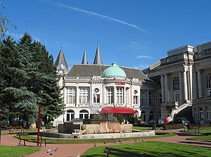
Spa, Belgium
City in Wallonia, Belgium
Distance: Approx. 996 meters
Latitude and longitude: 50.4925,5.86416667
Spa (French pronunciation: [spa] ; Walloon: Spå) is a city and municipality of Wallonia in the province of Liège, Belgium, whose name became an eponym for mineral baths with supposed curative properties. It is in a valley in the Ardennes mountains 35 km (22 mi) south-east of Liège and 45 km (28 mi) south-west of Aachen. In 2006, Spa had a population of 10,543 and an area of 39.85 km2 (15.39 sq mi), giving a population density of 265/km2 (690/sq mi).
Theux
Municipality in French Community, Belgium
Distance: Approx. 6563 meters
Latitude and longitude: 50.53333333,5.81666667
Theux (French pronunciation: [tø]; Walloon: Teu) is a municipality of Wallonia located in the province of Liège, Belgium. On 1 January 2006 the municipality had 11,571 inhabitants. The total area is 83.36 km2, giving a population density of 139 inhabitants per km2.

Spa Conference of 1920
Negotiations about German reparations
Distance: Approx. 2027 meters
Latitude and longitude: 50.49638889,5.88722222
The Spa Conference was a meeting between the Supreme War Council and the government of the Weimar Republic in Spa, Belgium on 5–16 July 1920. The main topics were German disarmament, coal shipments to the Allies and war reparations.

Franchimont Castle
Medieval castle in Theux, Belgium
Distance: Approx. 5760 meters
Latitude and longitude: 50.5277,5.8239
Franchimont Castle (French: Château de Franchimont) is a medieval castle in the municipality of Theux, Liège Province, Wallonia, Belgium. It sits at the western end of a small hill 2 kilometres (1.2 mi) south of the village of Theux, a sub-municipality.

Lake Warfaaz
Lake in Belgium
Distance: Approx. 2665 meters
Latitude and longitude: 50.50277778,5.88944444
The lake Warfaaz is an artificial lake located in Wallonia near the thermal city of Spa in Ardennes in Belgium. The dam was built in 1892 on the Wayai river. The water volume is 360,000 m³ and the area is 0,08 km².

Spa-La Sauvenière Airfield
Airport in Wallonia, Belgium
Distance: Approx. 3090 meters
Latitude and longitude: 50.4825,5.91027778
Spa-La Sauvenière Airfield (ICAO: EBSP) is a general aviation airfield located in Spa, a municipality of Wallonia (southern Belgium).

Les Francofolies de Spa
Music festival in Belgium
Distance: Approx. 959 meters
Latitude and longitude: 50.4921,5.8637
Les Francofolies de Spa is an annual music festival in Spa, Belgium. It is usually held in the month of July of every year and aims at promoting francophone music. Those attending the festival in 2008 exceeded 200,000.

Francorchamps
Village in Wallonia, Belgium
Distance: Approx. 6904 meters
Latitude and longitude: 50.4536,5.9519
Francorchamps (French pronunciation: [fʁɑ̃kɔʁʃɑ̃], Walloon: Francortchamp) is a village of Wallonia and a district of the municipality of Stavelot, located in the province of Liège, Belgium. It is home to the motor-racing Circuit de Spa-Francorchamps. A ski resort, the Mont des Brumes, is located nearby.

Roannay
River in Belgium
Distance: Approx. 6126 meters
Latitude and longitude: 50.455,5.94047
Roannay is a river in Belgium. It flows for 11 kilometres (7 mi) through the province of Liège in the northern-central part of the country.
Manoir de Lébioles
Manor house in Spa, Belgium
Distance: Approx. 3248 meters
Latitude and longitude: 50.465,5.8315
Manoir de Lébioles is a castle-like manor house in Creppe, a quarter of Spa in Belgium. Wilhelm II. abdicated there in 1918 from being emperor.
Sart-lez-Spa
Distance: Approx. 5931 meters
Latitude and longitude: 50.51573,5.93364
Sart-lez-Spa (French pronunciation: [saʁ le spa]; Walloon: Li Sårt-dilé-Spå) is a village of Wallonia and a district of the municipality of Jalhay, located in the province of Liège, Belgium. Nearby is the river Hoëgne, a tributary of the river Vesdre. It was a municipality before the fusion of the Belgian municipalities in 1977.

Mont des Brumes
Ski resort in Wallonia, Belgium
Distance: Approx. 6181 meters
Latitude and longitude: 50.43416667,5.90611111
Mont des Brumes is a ski resort located between Francorchamps and La Gleize, in the Belgian Ardennes. Though not the highest in Belgium, this resort has one of the longest alpine ski slopes in Belgium, including a red run 850 meters long with nearly 200 meters of vertical drop. The site also has a 150-meter beginners' track.
Weather in this IP's area
broken clouds
-12 Celsius
-16 Celsius
-12 Celsius
-12 Celsius
1038 hPa
77 %
1038 hPa
990 hPa
10000 meters
1.51 m/s
1.22 m/s
138 degree
57 %


