188.30.86.213 - IP Lookup: Free IP Address Lookup, Postal Code Lookup, IP Location Lookup, IP ASN, Public IP
Country:
 Great Britain
Region:
City:
Location:
Time Zone:
Postal Code:
ISP:
ASN:
language:
User-Agent:
Proxy IP:
Blacklist:
IP information under different IP Channel
ip-api
Country
Region
City
ASN
Time Zone
ISP
Blacklist
Proxy
Latitude
Longitude
Postal
Route
db-ip
Country
Region
City
ASN
Time Zone
ISP
Blacklist
Proxy
Latitude
Longitude
Postal
Route
IPinfo
Country
Region
City
ASN
Time Zone
ISP
Blacklist
Proxy
Latitude
Longitude
Postal
Route
IP2Location
188.30.86.213Country
gbRegion
england
City
kenn
Time Zone
Europe/London
ISP
Language
User-Agent
Latitude
Longitude
Postal
ipdata
Country
Region
City
ASN
Time Zone
ISP
Blacklist
Proxy
Latitude
Longitude
Postal
Route
Popular places and events near this IP address

Kingston Seymour
Human settlement in England
Distance: Approx. 2217 meters
Latitude and longitude: 51.398,-2.861
Kingston Seymour is a small village and civil parish with royal status in Somerset, England. It is situated within the unitary authority of North Somerset, between Clevedon and Weston-super-Mare on the North Somerset Levels. The parish has a population of 388.

Curzon Community Cinema, Clevedon
Distance: Approx. 2148 meters
Latitude and longitude: 51.43573889,-2.85502222
The Curzon Cinema & Arts, in Clevedon, North Somerset, England, is one of the oldest continually running purpose-built cinemas in the world.

Clevedon Town F.C.
Association football club in England
Distance: Approx. 1176 meters
Latitude and longitude: 51.42329194,-2.83675611
Clevedon Town Football Club is a semi-professional football club representing Clevedon, Somerset, England. Affiliated to the Somerset County FA, they are currently members of the Western League Premier Division and play at the Hand Stadium in Kenn. The club's motto 'vigilate et orate' is Latin for 'watch and pray'.

Kenn Church, Kenn Pier & Yew Tree Farm SSSI
Distance: Approx. 736 meters
Latitude and longitude: 51.4215,-2.8427
Kenn Church, Kenn Pier & Yew Tree Farm SSSI (grid reference ST415689) is a 15.37 hectare geological Site of Special Scientific Interest near the village of Kenn, Somerset, notified in 1997. The site is listed in the Geological Conservation Review because it consists of a complex sequence of Pleistocene sediments, including coarse glacial outwash gravels at the base overlain by a complex sequence of interglacial freshwater, estuarine and marine sands. The sequence is then capped by aeolian (windblown) coversands and Holocene silts.
Kenn, Somerset
Human settlement in England
Distance: Approx. 685 meters
Latitude and longitude: 51.4174,-2.8402
Kenn is a small village and civil parish in the county of Somerset, England. It falls within the area of the North Somerset unitary authority. It lies on the B3133 road near Clevedon in the North Somerset Levels.

Clock Tower, Clevedon
Victorian-era English structure in Somerset
Distance: Approx. 2188 meters
Latitude and longitude: 51.43630556,-2.85213889
A Victorian Clock Tower is located in the heart of the Triangle shopping centre in Clevedon, Somerset, England. It has been designated as a Grade II listed building.

Land Yeo
River in north Somerset, England
Distance: Approx. 2212 meters
Latitude and longitude: 51.42833333,-2.87583333
The Land Yeo is a small river which flows through North Somerset, England. It rises on Dundry Hill and supplies Barrow Gurney Reservoirs before flowing through various villages to Clevedon where it drains into the Severn Estuary. During the past 1,000 years it has powered at least ten watermills; however, only one is still functional.

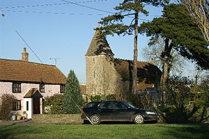
Church of St John The Evangelist, Kenn
Church in Somerset, England
Distance: Approx. 604 meters
Latitude and longitude: 51.4168,-2.8413
The Anglican Church of St John The Evangelist at Kenn within the English county of Somerset has a Norman tower, with much of the rest of the church dating from around 1300. It has been designated as a Grade II* listed building. The cross in the churchyard is both a Grade II listed building and has been scheduled as an ancient monument.

Church of St John the Evangelist, Clevedon
Church in Somerset, England
Distance: Approx. 2253 meters
Latitude and longitude: 51.4367,-2.855
The Church of St John the Evangelist is a Church of England church in Clevedon, Somerset, England. Designed by William Butterfield, it was built in 1876–78 at the expense of Sir Arthur Elton and has been a Grade II* listed building since 1976.
Colehouse Lane railway station
Disused railway station in North Somerset, England
Distance: Approx. 1314 meters
Latitude and longitude: 51.423,-2.866
Colehouse Lane railway station served the town of Clevedon, North Somerset, England, from 1897 to 1940 on the Weston, Clevedon and Portishead Railway.
Kingston Road railway station
Disused railway station in Kingston Seymour, Somerset
Distance: Approx. 1800 meters
Latitude and longitude: 51.4124,-2.875
Kingston Road railway station served the village of Kingston Seymour, Somerset, England, from 1897 to 1940 on the Weston, Clevedon and Portishead Railway.

Clevedon railway station (WCP)
Disused railway station in Clevedon, North Somerset
Distance: Approx. 2074 meters
Latitude and longitude: 51.4351,-2.8547
Clevedon railway station served the town of Clevedon, North Somerset, England, from 1897 to 1940 on the Weston, Clevedon and Portishead Railway.
Weather in this IP's area
overcast clouds
3 Celsius
1 Celsius
3 Celsius
4 Celsius
1020 hPa
94 %
1020 hPa
1019 hPa
6000 meters
2.57 m/s
20 degree
100 %