188.30.2.89 - IP Lookup: Free IP Address Lookup, Postal Code Lookup, IP Location Lookup, IP ASN, Public IP
Country:
 Great Britain
Region:
City:
Location:
Time Zone:
Postal Code:
ISP:
ASN:
language:
User-Agent:
Proxy IP:
Blacklist:
IP information under different IP Channel
ip-api
Country
Region
City
ASN
Time Zone
ISP
Blacklist
Proxy
Latitude
Longitude
Postal
Route
db-ip
Country
Region
City
ASN
Time Zone
ISP
Blacklist
Proxy
Latitude
Longitude
Postal
Route
IPinfo
Country
Region
City
ASN
Time Zone
ISP
Blacklist
Proxy
Latitude
Longitude
Postal
Route
IP2Location
188.30.2.89Country
gbRegion
scotland
City
larbert
Time Zone
Europe/London
ISP
Language
User-Agent
Latitude
Longitude
Postal
ipdata
Country
Region
City
ASN
Time Zone
ISP
Blacklist
Proxy
Latitude
Longitude
Postal
Route
Popular places and events near this IP address

Stenhousemuir
Human settlement in Scotland
Distance: Approx. 1539 meters
Latitude and longitude: 56.028,-3.806
Stenhousemuir (; Scottish Gaelic: Featha Thaigh nan Clach) is a town in the Central Lowlands of Scotland. It lies within the Falkirk council area of Scotland. The town is two miles (three kilometres) north-northwest of Falkirk and directly adjoins to Larbert in the west, where the nearest rail access is located.
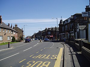
Larbert
Town in Falkirk, Scotland
Distance: Approx. 173 meters
Latitude and longitude: 56.02291,-3.82602
Larbert (Scottish Gaelic: Leth-Pheairt, Scots: Lairbert) is a town in the Falkirk council area of Scotland. The town lies in the Forth Valley above the River Carron which flows from the west. Larbert is three miles (five kilometres) from the shoreline of the Firth of Forth and 2+1⁄2 miles (4 kilometres) northwest of Falkirk.
Camelon railway station
Railway station in Falkirk, Scotland
Distance: Approx. 1929 meters
Latitude and longitude: 56.0062,-3.8182
Camelon railway station is a railway station serving the suburb of Camelon in Falkirk, Scotland. It is located on the Edinburgh-Dunblane and Cumbernauld Lines. Train services are provided by ScotRail.

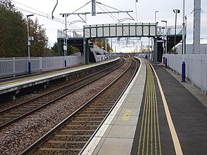
Larbert railway station
Railway station in Falkirk, Scotland
Distance: Approx. 76 meters
Latitude and longitude: 56.0222,-3.8298
Larbert railway station is a railway station serving Larbert near Falkirk, Scotland.

Larbert High School
Secondary school in Stenhousemuir, Falkirk, Scotland
Distance: Approx. 1243 meters
Latitude and longitude: 56.02261,-3.80872
Larbert High School is a six-year, non-denominational state school in Stenhousemuir, Scotland, United Kingdom (UK). The school is run by Falkirk Council Education Services on behalf of the Scottish Government. In 2005, the total running costs of the school were £5,852,498 or £3,553 per pupil.

Ochilview Park
Football stadium in Stenhousemuir, Scotland
Distance: Approx. 1085 meters
Latitude and longitude: 56.02833333,-3.81472222
Ochilview Park is a football stadium in Stenhousemuir in the Falkirk council area of Scotland. It is the home ground of Scottish League One club Stenhousemuir. The stadium has a capacity of 3,746 with 626 seated.

Camelon
Settlement in Falkirk, Scotland
Distance: Approx. 2112 meters
Latitude and longitude: 56.004596,-3.817454
Camelon (; Scots: Caimlan, Scottish Gaelic: Camalan) is a large settlement within the Falkirk council area, Scotland. The village is in the Forth Valley, 1.3 miles (2.1 km) west of Falkirk, 1.3 miles (2.1 km) south of Larbert and 2.6 miles (4.2 km) east of Bonnybridge. The main road through Camelon is the A803 road which links the village to Falkirk.

Arthur's O'on
Probable Roman temple near Falkirk, Scotland, destroyed in 1743
Distance: Approx. 1849 meters
Latitude and longitude: 56.0245,-3.7992
Arthur's O'on (Scots: Oven) was a stone building thought to be Roman temple that, until 1743, stood on rising ground above the north bank of the River Carron not far from the old Carron ironworks in Stenhousemuir, near Falkirk, Scotland. The structure is thought to be the 'stone house' which gave its name to Stenhousemuir. Early historians discussed historical and mythical associations with the site and by 1200 the estate of Stenhouse on which it stood had been named after it.

Carronvale House
Country house in Stirlingshire, Scotland
Distance: Approx. 845 meters
Latitude and longitude: 56.0173,-3.8188
Carronvale House is a category A listed country house in Larbert, Stirlingshire, Scotland. It is a large two-storey house with neo-Georgian details. Its outer walls date from the 18th century, with two new wings added in the 1820s, and it was extensively remodelled in 1897 by architect Sir John Burnet.

Forth Valley Royal Hospital
Hospital in Falkirk, Scotland
Distance: Approx. 1243 meters
Latitude and longitude: 56.0254,-3.848
Forth Valley Royal Hospital is a hospital located in Larbert, Scotland. With 860 inpatient beds, 25 wards, and 16 operating theatres, it was Scotland's largest ever NHS construction project at the time but has been surpassed by the Queen Elizabeth University Hospital amongst others. Built at a cost of £300 million on the site of the old Royal Scottish National Hospital, it opened to its first patients in 2010.

Bellsdyke Hospital
Former psychiatric hospital at Larbert, Falkirk from 1869 to 1997
Distance: Approx. 1503 meters
Latitude and longitude: 56.0352,-3.8205
Bellsdyke Hospital, also known as Stirling District Lunatic Asylum ('SDLA') or Stirling District Asylum, is a former psychiatric hospital at Larbert, Falkirk council area that was opened in June 1869 and largely closed in 1997. It was an asylum set up by the Stirling District Lunacy Board.

Royal Scottish National Hospital
Hospital in Larbert, Scotland
Distance: Approx. 1206 meters
Latitude and longitude: 56.0278,-3.8456
The Royal Scottish National Hospital was a psychiatric institution situated in Larbert (today in Falkirk council area), Scotland. It was first founded as the Scottish National Institution for the Education of Imbecile Children in 1862, with the building being officially opened on 23 May 1863.
Weather in this IP's area
few clouds
5 Celsius
3 Celsius
3 Celsius
5 Celsius
1042 hPa
93 %
1042 hPa
1026 hPa
10000 meters
2.16 m/s
5.23 m/s
205 degree
20 %