Country:
Region:
City:
Latitude and Longitude:
Time Zone:
Postal Code:
IP information under different IP Channel
ip-api
Country
Region
City
ASN
Time Zone
ISP
Blacklist
Proxy
Latitude
Longitude
Postal
Route
Luminati
Country
Region
mc
City
archena
ASN
Time Zone
Europe/Madrid
ISP
Informatica Fuentealbilla S.l.
Latitude
Longitude
Postal
IPinfo
Country
Region
City
ASN
Time Zone
ISP
Blacklist
Proxy
Latitude
Longitude
Postal
Route
db-ip
Country
Region
City
ASN
Time Zone
ISP
Blacklist
Proxy
Latitude
Longitude
Postal
Route
ipdata
Country
Region
City
ASN
Time Zone
ISP
Blacklist
Proxy
Latitude
Longitude
Postal
Route
Popular places and events near this IP address

Archena
Municipality in Murcia, Spain
Distance: Approx. 419 meters
Latitude and longitude: 38.115,-1.29916667
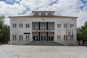
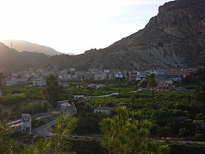
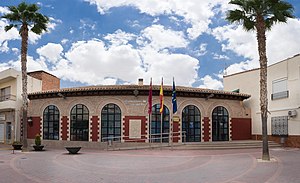
Archena is a municipality of Spain in the province of Murcia and is located in the northeastern quarter. It has a population of 18,496 (as of 2012) and an area of 16.5 km2 (6.4 sq mi). It is 24 km (15 mi) away from the provincial capital, Murcia.

Molina de Segura
Municipality in Murcia, Spain
Distance: Approx. 9759 meters
Latitude and longitude: 38.05476667,-1.21311111
Molina de Segura is a municipality of Spain in the autonomous community and province of Murcia. It is located 10 km from the provincial capital, Murcia. It borders the towns of Las Torres de Cotillas, Alguazas, Lorquí, Ulea, Archena, Abarán, Blanca, Murcia and Fortuna.

Lorquí
Municipality in Murcia, Spain
Distance: Approx. 5043 meters
Latitude and longitude: 38.08166667,-1.255
Lorquí is a Spanish municipality in the autonomous community of Murcia. It has a population of 6,493 (2006) and an area of 15 km2 .

Ricote
Municipality in Region of Murcia, Spain
Distance: Approx. 7449 meters
Latitude and longitude: 38.15,-1.36666667
Ricote is a Spanish municipality in the autonomous community of Murcia. It has a population of 1,509 (2004) and an area of 87.7 km2. Ricote had a community of Moriscos until their expulsion from Spain in 1609.

Ulea
Municipality in Region of Murcia, Spain
Distance: Approx. 3991 meters
Latitude and longitude: 38.13333333,-1.33333333
Ulea is a Spanish municipality in the autonomous community of Murcia. It has a population of 991 (2007) and an area of 40 km2 (15 sq mi).

Villanueva del Río Segura
Municipality in Region of Murcia, Spain
Distance: Approx. 3491 meters
Latitude and longitude: 38.13555556,-1.32416667
Villanueva del Río Segura is a municipality in the Region of Murcia, Spain.
Alguazas
Municipality in Murcia, Spain
Distance: Approx. 8441 meters
Latitude and longitude: 38.05138889,-1.24138889
Alguazas (Spanish: [alˈɣwaθas]) is a municipality of Spain in the autonomous community and province of Murcia and it is located in the south-west of the northeastern quarter.

Campos del Río
Municipality in Murcia, Spain
Distance: Approx. 9633 meters
Latitude and longitude: 38.04083333,-1.35166667
Campos del Río is a municipality in the autonomous region of Murcia in southeastern Spain. It covers an area of 47.3 km2 and shares borders with Ojós at its north, Villanueva del Río Segura and Alguazas at its north-east, Las Torres de Cotillas at its east, Murcia at its south-east, Mula and Albudeite at its south and west and Ricote at its north-west.

Ojós
Municipality in Murcia, Spain
Distance: Approx. 5576 meters
Latitude and longitude: 38.14777778,-1.34222222
Ojós (Spanish: [oˈxos]) is a municipality in the autonomous community of Murcia in southeastern Spain. It is located in the south-west of the north-eastern quarter of the region and has an area of 45.3 km 2 and shares borders with Blanca at its north, Ulea at its north-east, Villanueva del Río Segura at its East, Campos del Río at is south-west and Ricote at its north-west. The municipality was inhabited by 500 people in 2019.

Ceutí
Municipality in Murcia, Spain
Distance: Approx. 4435 meters
Latitude and longitude: 38.07888889,-1.27222222
Ceutí is a municipality in the autonomous region of Murcia in southeastern Spain and is located in the south-east of the northeasternquarter of the Region. As of 2021, there are 12,199 inhabitants.
Weather in this IP's area
overcast clouds
19 Celsius
19 Celsius
18 Celsius
19 Celsius
1021 hPa
70 %
1021 hPa
1008 hPa
10000 meters
5.27 m/s
7.21 m/s
95 degree
100 %
07:46:33
17:53:21
